AUSTIN, Texas — Editor's note: This blog is no longer being updated. Click here for the latest weather blog.
A front is currently stalled across the KVUE area, but it expected to slide south through Central Texas overnight. This front could lift back to the north on Friday, sparking additional scattered showers and storms.
Before we get into the timeline, we want you to know that there's a low-end severe weather threat today. We're not expecting major issues, but one or two storms could produce some gusty winds and maybe some small hail.
The Storm Prediction Center includes most of the KVUE area in the "marginal" – level 1 of 5 – risk for severe weather today.
Timeline: Storms develop by mid-afternoon
So let's get into the details with the timing. The rest of this morning into the lunchtime hour will be pretty much completely dry. This mean temperatures will still warm up aggressively. We're likely reach a high temperature of around 100 degrees around 1 or 2 p.m. just before the storms develop.
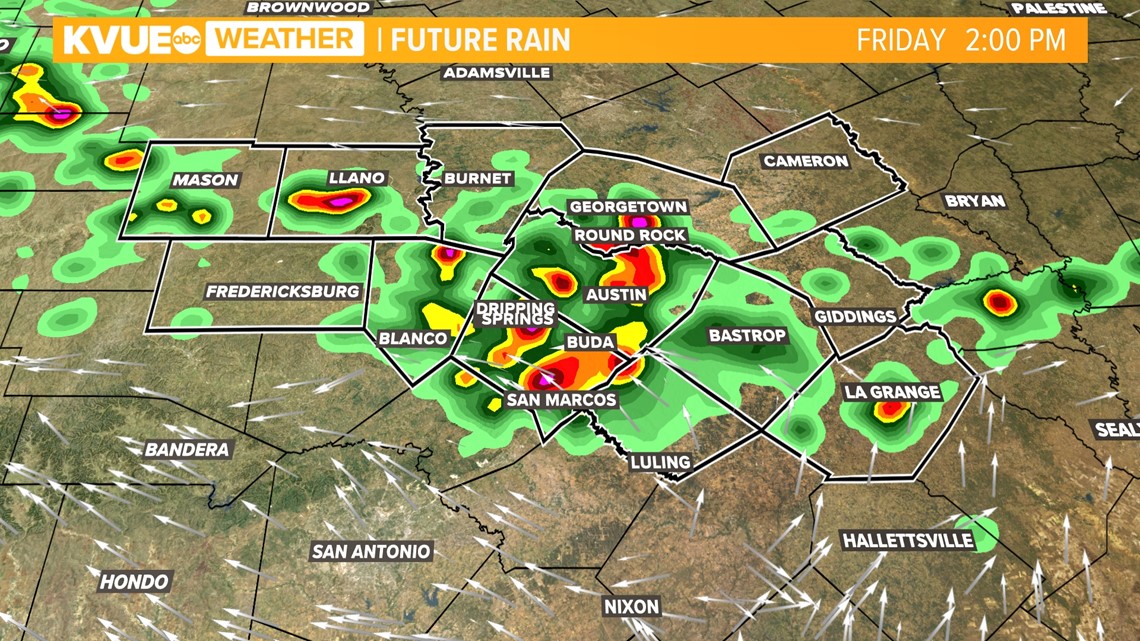
As the front pushes into Central Texas, we expect scattered showers and storms to begin developing as early as 2 or 3 p.m. this afternoon.

Once storms begin to fire up, they will quickly expand in coverage through the late afternoon hours. Remember, some of these storms could be on the strong side.
You can always check in with the radar on the KVUE app before you head out to pick up the kids from school or practice or before you drive home from work.


Scattered to numerous storms will continue into the early evening hours, but they will start to lose steam once the sun goes down.
After the evening storms dissipate, the rest of the overnight should be pretty quiet.

But here's the thing: The frontal boundary will still be stalled over Central Texas tomorrow, and that means another round of scattered showers and storms will be possible during the heat of the day.
The rain chance for Friday looks slightly lower than today, but the potential for heavy rainfall and a strong storm or two will continue.

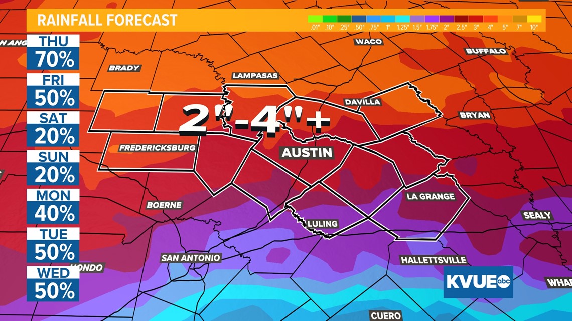
How much rainfall? More rain next week?
Rainfall totals on average over the next 48 hours will range from a quarter inch to one inch. Outside of that range, there could be a couple spots that miss out on significant rain, but there will also be some that hit the lottery with one to three inches of rainfall.
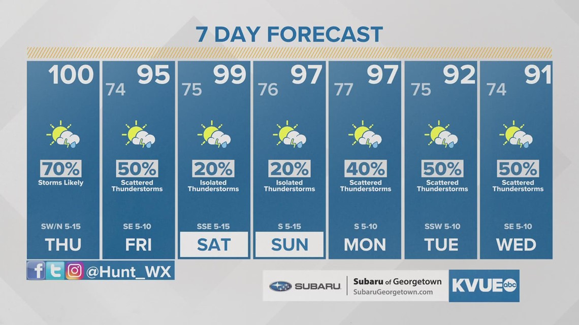
If you somehow manage to avoid rain through Friday, it's still not time to give up hope. Next week could bring a pretty substantial pattern shift with an influx in tropical moisture as a few upper-level disturbances roll into Texas. Rain chances look pretty promising for the first half of next week.
The Weather Prediction Center shows the potential for much of Central Texas to pick up between two and four inches of rain over the next seven days.

The KVUE Weather Team will continue to monitor this incoming system closely.
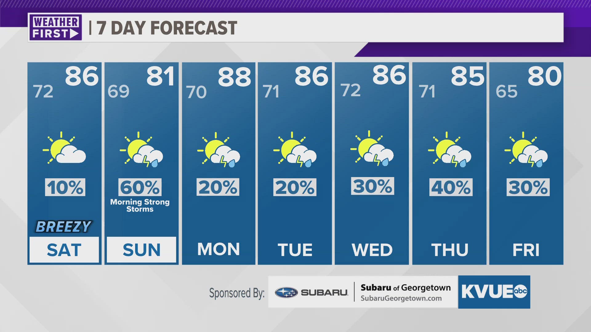
In the meantime, here is a look at your extended forecast.

PEOPLE ARE ALSO READING: