
AUSTIN, Texas — Happy Saturday and start to Bowl Season!
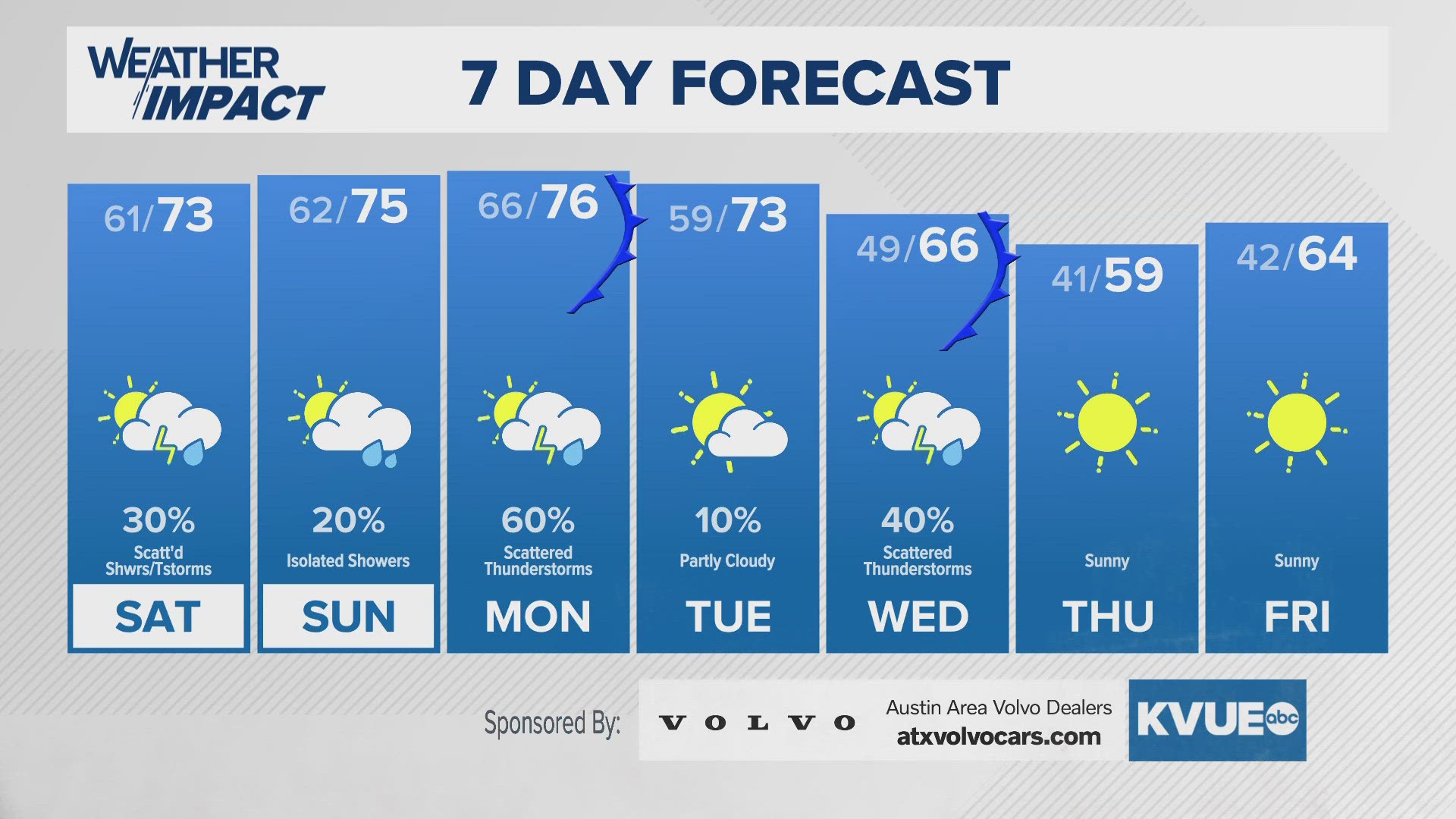
We're tracking a few isolated showers and maybe a rumble of thunder or two as well during your Saturday afternoon, so indoor game watching or christmas movie watching would be a good option for the afternoon hours. It'd be a bit warm outside for the blanket and fireplace though.
As for Sunday, we'll have similar rain chances, and although we have seen models trend into the 80s for Sunday, we believe that there'll be additional cloud cover that'll limit that radiational heating, keeping highs in the mid-70s. The storm chances increase as we head into Monday, because a frontal boundary dropping into Central Texas will provide somewhat of a lifting mechanism that'll bring in good storm chances ahead of the front.
Behind it, we should be dry Tuesday, but Wedesday provides another strong cold front that'll again bring in a few scattered storms as well, but this front will be more efficient when it comes to cooling us down, and rather substantially as well.
Lows Thursday morning look to be at around 41 with highs possibly failing to reach 60 in many spots.
We hope you enjoy your football Saturday!
SATURDAY MORNING:
Cloudy and warm. 20% showers or drizzle. Southeast wind at 5 to 10 mph.
LOW: 61
SATURDAY:
Mostly cloudy. 30% shower or light drizzle. Winds light and variable.
HIGH: 73
SATURDAY NIGHT:
Cloudy and warm. 20% showers or drizzle. Southeast wind at 5 to 10 mph.
LOW: 62
SEVEN-DAY FORECAST:


Check out the live radar for what you can expect the rest of the day and into the workweek.