AUSTIN, Texas — *A Tornado Watch has been issued until 9 p.m. CDT for MilamCounty.*
We’re not done with the storm chance for this weekend. We’re tracking another system that will bring a more widespread storm chance to our KVUE area throughout Sunday. Some of these storms could be severe.
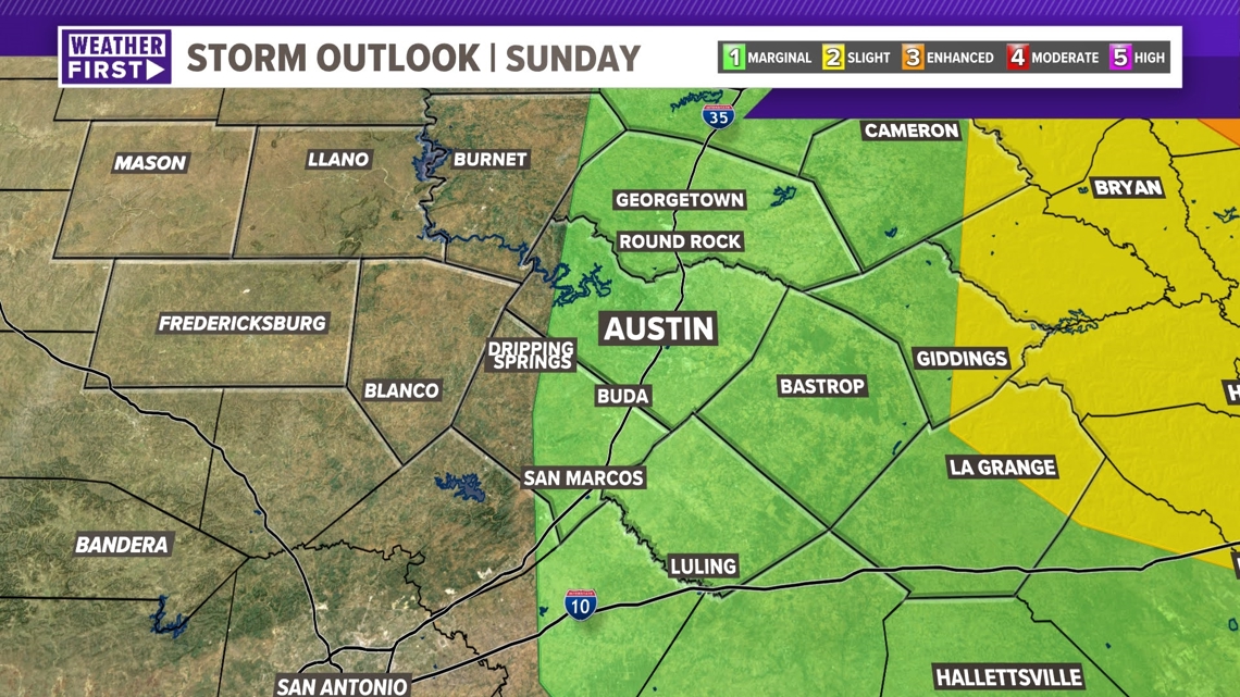
We can’t completely rule out severe weather in Austin, while the threat will be in the Hill Country for Sunday morning, the threat shifts east into the Coastal Plains for the afternoon.
At 2:30 p.m. the National Weather Service issued a Tornado Watch for counties east of I-35 due to the existing chances for shear and rotation in the atmosphere. This will expire at 9 p.m., and as of 8 p.m. there has been no tornadic activity in the Coastal Plains.

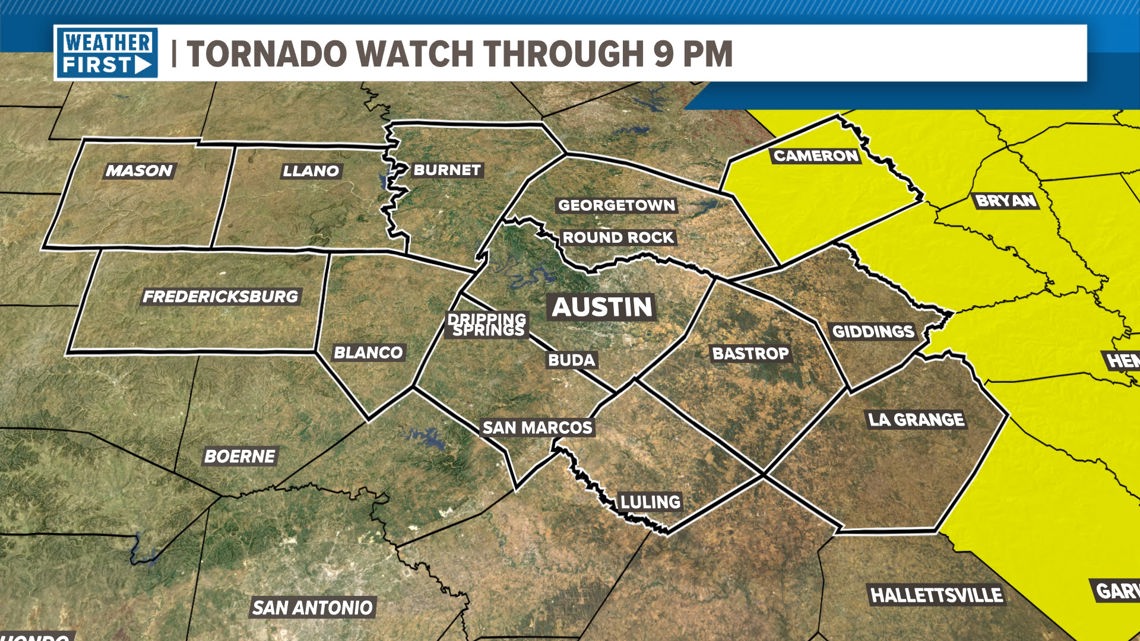
However, the region is still warm, humid, and breezy; and the isolated storms that are leftover could take advantage of ingredients in the atmosphere. So don't take down you're guard until after the Tornado Watch expires.
Our severe outlook continues into the rest of Sunday, with just a level one risk for the majority of our viewing area. Milam, Lee, and Fayette County stay in a level 2 risk. From 12 pm- 9 pm Sunday, it is possible for a few scattered and isolated showers or storms to develop again.

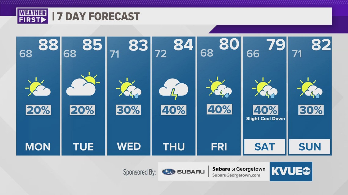
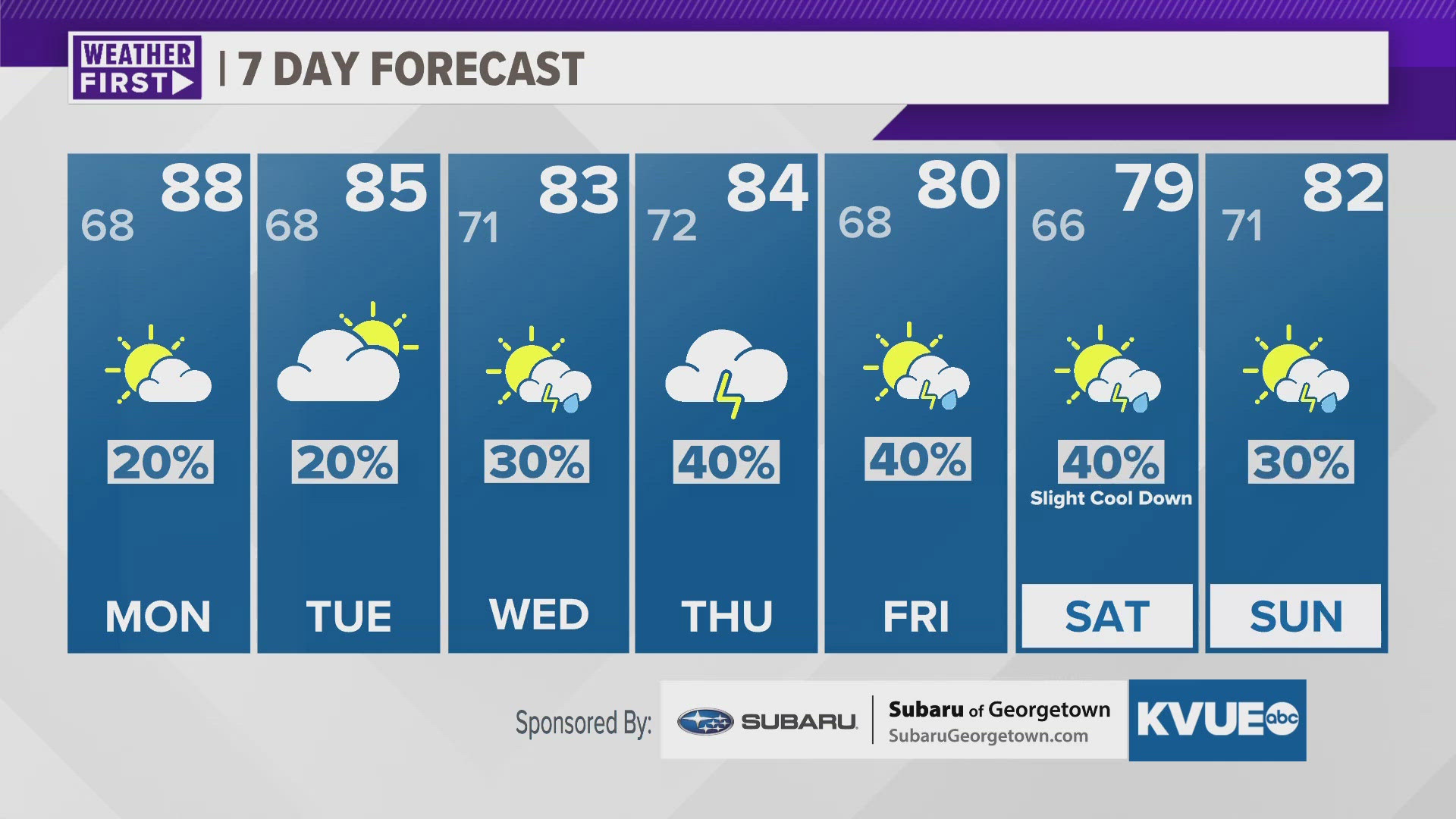
The weather pattern stays warm and unsettled through the workweek as rain and storm chances continue. The KVUE Weather Team will keep a close eye on this developing forecast.
In the meantime, the extended forecast can be found below.