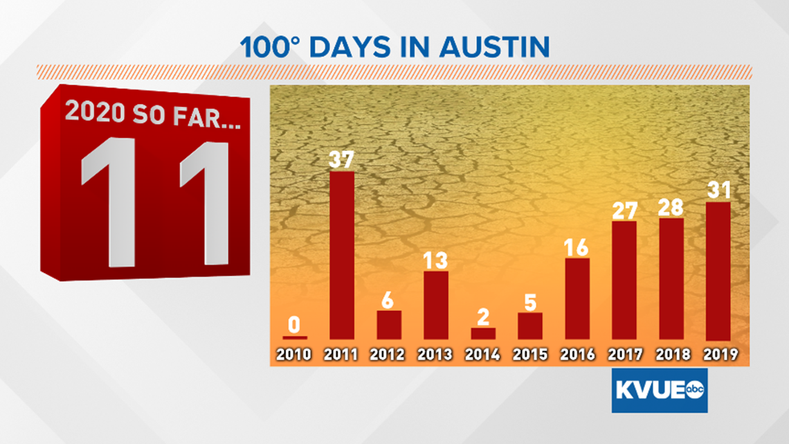
AUSTIN, Texas — The past seven days have been full of triple-digit heat for Central Texas, including a record-breaking 108 degrees in Austin on Monday. This broke the daily record by 3 degrees and fell just 2 degrees below the all-time July record high for Camp Mabry.
Every day in the last week has exceeded the century mark.
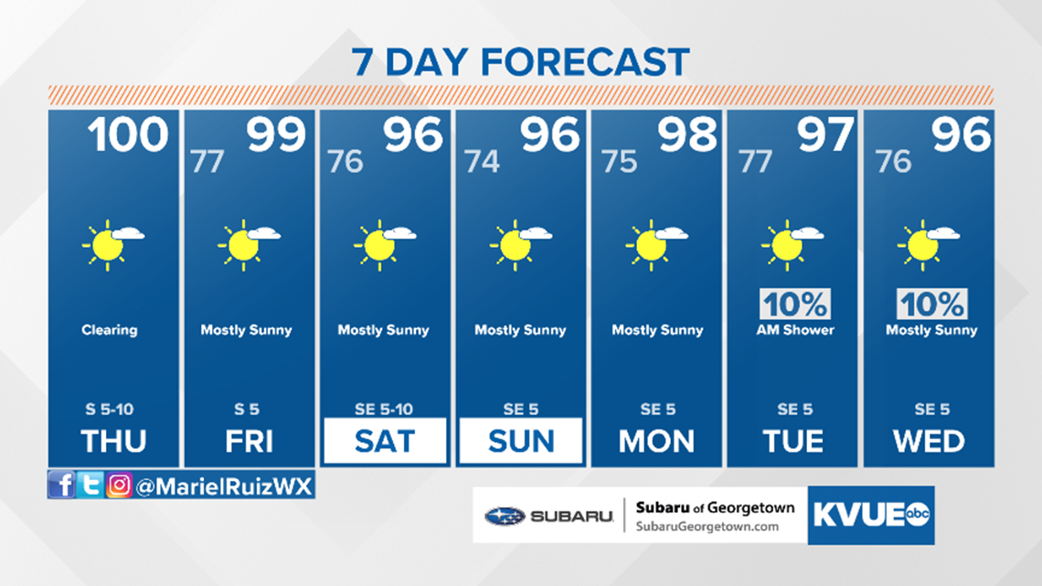
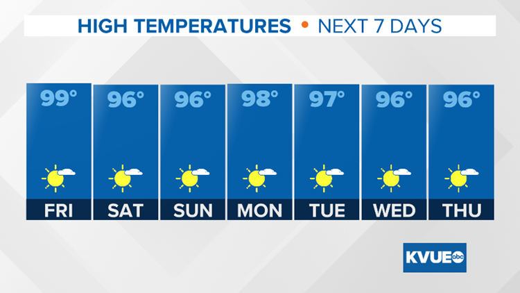
Fortunately, slightly cooler temperatures are now on the horizon by the end of the week and this weekend. This cooldown will bring temperatures much closer to seasonal averages by the weekend.

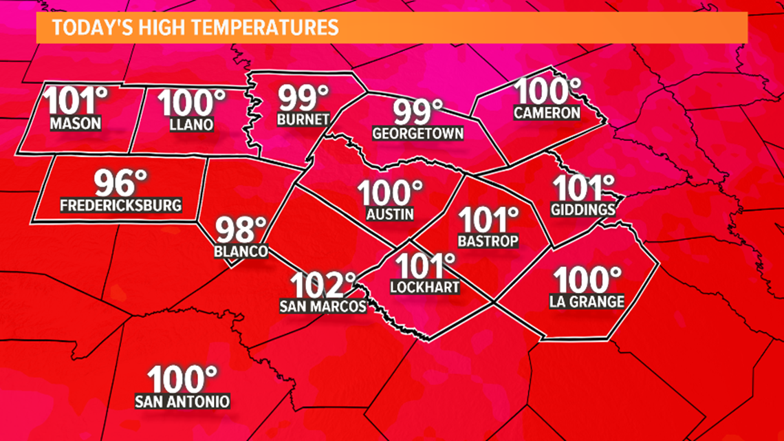
With that being said, we're not saying goodbye to the triple digits just yet. Wednesday afternoon brought the latest round of 100+ degree temperatures, and although Thursday continues the cooling trend, it still looks like highs will be near the century mark for much of the area.

By Thursday and Friday, the ridge of high pressure that has been responsible for the persistent heat will finally begin to break down. As this happens, temperatures will fall back to the upper 90s.
Over the weekend, the ridge will gradually shift northward. This will continue to open the door for cooler weather.
RELATED: Today's Allergy Report

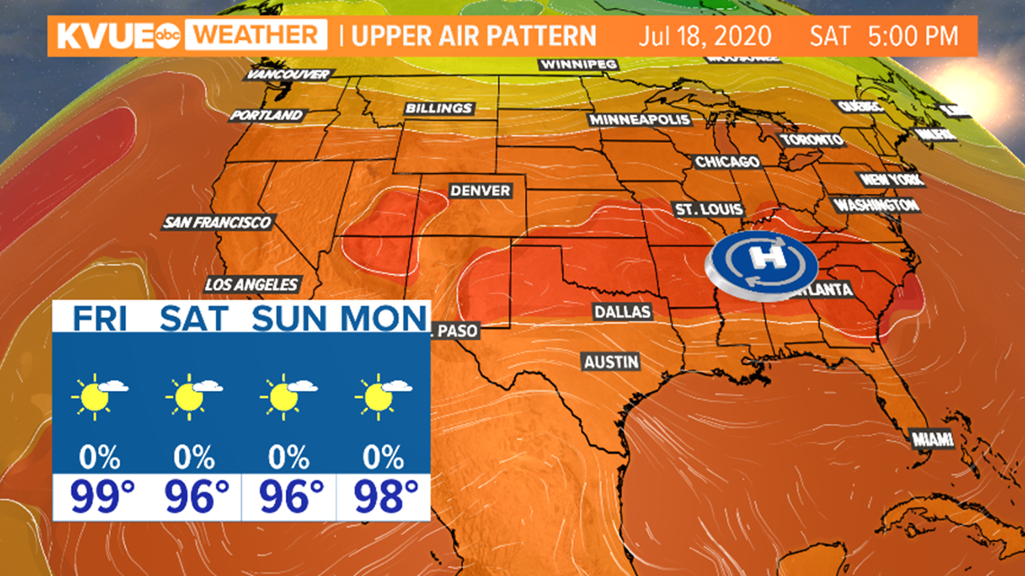
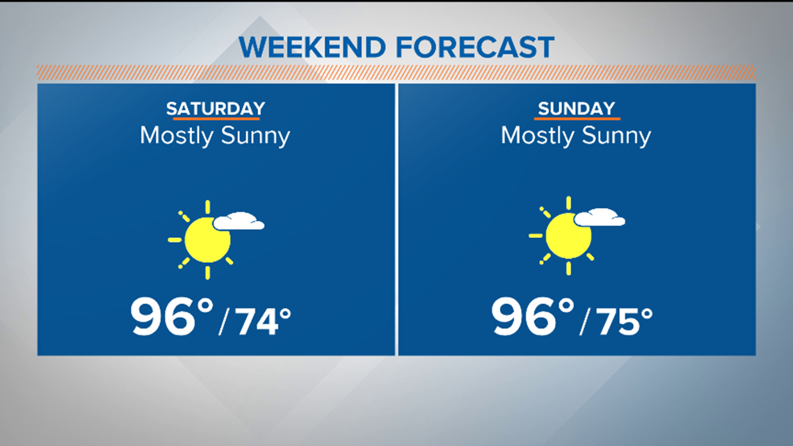
By Saturday and Sunday, afternoon highs will likely be within a degree or two of the average for this time of the year, which is about 95 degrees for Austin.
Relative to the recent temperatures, dry weather with mid-90s will mean a fairly nice weekend for Central Texas!

With the heat becoming more tolerable, the next item on the agenda will be to search for higher rain chances next week.
The current outlooks from the Climate Prediction Center suggest that above-average temperatures remain likely for the area through next week.
However, while temperatures remain hot, there may be an opportunity for some rain chances next week as that ridge of high pressure continues to shift northward.
The latest 8- to 14-day precipitation outlook indicates above-average rainfall may be possible between July 22 and July 28, especially for coastal portions of Texas. Meanwhile, drier conditions are expected northwest of Austin.

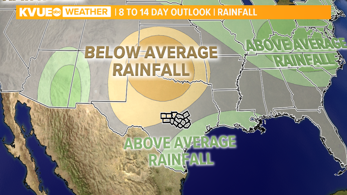
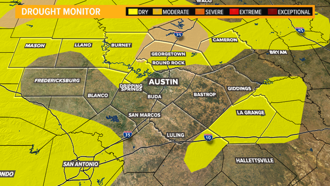
Any rainfall would not only be beneficial in terms of heat relief but would also help alleviate some of the drought conditions that have developed for parts of the area.

RELATED:
The KVUE Storm Team will continue to monitor the forecast
The extended forecast can be found below: