AUSTIN, Texas — So far this month, that old "April showers" phrase has been living up to its name in Central Texas.
Last week's widespread rains led to neighborhoods picking up over 4 inches of precipitation in 48 hours. And this past weekend, extensive clouds and showery activity kept a dreary feel to the region.
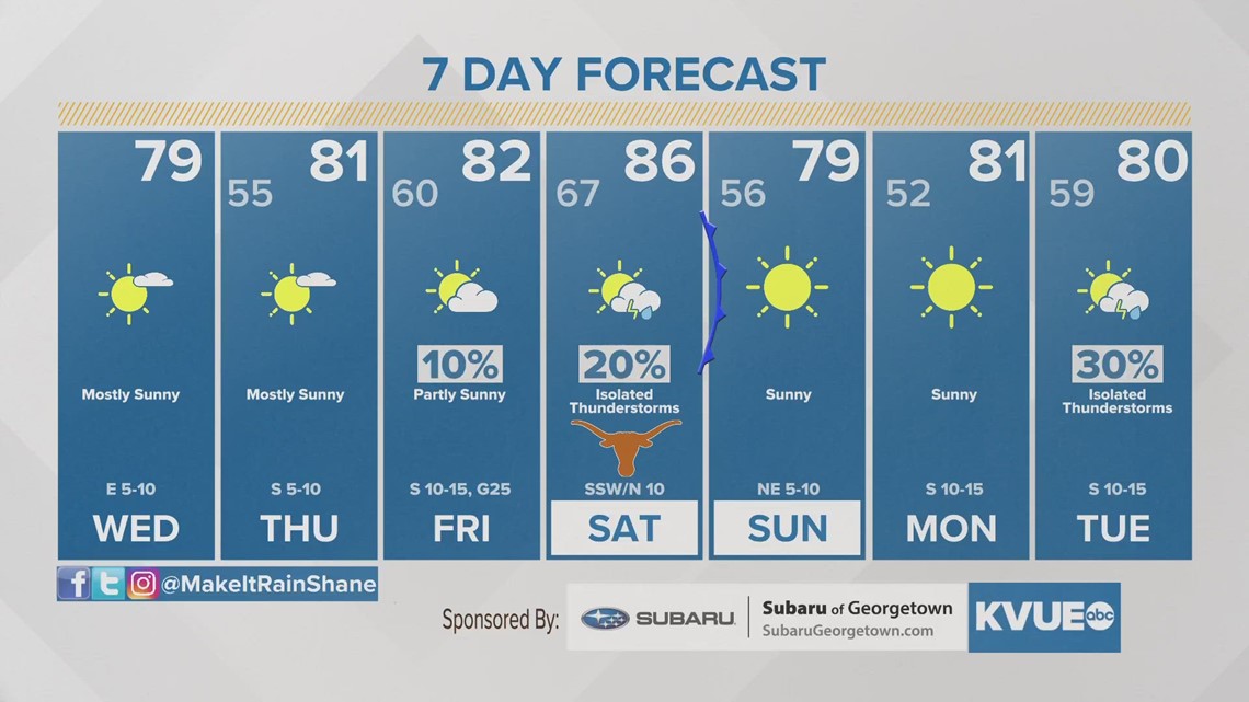
For a couple more days, clouds and isolated showers stay in the forecast. However, the Gulf of Mexico is brewing up something that will hopefully alleviate the dull conditions overhead.
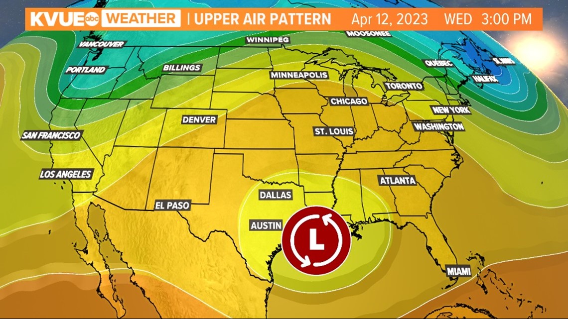
Around Wednesday afternoon, weather models are in good agreement that an area of low pressure will form in the northern stretches of the Gulf of Mexico.

This has widened the eyes of many living along the eastern extent of the Gulf Coast because this system could take on characteristics of a tropical depression. It's a reminder that hurricane season is just around the corner.
The system's greatest impacts will be wind and rain. Two to 3 inches of rain are expected to spread from New Orleans to the Florida Panhandle, with incoming gusts along the coast, up to 30 to 40 mph.
However, if you're here in Austin come midweek, this system will actually benefit our weather.

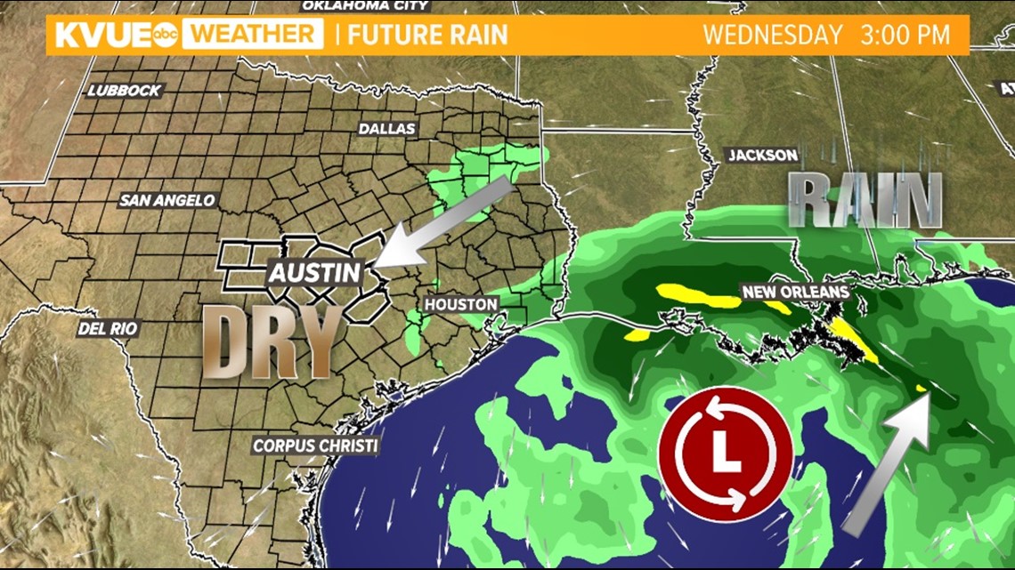
As the counterclockwise motion of the system lobs moisture to its north and east, it will also pull in dry, sinking air on its west side. Central Texas will line up with that subsiding air, leading to a couple of gorgeous days on Wednesday and Thursday.
High temperatures will be about average for this time of year, ranging through the mid- and upper 70s. If you have been stuck indoors due to the spotty showers and abundant clouds, Wednesday and Thursday will be your best chance to soak up the sun and get outdoors this week!