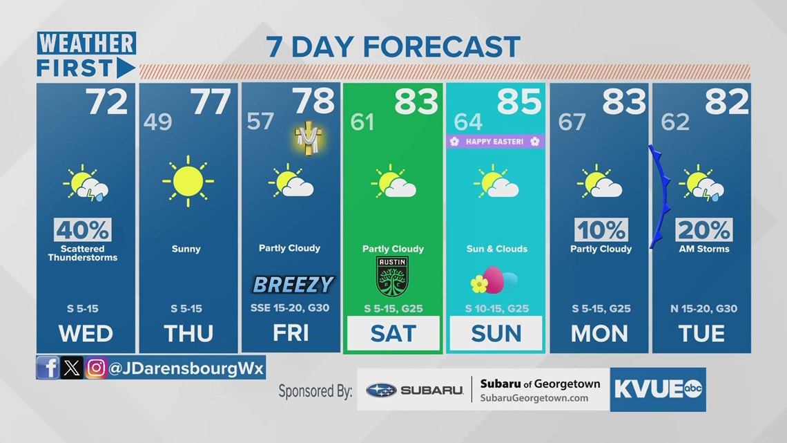
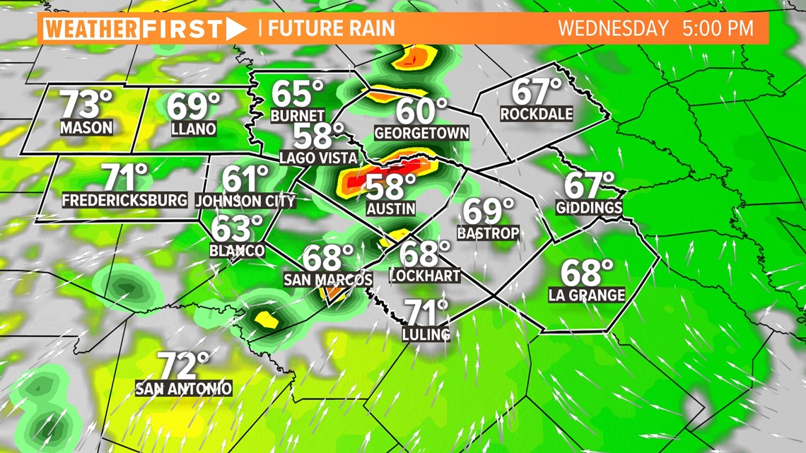
AUSTIN, Texas — Wednesday will bring the chance for a brief few rounds of rain across the KVUE area. Our dryline, usually set up across West Texas, will shift east, causing the potential for two rounds of rain, the first of which wrapped up late Wednesday morning.
The more active weather for Central Texas will come with the second round of showers and storms in the afternoon and early evening. As lighter rain moves off to the east, the KVUE Storm Team will be monitoring incoming storms in the Hill Country. Storms will gradually move east and become weaker in nature. At the moment, the better risk – though still low – will be supported in our northernmost counties between the hours of 4 and 8 p.m.

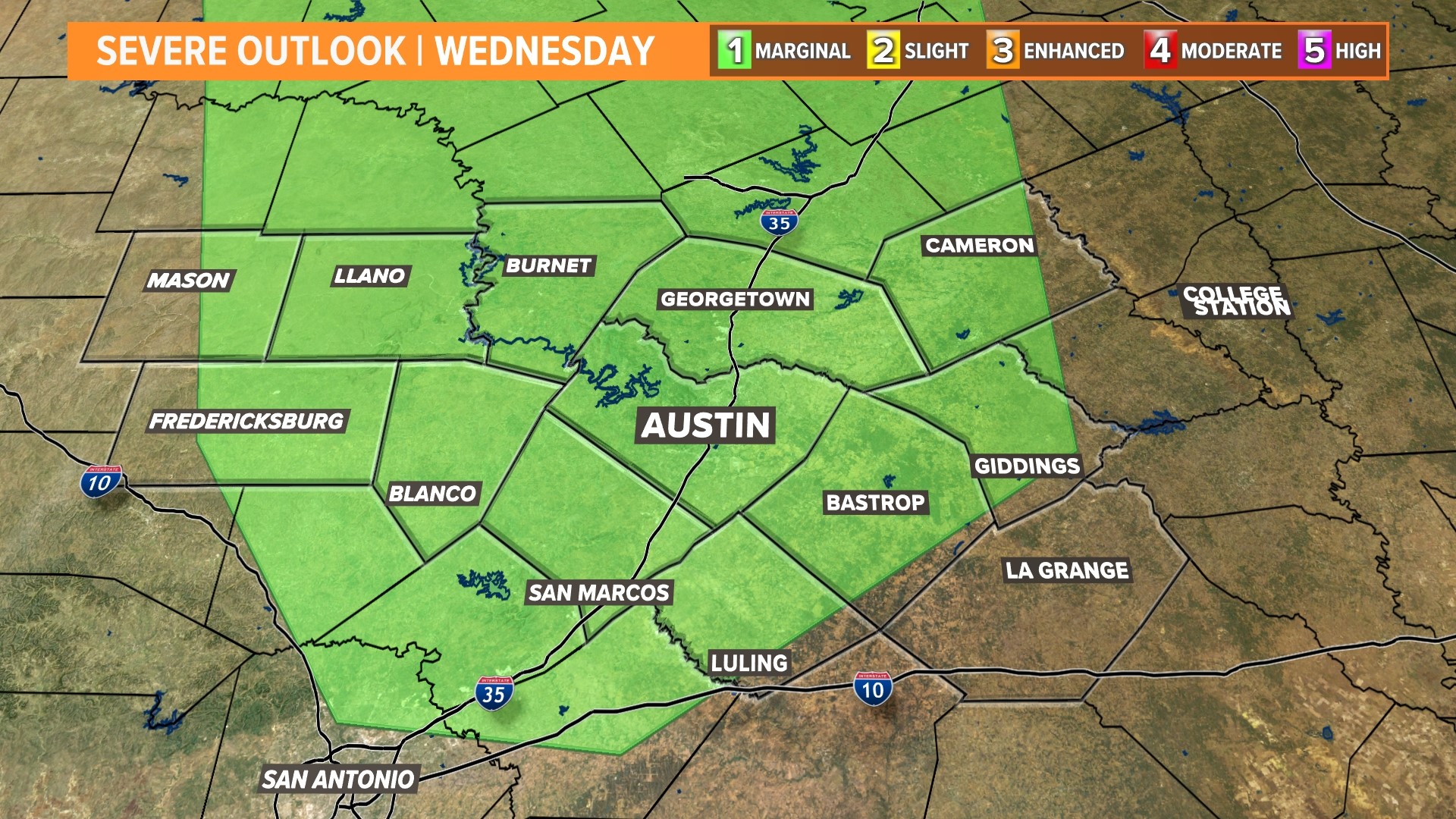
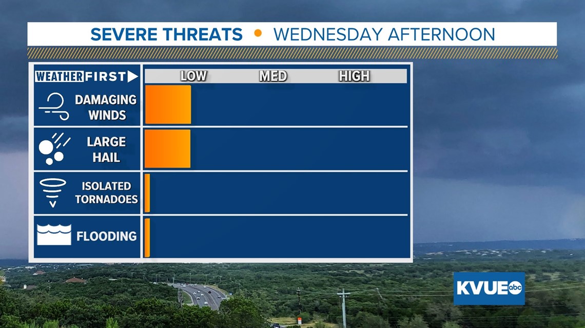
The National Weather Service has highlighted most of Central Texas in the "marginal" – level 1 out of 5 – risk for severe weather. Again, this is a low-risk event, but with stronger storms that do form, the main factors will be the potential for blustery winds and small hail.


This will be our last chance for active weather this week, as we enter into a drier and warmer trend throughout the next four days. Easter weekend may even get a little sweaty, but another storm chance may exist for Monday night.