

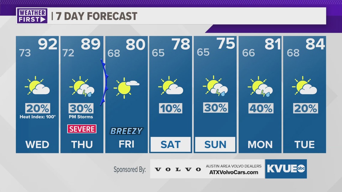
AUSTIN, Texas — Good Tuesday evening Austin, it was quite a warm day across the region, with highs recorded in the lower 90s for just the second time this year. The record high temperature for May 7th is 102 set back in 1998.
Tomorrow we are expecting even warmer conditions, which is likely to be the hottest day of the year so far. Highs will range through the lower and mid-90s, with feels-like temperatures up to 100 degrees.
Both Tuesday evening and Wednesday will have a 10-20% chance for showers or storms. Tuesday has a marginal, level 1 out of 5, risk for severe weather. With isolated storms expected to pop up in the Hill Country or northern I-35 corridor. Main risk factors will be hail and gusty winds.
By Thursday we will watch for additional storms, which could be widespread and strong across Central Texas. The area is again already under a slight risk. A cold front will bring this rain through, causing a cool down to the upper 70s and lower 80s by Friday and Saturday.
More rain is on the way come Sunday but that event is a bit too far out to hash out details just yet. You can find updates here, or on-air each and every day.
TUESDAY NIGHT:
Increasing clouds. South wind at 5 to 10 mph.
LOW: 73
WEDNESDAY:
Partly cloudy, and humid. South wind at 5 to 10 mph. Heat index up to 100°F.
HIGH: 92
7-DAY FORECAST:

Check out the live radar for what you can expect the rest of the day and into the workweek.