x
Breaking News
More () »

Forecast: Scattered strong storms Friday; higher storm chance Sunday morning

Here are the latest updates from the KVUE Weather Team.

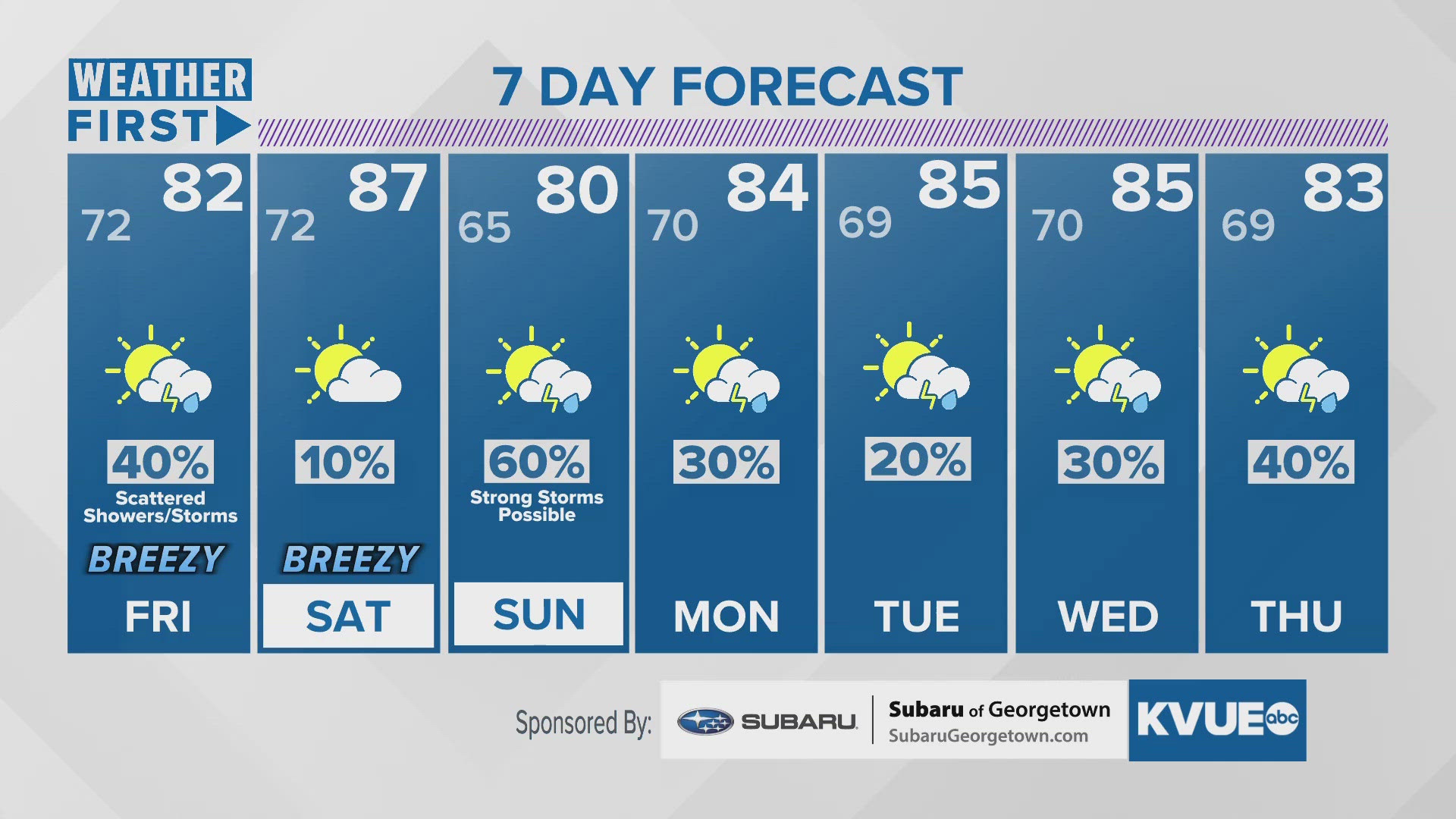
AUSTIN, Texas — We're tracking two separate disturbances moving through Central Texas over the course of the next several days. The first arrives Friday morning and lingers through the early afternoon. The Storm Prediction Center has placed all of Central Texas under a "marginal" – level 1 out of 5 – risk for strong storms Friday. Afternoon highs peak in the lower 80s, with breezy conditions continuing throughout the day. Even windier conditions arrive Saturday, with gusts near 40 mph will be possible.

The second chance for storms arrives Saturday night through early Sunday morning. Storms within this disturbance have a higher chance of being stronger. The main concerns are large hail, damaging wind and isolated tornadoes. 

We will have to iron out the exact timeline over the next day or two, but make sure you stay on top of the forecast as we head into the weekend.

THURSDAY NIGHT:
Cloudy, warm, and breezy. South wind at 15 to 20 mph with gusts up to 35 mph.
LOW: 72

FRIDAY:
Partly cloudy. 40% showers and storms. One or two storms could be severe. Windy. South wind at 10 to 20 mph with gusts up to 30 mph.
HIGH: 82

FRIDAY NIGHT:
Cloudy, warm, and muggy. Drizzle possible. South wind at 10 to 20 with gusts to 30 mph.
LOW: 72

7-DAY FORECAST:

Scattered storms on Friday.

Today's Allergy Report

Check out the live radar for what you can expect the rest of the day and into the workweek.

Stay with KVUE on YouTube, Facebook, Twitter and Instagram, and download the KVUE News app so you can stay ahead of the weather: kvue.com/app.

KVUE on social media: Facebook | X | Instagram | YouTube

Before You Leave, Check This Out