AUSTIN, Texas — Editor's note: This article will no longer be updated. Further information regarding upcoming weather can be found here.
A busy week of weather continues for Central Texas with widespread rain and storms expected for Wednesday night. Some of these storms could be strong to severe with large hail, isolated tornadoes, and gusty winds.
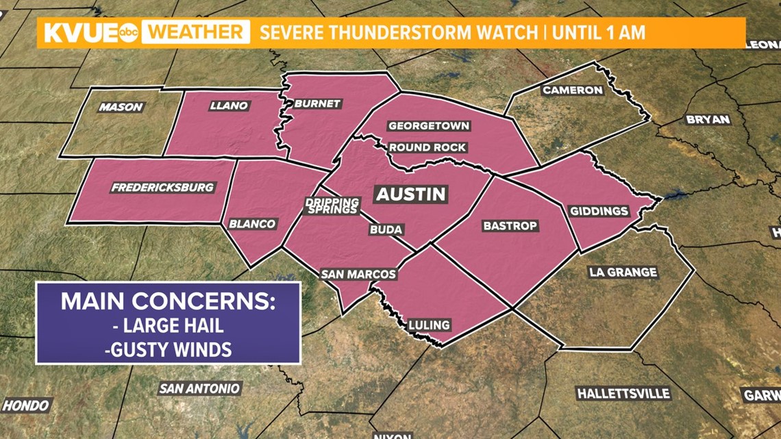
A Tornado Watch for Austin and much of our KVUE was canceled and replaced with a Severe Thunderstorm Watch until 1 a.m. Thursday morning. The watch has now expired. Make sure you are staying weather aware and you have a reliable way to get weather alerts such as the KVUE app.

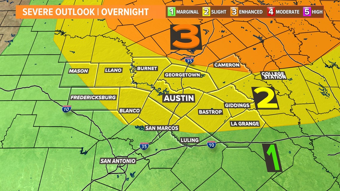
The severe weather threat from the Storm Prediction Center has increased since yesterday. Most of the KVUE area is now included in the 'slight' - level 2 of 5 - risk for severe storms.
Milam Country is clipped by the level 3 risk. The main concern will be large hail which could reach ping pong ball size or even larger.

Ahead of the front, we could see a few storms develop in the evening which could contain an isolated tornado threat. However, our highest storm chances arrive later in the evening.
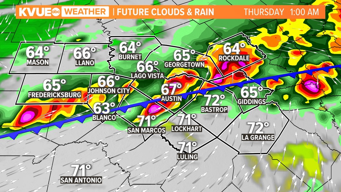
Later Wednesday night, high-resolution forecast models are showing a strong line of storms pushing through Central Texas Wednesday overnight into Thursday morning.
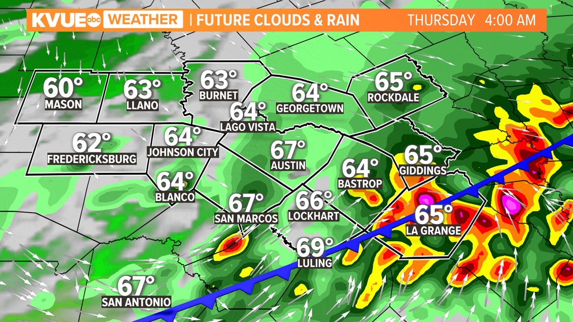
This line would continue to push toward the Coastal Plains through the early morning hours. Some lingering showers will be possible in the Coastal Plains during the morning, but conditions clear later in the afternoon.
Isolated storms possible ahead of the front could develop in the Hill Country around 9:30 p.m.

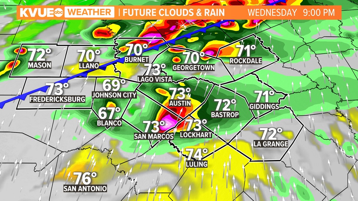
As the cold front approaches Central Texas, a line of stronger storms could develop closer to midnight, and possibly be in the Austin metro by around 1 a.m.

By 4 a.m, the bulk of moisture is expected to be shifting east, and eventually clearing out of Central Texas come the early afternoon. These lasting storms could remain strong, with the main threats of wind and hail continuing.

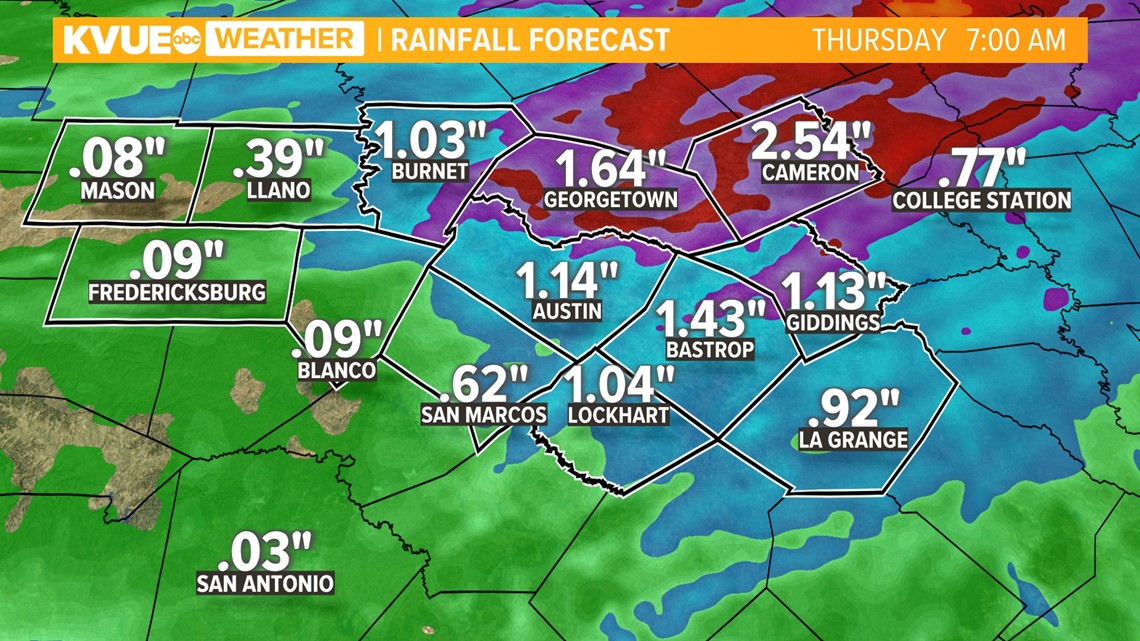
Between now and Thursday morning, areas along and east of I-35 could pick up 1 to 2+ inches of rainfall. Some localized totals could be in the 2 to 3 inches range, so we can't rule out some minor flooding.

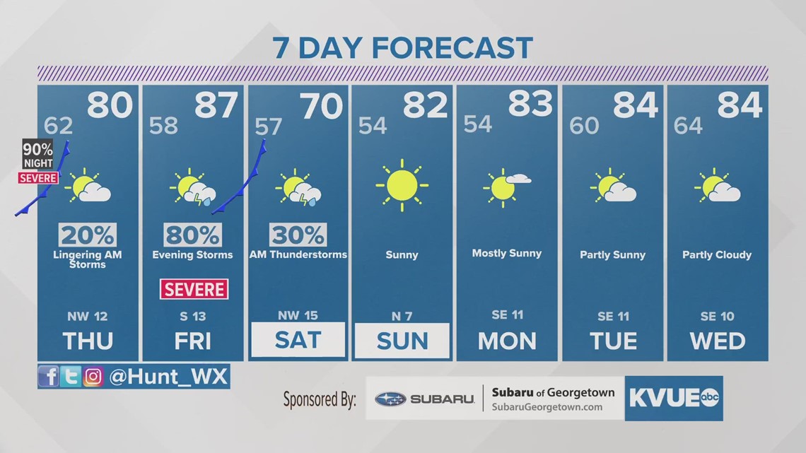
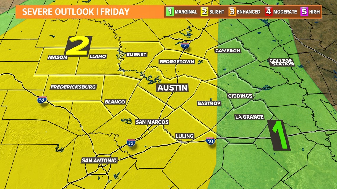
The third and final chance for storms this week will be Friday evening as a second cold front moves through. Forecast models are now hinting at some of the storms associated with this system being on the stronger side. The Storm Prediction Center has placed a majority of Central Texas under the "slight" risk for Friday night into Saturday morning. We'll have additional details on the possible impacts of this system soon.

The KVUE Storm Team will continue to closely monitor this developing forecast.
In the meantime, the extended forecast can be found below: