AUSTIN, Texas — We're tracking a system that could bring in a few showers and storms Monday evening, some of which could be on the stronger side. Here's the latest.
Threats
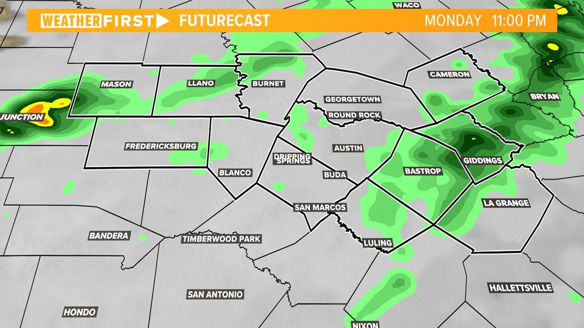
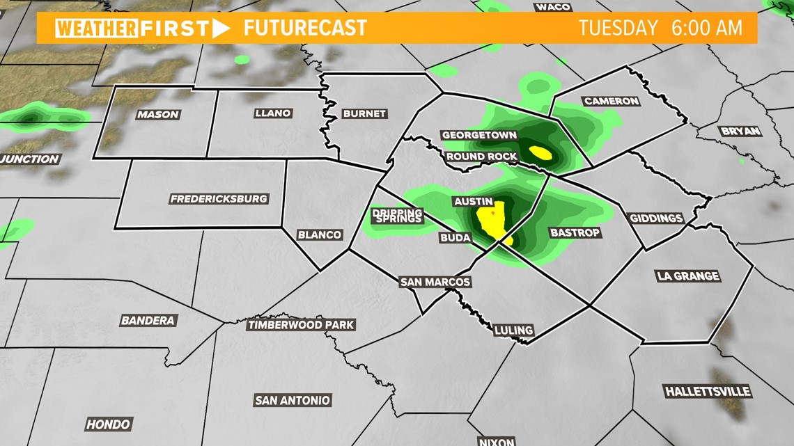
We're tracking this system in two separate rounds, with the first expected Monday evening and the second round is expected Tuesday morning.
The Monday morning update from the Storm Prediction Center now places the severe weather threat to the west of the KVUE viewing area.

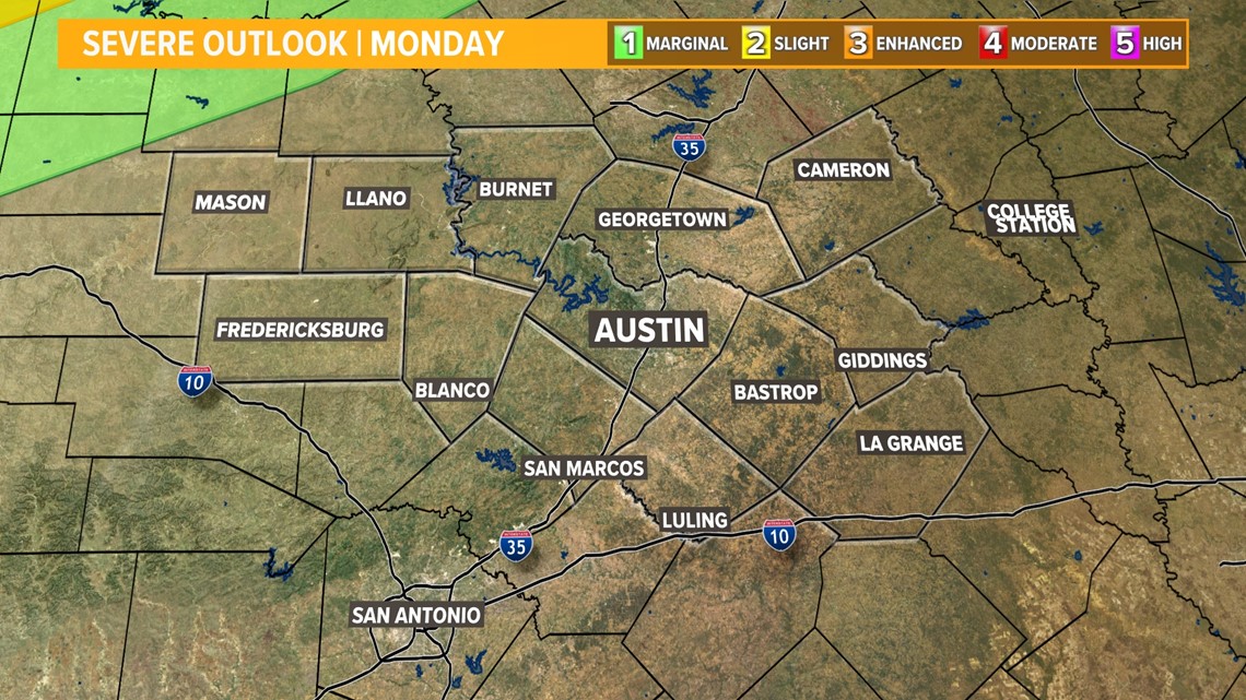

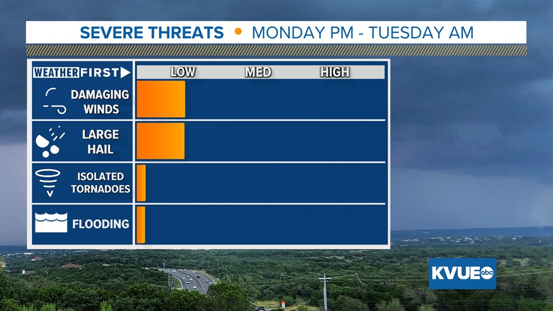
When it comes to main threats, we're only tracking hail and damaging winds, and even those are on the lower end. The system passing through is on the end of a long-reaching cold front as part of an upper-level low spinning in the Intermountain West.
Timing
As we mentioned, this system looks to be coming in two rounds. The first of these rounds would be from 8 to 11 p.m. Monday, with the system only producing isolated showers in the Hill Country and Coastal Plains, according to our latest model runs.

The second round appears to show similar characteristics. However, we're tracking this system coming through between 5 to 8 a.m. Tuesday, and this round has a better chance for storms in the Coastal Plains and along the Interstate 35 corridor.
We currently do not expect any severe weather Tuesday morning.

Summary
These storms don't look to have much of a strong punch, but that's not to say we can completely rule out any chance for small hail or strong wind gusts. Stick with KVUE for the latest as we track all of this.
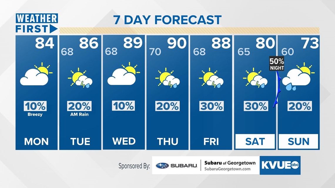
In the meantime, your seven-day outlook is below.