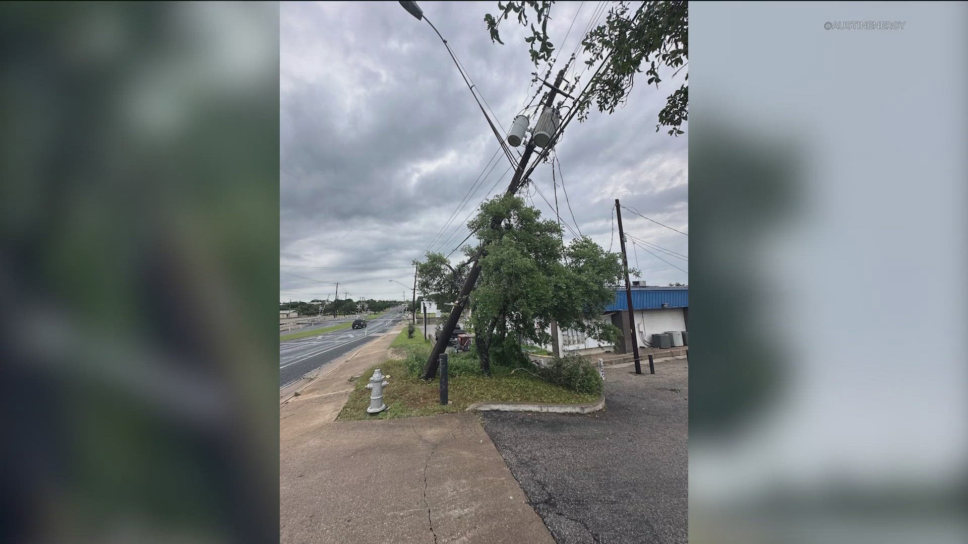
AUSTIN, Texas — It was certainly an active evening Tuesday into Wednesday across Central Texas as widespread strong storms swept through the area. The KVUE Weather Team tracked large, damaging hail and beneficial rain.
Here's a summary of what we saw.
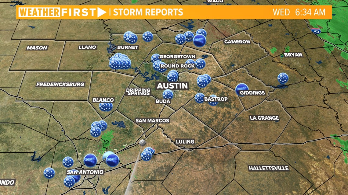
Storm reports
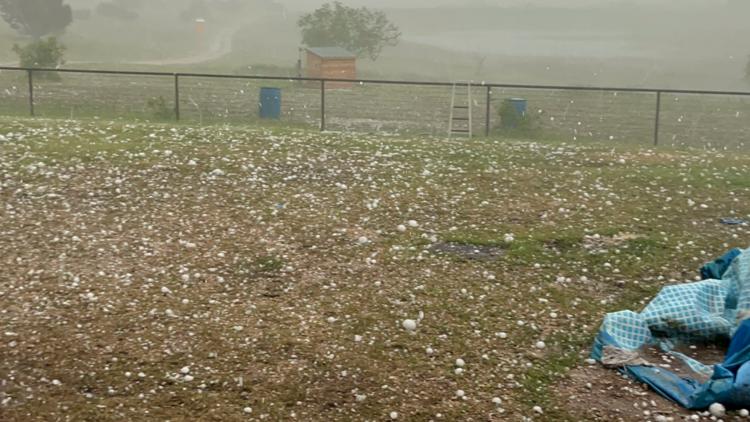
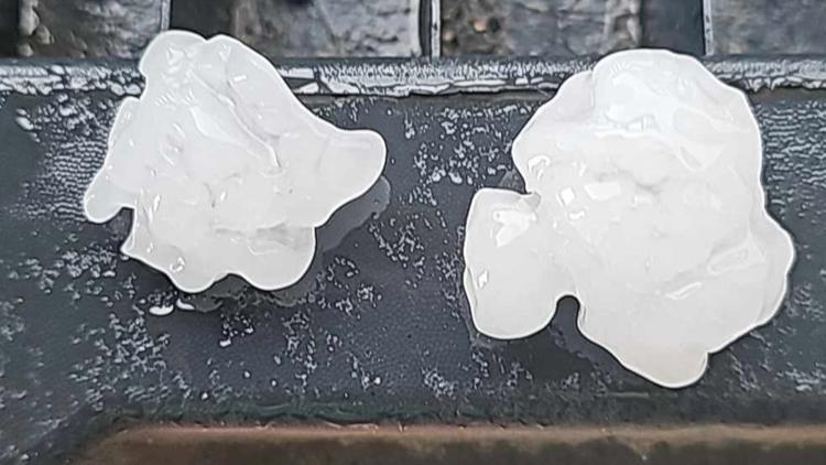
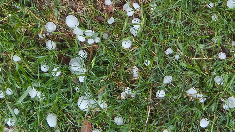
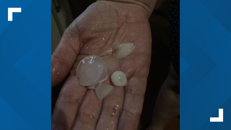
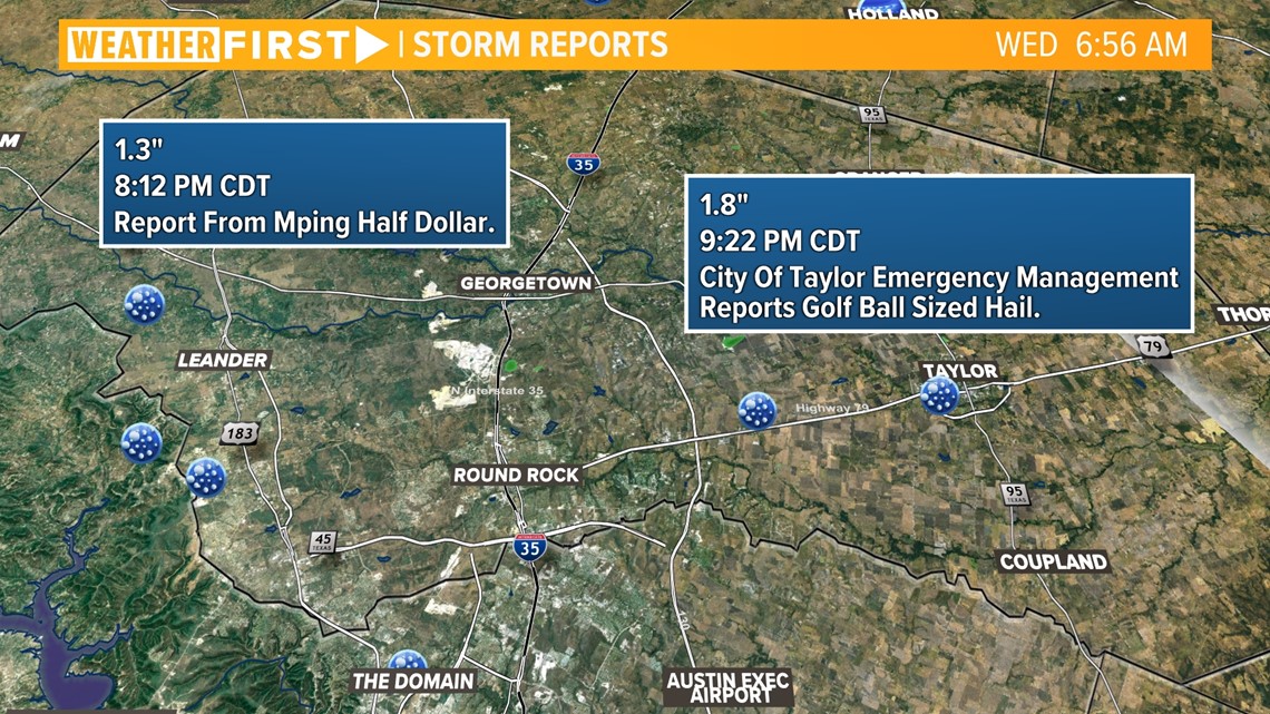
Widespread hail reports were received by KVUE and the National Weather Service over the past 24 hours. The most frequent reports were located in the northern half of the viewing area, especially in Burnet County.

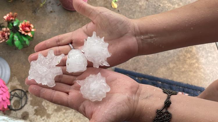
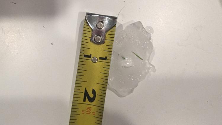
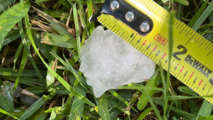
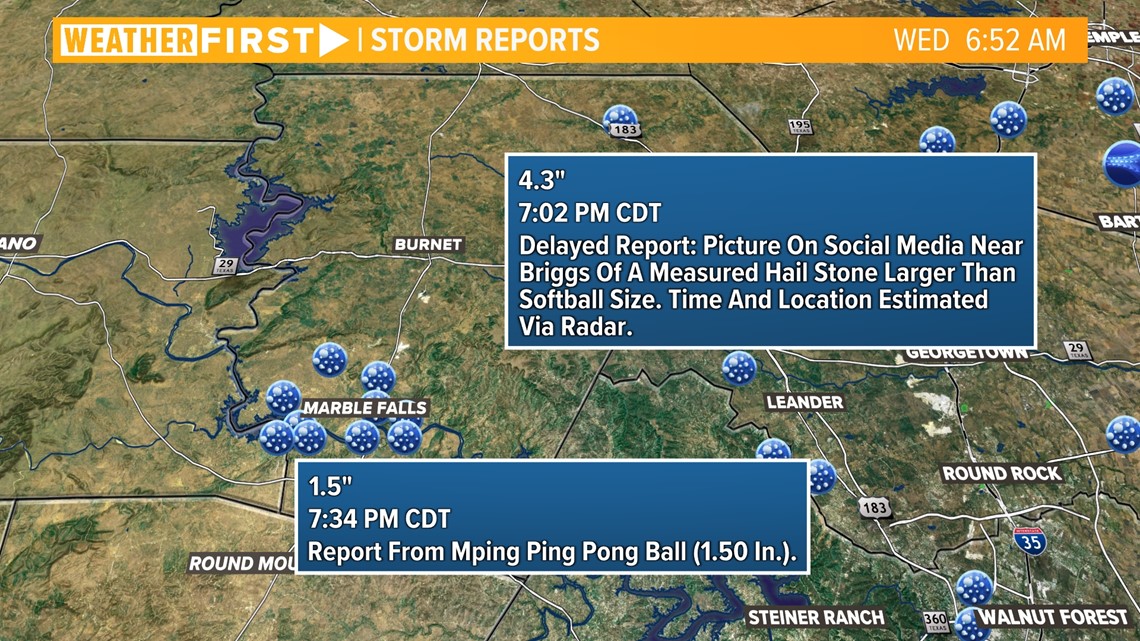
The largest reported hail incidents were located in Burnet County, specifically near the Briggs area, where hail around softball-size was recorded.
Closer to Marble Falls, hail about the size of a ping pong ball was reported.

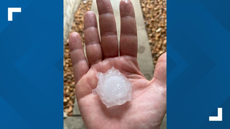
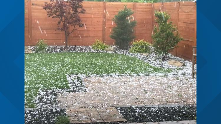
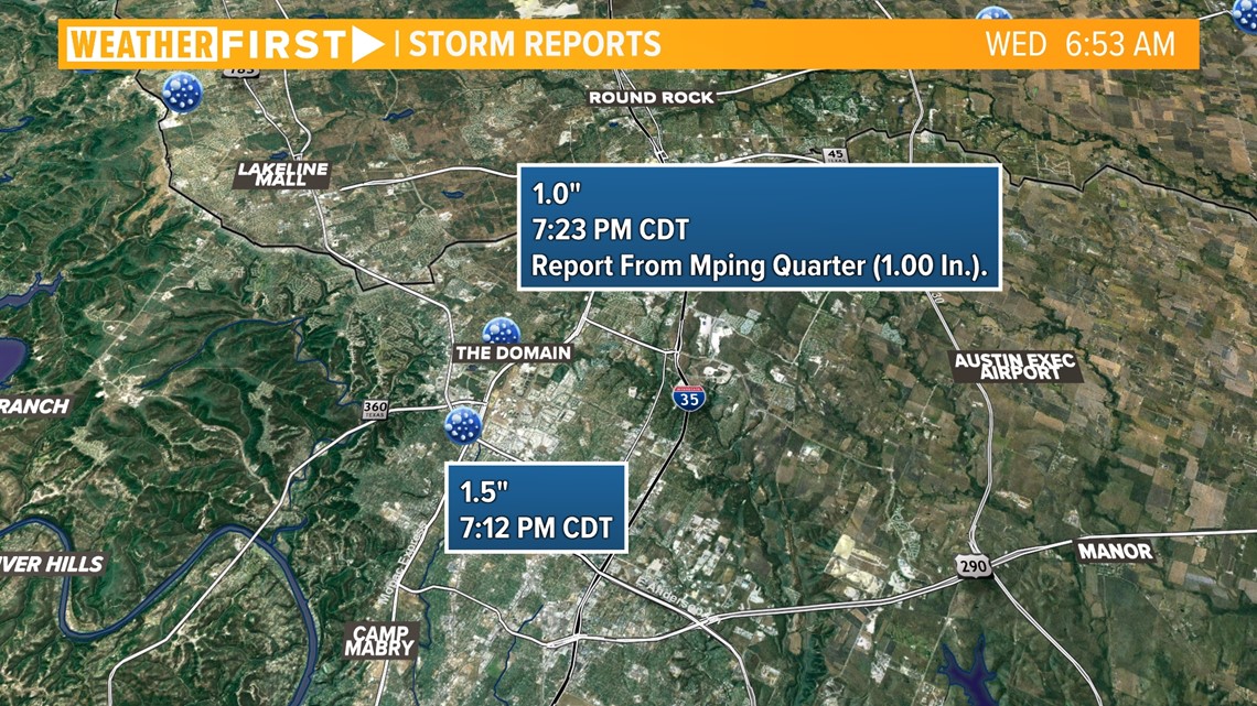
Along the Interstate 35 corridor, northern Travis County and Williamson County received the most hail reports. Around The Domain area, hail ranging from an inch to an inch and a half was reported.


Rain totals
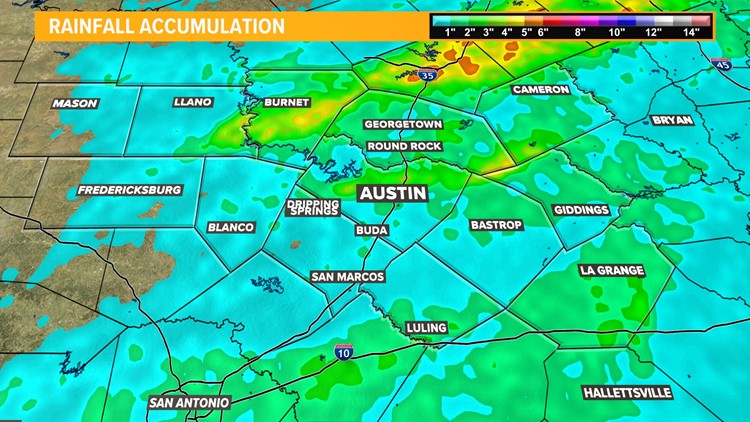
While the damaging hail was not welcome in Central Texas, it was certainly exciting to see widespread beneficial rainfall. The heaviest rain fell in Burnet, Williamson, Travis and Fayette counties. Radar-estimated rainfall totals range from a few tenths of an inch to over 4 inches.

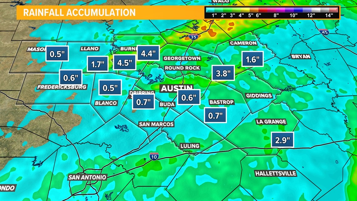
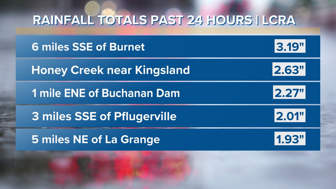
Official Lower Colorado River Authority (LCRA) rain gauge totals ranged from a few hundredths of an inch to more than 3 inches for some locations.
Here is a look at some of the largest official rain totals from Tuesday through Wednesday morning:

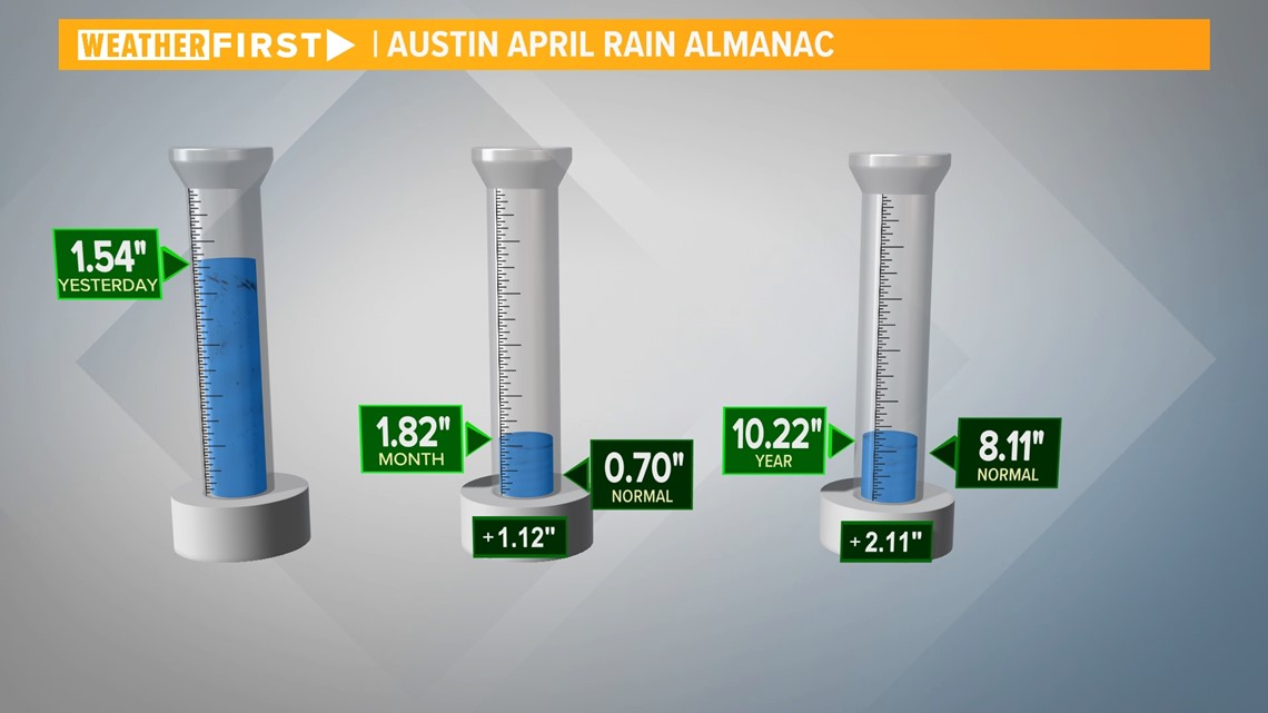
At Camp Mabry, we recorded more than an inch and a half of rain, which brings us well ahead of the normal rainfall total by this point in the month of April by over an inch. This also keeps us ahead of our yearly normal rainfall up to this point.
The Austin-Bergstrom International Airport recorded just more than a half-inch of rain during Tuesday evening's storms.

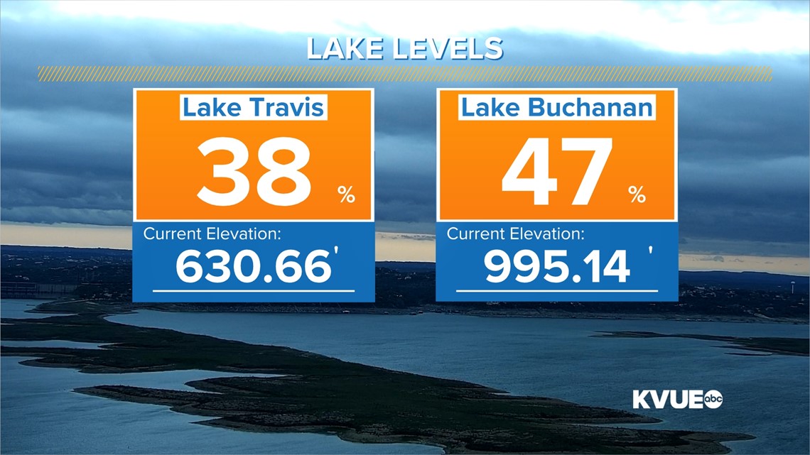
Did this rain impact our lake levels? The answer is yes! It's not much, but Lake Travis increased by 1.56 inches and Lake Buchanan by 1.32 inches over the past 24 hours. Lake Travis is at 38% capacity and Lake Buchanan is at 47% capacity.

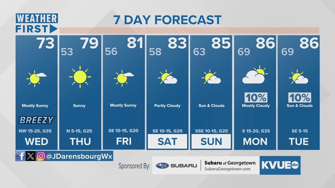
Looking ahead, we'll be trending on the drier side for the rest of the workweek and weekend. Isolated rain chances could return as early as next week. Here is a look at your extended forecast: