AUSTIN, Texas — Editor's note: This blog is no longer being updated.
Sunday was officially the hottest day so far of the year with a high of 102 for Austin. We don't have good news with regards to heat relief, but a weak "cold" front will help drop highs back to the mid and upper 90s for Labor Day.
Ahead of that front, we saw some widely scattered showers and storms develop north of Austin. It was hit or miss activity, but a 30% chance of showers and storms continued through Sunday evening.

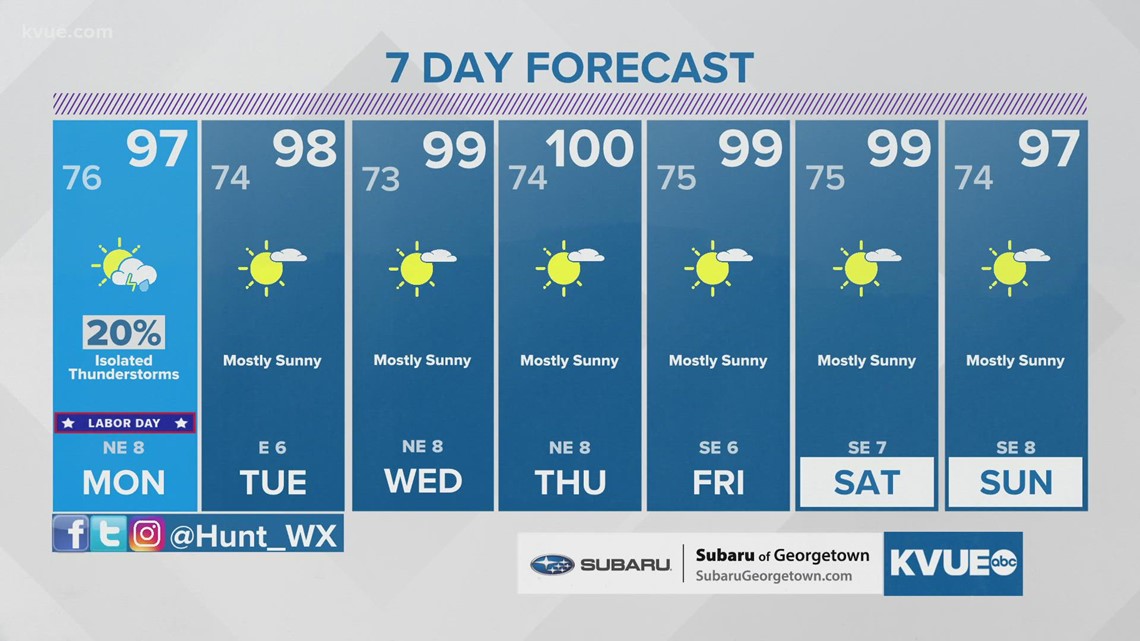
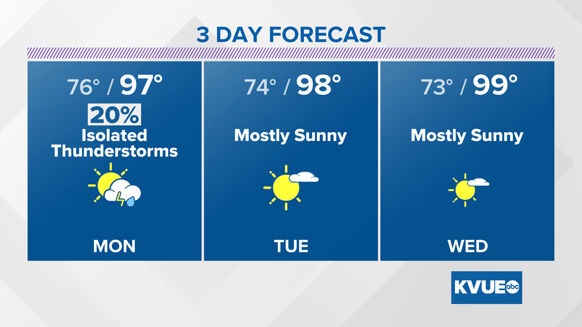
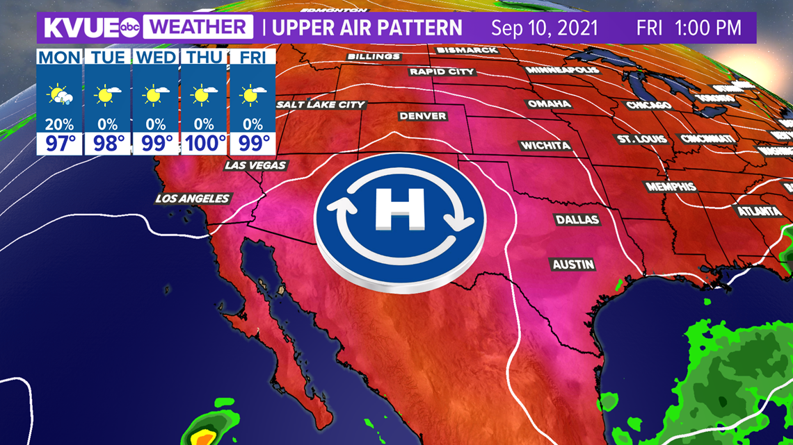
Models have really backed off on the rain chances for Labor Day. We've now dropped the rain chance to just 20%. We will get a wind shift tomorrow out of the northeast, and afternoon highs will dip slightly to the mid to upper 90s.
Keep an eye to the sky for any outdoor Labor Day plans, but it looks like most will stay dry.

After Labor Day, we drop the rain chances and start to ramp up the heat again as another ridge of high pressure builds into Texas. Highs will be in the upper 90s the lower triple digits again mid and late week with no rain chances.

The KVUE Storm Team will continue to keep an eye on the forecast.
In the meantime, the extended forecast can be found below: