AUSTIN, Texas — Editor's note: This blog is no longer updating. For the latest, click here.
Storm chances kick off the start of the workweek as we remain under the influence of an upper-level trough of low pressure.
After a stormy Sunday with flash flooding in Travis County and Doppler-estimated rainfall accumulation of up to half a foot for some parts of Central Texas, we're expecting the wet weather pattern to continue Monday.


Monday afternoon storms possible
We'll start off the day mainly dry with partly cloudy skies. Temperatures will even be a few degrees below average now that we are on the backside of a boundary, which brought us stormy weather on Sunday.
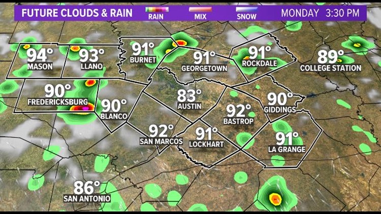
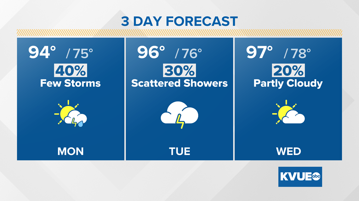
Rain chances begin to initiate once again Monday afternoon. We're tracking a 40% chance of rain, so it shouldn't be as widespread as Sunday, but isolated heavy downpours will still be possible. This could result in additional minor localized flooding given that many areas now have saturated grounds.

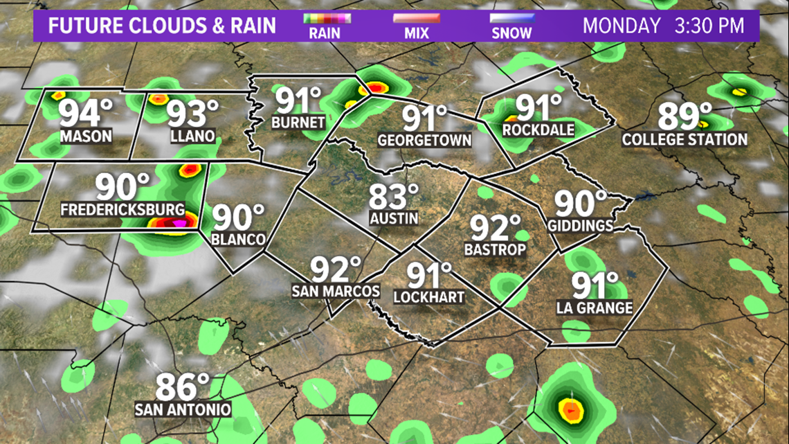
The trough of low pressure in the upper levels of our atmosphere that is helping initiate this wetter weather pattern will be short-lived. Another ridge of high pressure builds in by midweek, bringing us right back up to typical mid-August conditions with mostly sunny skies.

Tracking the tropics
As of Sunday night, Tropical Storm Fred has maximum sustained winds of 40 mph, is moving to the north-northwest at 10 mph and the center is about 200 miles south of Panama City, Florida. Fred is expected to make landfall along the Florida Panhandle as a tropical storm Monday. Heavy rainfall, tropical storm force winds and dangerous storm surge will all be a concern through Tuesday for parts of the southeast.


Grace is currently a Tropical Depression with maximum sustained winds of 35 mph and moving west at 15 mph. The center is currently about 295 miles east-southeast Haiti. Grace is expected to move through the Caribbean over the next several days and then into the middle of the Gulf.
At this time, it is too early to tell if the Texas coast will have any direct impacts, but we urge you to keep up to date with the forecast through the week as it is likely to change.

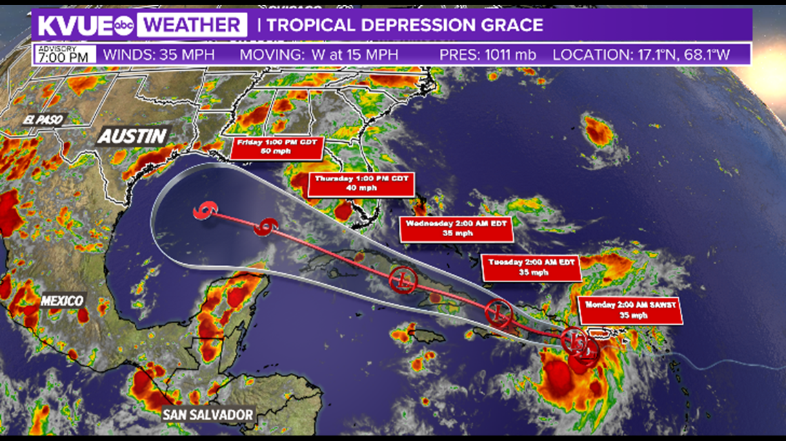
The KVUE Storm Team will continue to monitor this developing forecast.
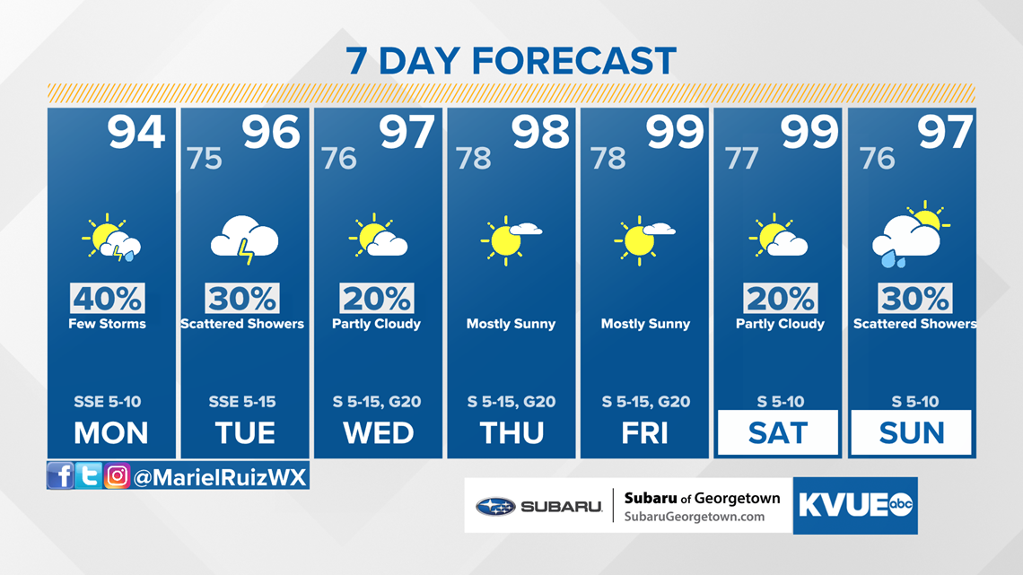
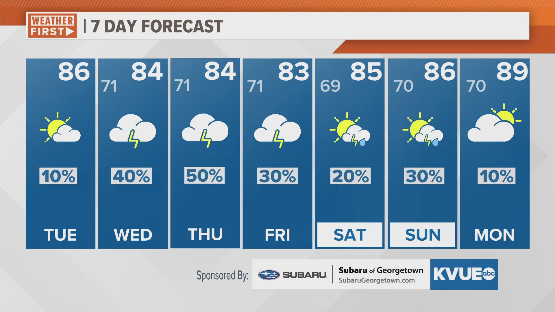
In the meantime, the extended forecast can be found below: