
AUSTIN, Texas — *an Areal Flood Watch is in effect for Llano, Gillespie, Blanco, Burnet, Williamson, Travis, Milam, Hays, Caldwell, Bastrop, Fayette, and Lee County until 7 a.m. Thursday morning*
We hope you've had a good Wednesday so far!
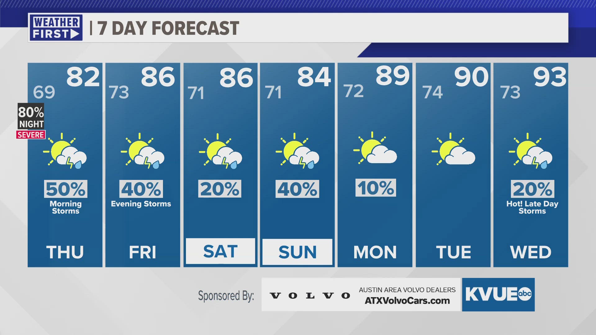
We're tracking the potential of strong storms during the evening hours and the potential for heavy rain during the overnight hours, and we've already had some reports of flash flooding that has resulted in road closures in the Austin metro. The severe threat for the evening hours is mainly a 2 out of 5 "slight" risk, but portions of Mason County are in that "enhanced" - 3 out of 5 - risk. All modes of severe weather are fair game, although damaging winds and hail look to be the primary threats. Additionally, there's a "moderate" - 3 out of 4 - flood risk for later Wednesday night into early Thursday morning, with some isolated spots getting up to five inches of rain, which could cause flash flooding, so please do not drive through flooded roads. We have already received reports of four and a half inches or more in Blanco County, and more rain could be on the way through the rest of the overnight hours.
Afterwards, we're tracking a slightly calmer pattern for Friday, although there could be one or two evening storms, and the weekend, with upper 80s to near 90 for next week under drier conditions.