

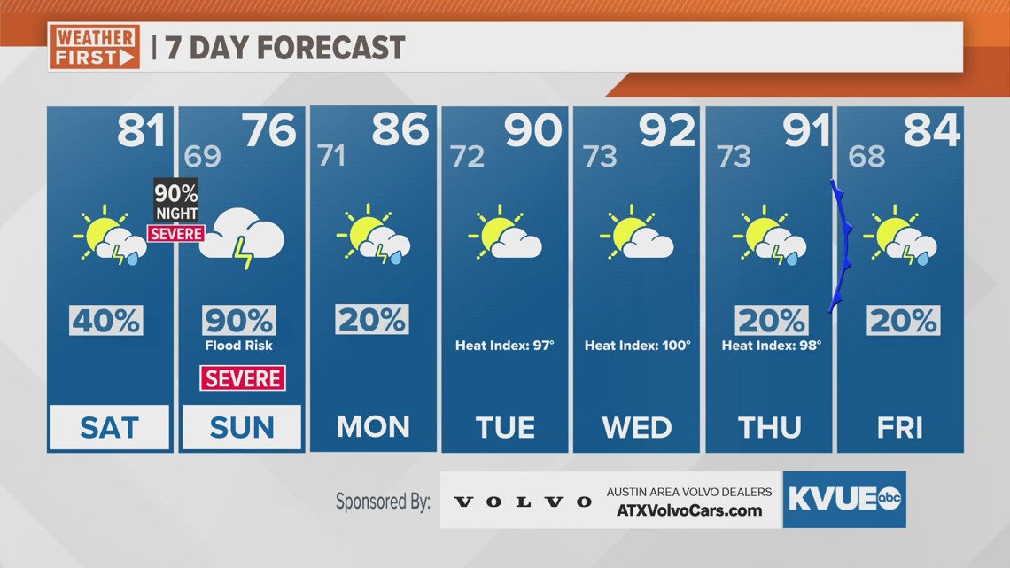
AUSTIN, Texas — There will be some drizzle and isolated showers during the day on Saturday, but storm chances really ramp up Saturday night into Sunday morning. During this time frame we expect widespread rain and storm to move in from the north. These storms will bring both a severe weather risk and flood threat. The rain chance on Sunday during the morning is now 70 to 80 percent.
A widespread 1 to 3 inches of rainfall is likely with isolated totals of 4"-5" plus. Again, this will mean that the flood threat continues through this weekend.
Rain chances really dwindle early next week, and the heat will ramp up. High temperatures will be in the low to mid 90s by the middle of next week. Unfortunately, it will also still be very humid so feels like temperatures during the peak heat of the afternoon will be close to 100 degrees.
SATURDAY:
30% showers and storms, mainly late day. Mostly cloudy with patchy drizzle. Southeast wind at 5 to 10 mph.
HIGH: 81
SATURDAY NIGHT:
90% rain and storms. Storms could be severe. Southeast wind at 5 to 15 mph.
LOW: 68
SUNDAY:
90% rain and storms. Flood risk and severe threat. South-southeast wind at 5 to 15 mph.
HIGH: 76
7-DAY FORECAST:

Check out the live radar for what you can expect the rest of the day and into the workweek.