
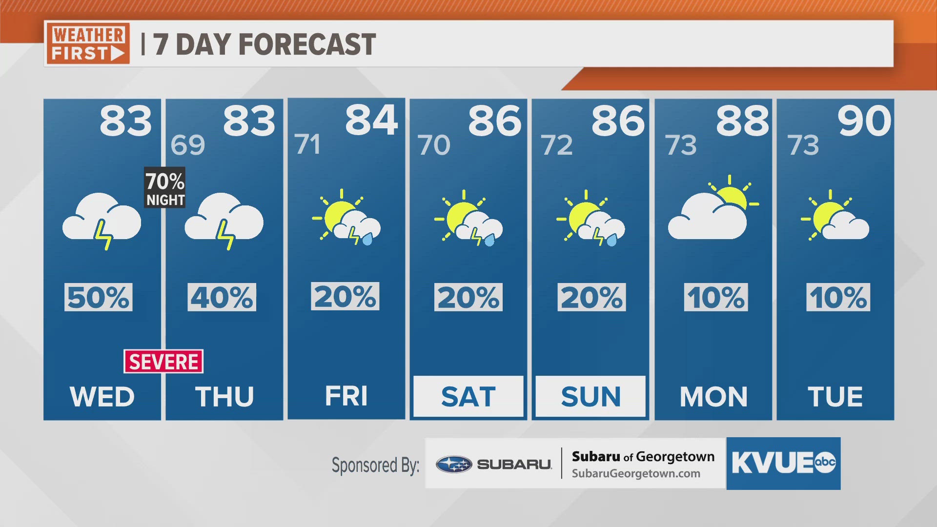
AUSTIN, Texas — We've had a fairly quiet start to the week so far, but changes are on the way as we track the potential for strong storms late Wednesday afternoon through the overnight hours.
Morning temperatures will start in the upper 60s and lower 70s and by daybreak Wednesday morning, our moist pattern could produce more patchy fog and patchy drizzle, especially in the Coastal Plains. Scattered showers and storms will be possible as temperatures climb into the lower 80s, but our main severe weather threat arrives Wednesday evening through Thursday morning.
Some sparse storms are expected to develop around 7 p.m. or 8 p.m. Wednesday, and then a more substantial line of storms will push in from the Hill Country past midnight and into Thursday morning until around 6 a.m.
The Storm Prediction Center has placed all of Central Texas under either a level 1 or 2 risk for strong storms, with the highest areas of concern being the Hill Country and northern parts of the I-35 corridor. The main impacts will be storms containing large hail and damaging wind. Isolated tornadoes cannot be ruled out and we will also monitor the potential for flash flooding under any heavy storms.
More isolated and scattered rain and storms could reemerge Thursday evening as rain chances eventually linger into the weekend. Not everyone will receive rainfall over the weekend, but isolated storm chances will remain Friday through Sunday.
A warming trend takes place over the weekend with highs in the mid-80s. We'll continue to trend even warmer for next week with highs returning to the lower 90s by Tuesday.