
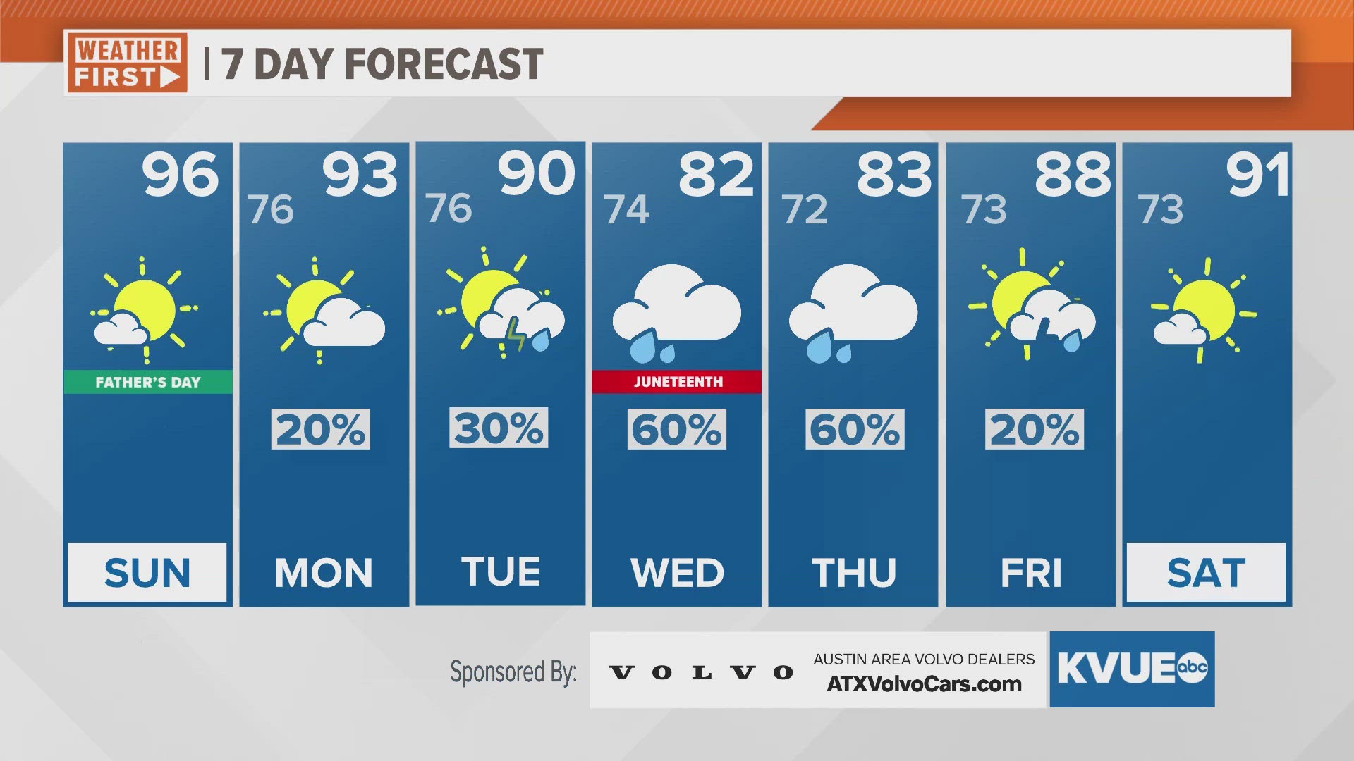
AUSTIN, Texas — It'll be really hot and dry for Father's Day, but we're tracking humid and wet changes as we head into next week. Highs today will trend through the mid and upper 90s throughout the region, with SSE winds boosting humidity too. Heat index values will be up to 100 for most of us Sunday.
Cooler temperatures will gradually return for the middle portion of this week, with highs only getting to the 80s area-wide by Wednesday. The KVUE Storm Team is still tracking the formation of a potential tropical system near the Yucatan Peninsula early this week, which will glide north towards South Texas.
The cooler temperatures and higher rain chances will be fringe impacts from this system we feel here in Central Texas. As of now, about 1-3" inches of rain are expected to favor areas along and east of the I-35 corridor, but we still anticipate some change in this forecast as we head closer to this event.
The rain will be short-lived this week as the sunny and hot weather makes a return by Saturday of next weekend.
SUNDAY:
Mostly sunny. Southeast wind at 5 to 15 mph.
HIGH: 97
SUNDAY NIGHT:
Mostly clear. Calm wind.
LOW: 77
SEVEN-DAY FORECAST:


Check out the live radar for what you can expect the rest of the day and into the workweek.