
AUSTIN, Texas — Happy Tuesday, everyone!
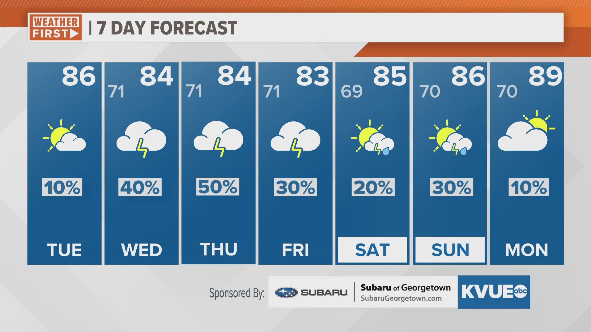
Heading into the afternoon, expect partly sunny skies with highs in the mid-80s. We'll monitor a "moderate" on the Air Quality Index due to smoke blowing in from fires in Mexico. While an isolated shower can't be ruled out in the Hill Country this evening, most remain dry for today. Looking ahead, rain chances will be on the rise for the middle and back half of the week.
Scattered showers and a few strong storms will be possible Wednesday afternoon through the night. The strongest storms are currently forecast to arrive overnight Wednesday into early Thursday. The Storm Prediction Center has placed all of Central Texas under a "marginal" -level 1 out of 5- risk for strong storms during this timeframe. The main concerns will be large hail and the potential for isolated tornadoes.
We'll be monitoring another round of showers and storms Thursday afternoon and evening as daily rain chances eventually linger into the weekend.
The timing and location of the rain will be a day-to-day forecast, so be sure to check back with KVUE frequently if you have outdoor plans this week.