
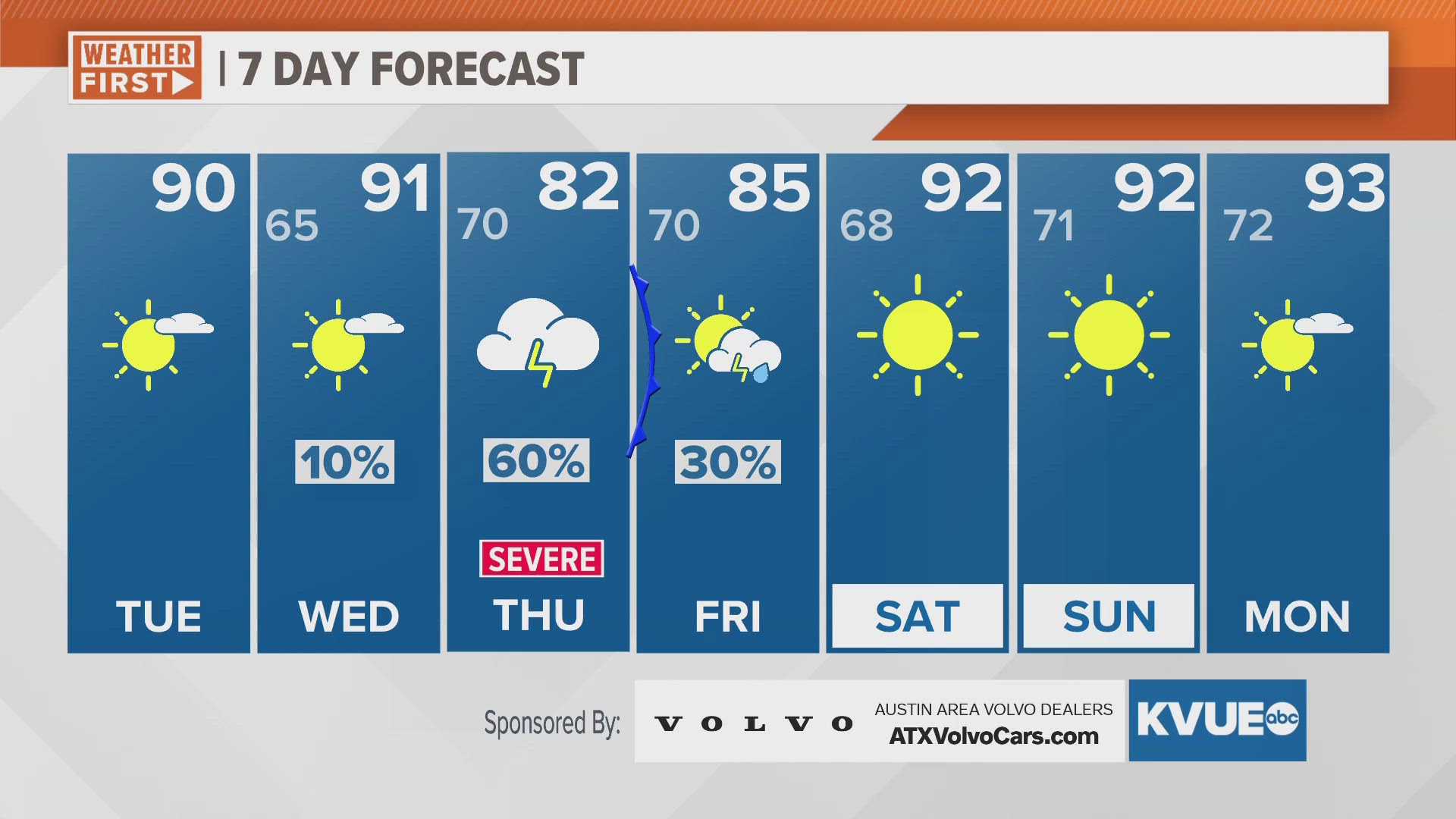
AUSTIN, Texas — Drier and warmer for the next couple days, but rain chances quickly return to the forecast before we know it.
Mostly sunny and warm conditions this afternoon with highs at approximately 90 degrees. Don't forget your sunscreen if you'll be spending prolonged periods of time outside – the UV index is a 10, which is considered "very high."
The Storm Prediction Center has highlighted Mason County under a "marginal" risk for an isolated storm Tuesday afternoon or early evening, but no significant rain chances are in the forecast. We'll see similar conditions for Wednesday.
On Thursday, unsettled weather returns with a 60-70% chance of scattered showers and storms. The Storm Prediction Center has already placed all of Central Texas under a "slight" – level 2 out of 5 – risk for severe weather. Our main concerns will be storms containing large to very large hail along with heavy downpours that could lead to flooding concerns.
Looking ahead to the weekend, we'll trend drier and warmer as highs range from the lower to mid-90s.
TUESDAY:
Mostly sunny and warm. Northwest wind at 5 to 10 mph.
HIGH: 84
TUESDAY NIGHT:
Mostly clear and mild. South wind at 5 to 10 mph.
LOW: 65
SEVEN-DAY FORECAST:


Check out the live radar for what you can expect the rest of the day and into the workweek.