

AUSTIN, Texas — *A Flood Watch is in effect for Milam County until 1 p.m. Sunday.
Heavy showers and storms moved through Central Texas overnight and now we're tracking the potential of more storms for your Sunday forecast.
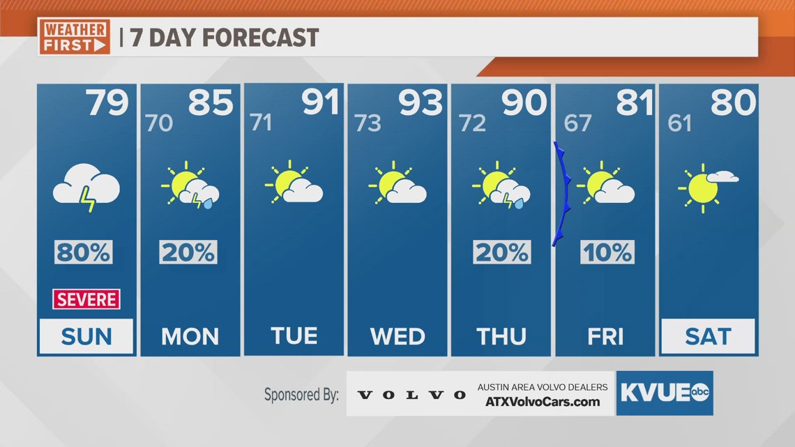
Sunday morning temperatures start in the 60s and will struggle to make it into the upper 70s for the afternoon. Rain returns later in the morning with additional storms developing for the afternoon into early evening.
The severe weather threat, and especially the potential for flooding will continue. Rain chances decrease by late Sunday evening. We could pick up an additional one to two inches for some spots with isolated higher totals.
Our rain chances go down but our temperatures go up for the workweek. Afternoon highs be in the low to mid 90s by the middle of the workweek. Unfortunately, it will also still be very humid, so "feels like" temperatures during the peak heat of the afternoon will be closer to 100 degrees. Make sure to stay hydrated!
But there is hope in sight! A cold front arrives Thursday evening and will drop our temperatures into the upper 70s just in time for next weekend.
SUNDAY MORNING:
20% rain and storms. Northeast wind at 5 to 15 mph.
LOW: 66
SUNDAY:
80% rain and storms. Flood risk and severe threat. South-southeast wind at 5 to 10 mph.
HIGH: 79
SUNDAY NIGHT:
20% chance for showers early. Increasing clouds. Patchy drizzle and fog develop late. Southeast wind at 5 to 10 mph.
LOW: 70
7-DAY FORECAST:

Check out the live radar for what you can expect the rest of the day and into the workweek.