
AUSTIN, Texas — Most of the severe weather missed the KVUE area to northwest Thursday evening. Through the overnight a few non-severe storms could scrape by northern sections of the KVUE area, but we're no longer concerned about severe weather. Outside of storms, there could be some light rain showers or drizzle through daybreak Friday.
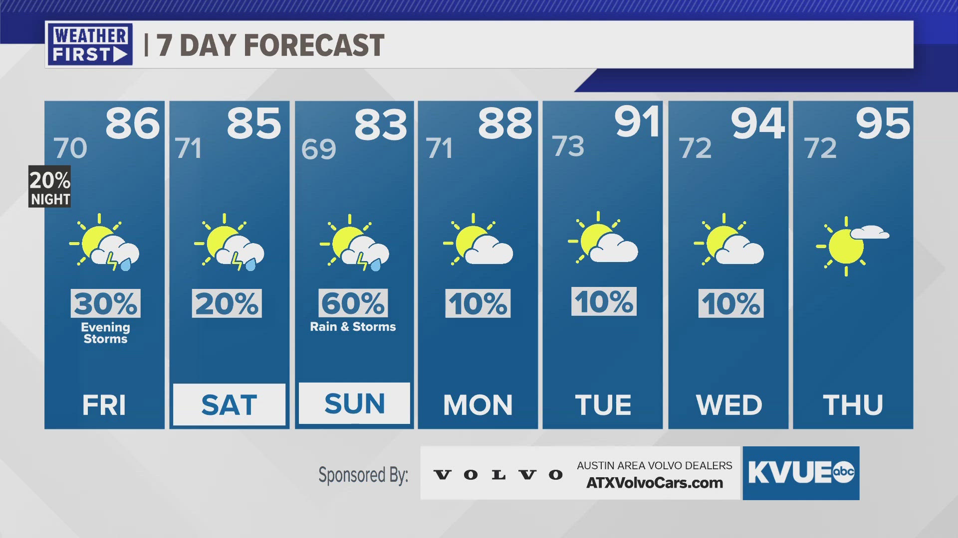
The day on Friday will be mostly to partly cloudy with highs in the 80s. The afternoon is likely mainly dry with just a small chance for a shower or isolated storm. There will be another opportunity for scattered strong to severe storms during the evening Friday, mainly west of I-35. The day on Saturday is mainly dry, and then storm chances start to ramp up again Saturday night into Sunday.
We're now expecting fairly widespread rain and storms on Sunday. The rain chance is 60 percent, and this system could bring more severe weather and localized flooding. The forecast next week trends much drier, but also much hotter. High temperatures are expected to reach the mid 90s by the middle of next week.
THURSDAY NIGHT:
30% evening showers and storms, mainly in the Hill Country. A few could be severe. Southeast wind turning northeast late at 5 to 10 mph.
LOW: 70
FRIDAY:
Partly cloudy. 30% showers and storms, mainly during the evening. Storms could be severe. East-southeast wind at 5 to 10 mph.
HIGH: 86
FRIDAY NIGHT:
30% evening storms, then mostly cloudy. East-southeast wind at 5 to 10 mph.
LOW: 71
7-DAY FORECAST:


Check out the live radar for what you can expect the rest of the day and into the workweek.