
AUSTIN, Texas — Today will be a generally nice one. Highs will get into the lower and mid-80s, with a risk for a few stronger thunderstorms in Hill County this afternoon. The overall risk is low.
Still light concentrations of smoke across central and south Texas, so that hazy look to the skyline may still be around today. And if you are sensitive to air quality issues, please limit your time outside.
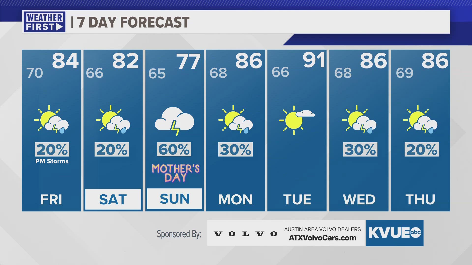
Tracking heavier rains this weekend that could interrupt any outdoor Mother's Day plans. Monday also looks like a wet start to the week. Multiple rounds of rain will increase our flood risk as we head through the days 4-5 days here. Drier and warmer Tuesday, and then our moist pattern returns for the middle of next week with a 20-30% chance for showers and storms Wednesday and Thursday.
THURSDAY NIGHT:
Early evening storms, some of which could be strong. East wind shifting out of the north at 5 to 10 mph.
LOW: 70
FRIDAY:
Partly sunny and warm. Less humid. 10% afternoon storm in the Hill Country. Northeast wind at 10 to 15 mph with gusts around 20 mph possible.
HIGH: 84
7-DAY FORECAST:


Check out the live radar for what you can expect the rest of the day and into the workweek.