
AUSTIN, Texas — We've tracked a very nice Friday across Central Texas, which is a good change of pace given how everything went down Thursday night, especially in Hays and Williamson Counties. This is despite a couple of storms that have popped up in the Hill Country Friday afternoon.
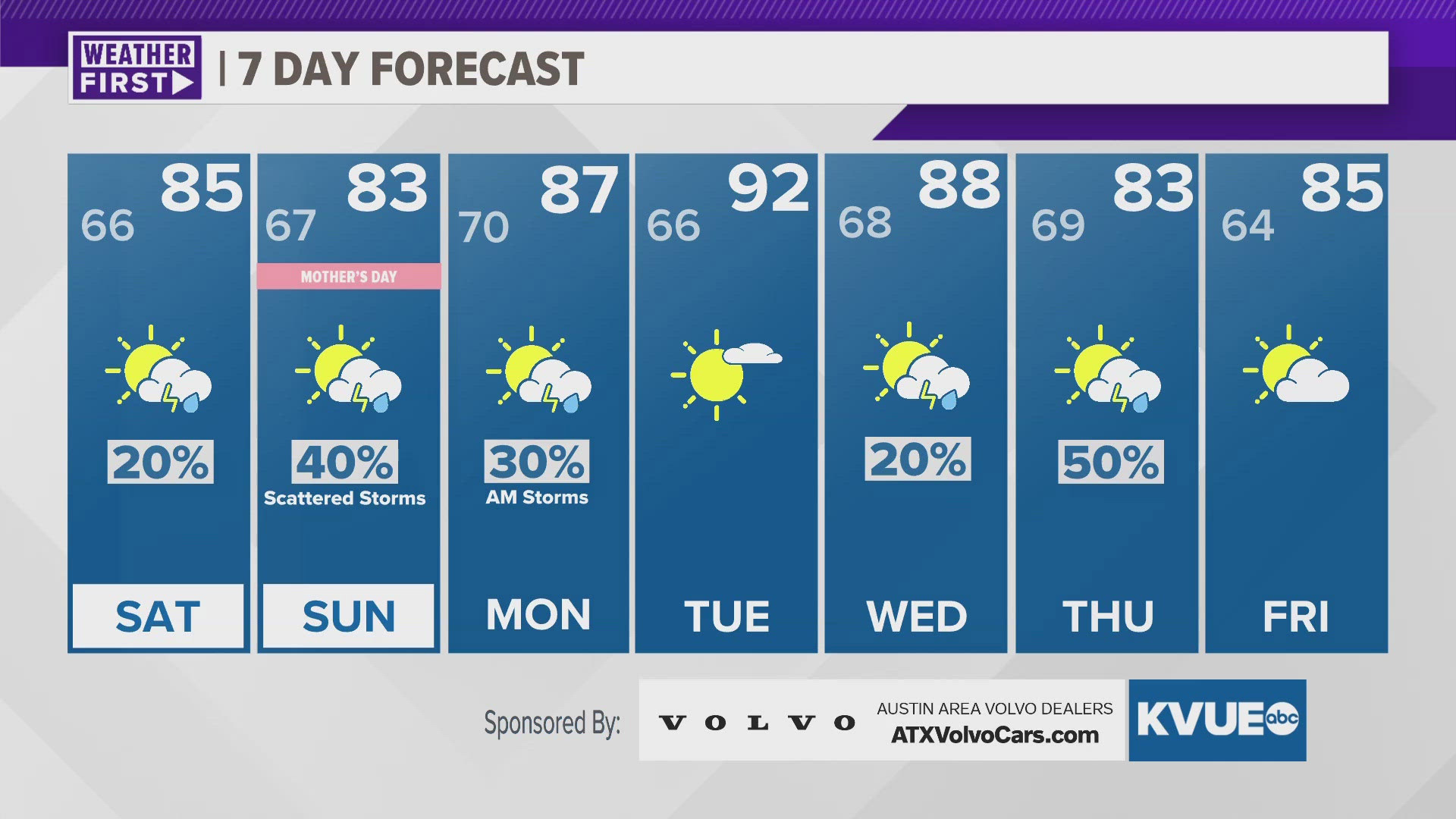
For Saturday, we expect similarly calm conditions. However, there is a 20% chance of a brief popup shower or storm with the daytime heating and highs in the mid-80s. We are also tracking the potential for more storms for Mother's Day into Monday morning, but these chances have trended lower than previous runs. Highs Monday and Tuesday have trended higher, with Tuesday now looking like we hit the lower 90s as opposed to just the mid 80s.
Better storm chances return for next Thursday as another disturbance slides in.
FRIDAY NIGHT:
Mostly cloudy and pleasant. 10% chance of a brief shower. Northeast wind at 5 to 10 mph.
LOW: 66
SATURDAY:
Mostly cloudy and a wee bit more humid with a 20% chance of a stray shower. East wind at 10 to 15 mph.
HIGH: 85
SATURDAY NIGHT:
Partly sunny and warm. Less humid. 10% afternoon storm in the Hill Country. Northeast wind at 10 to 15 mph with gusts around 20 mph possible.
LOW: 67
7-DAY FORECAST:


Check out the live radar for what you can expect the rest of the day and into the workweek.