
AUSTIN, Texas — The chance for storms this evening in our KVUE area is low, but not completely zero. Across Mason, Llano, Burnet, and Gillespie counties there is a 10% chance for a strong to severe storm. There is a level 2 severe risk for these areas due to the threat for hail and strong winds. Again, the overall storm risk is low, but if a storm is able to form it could be severe.
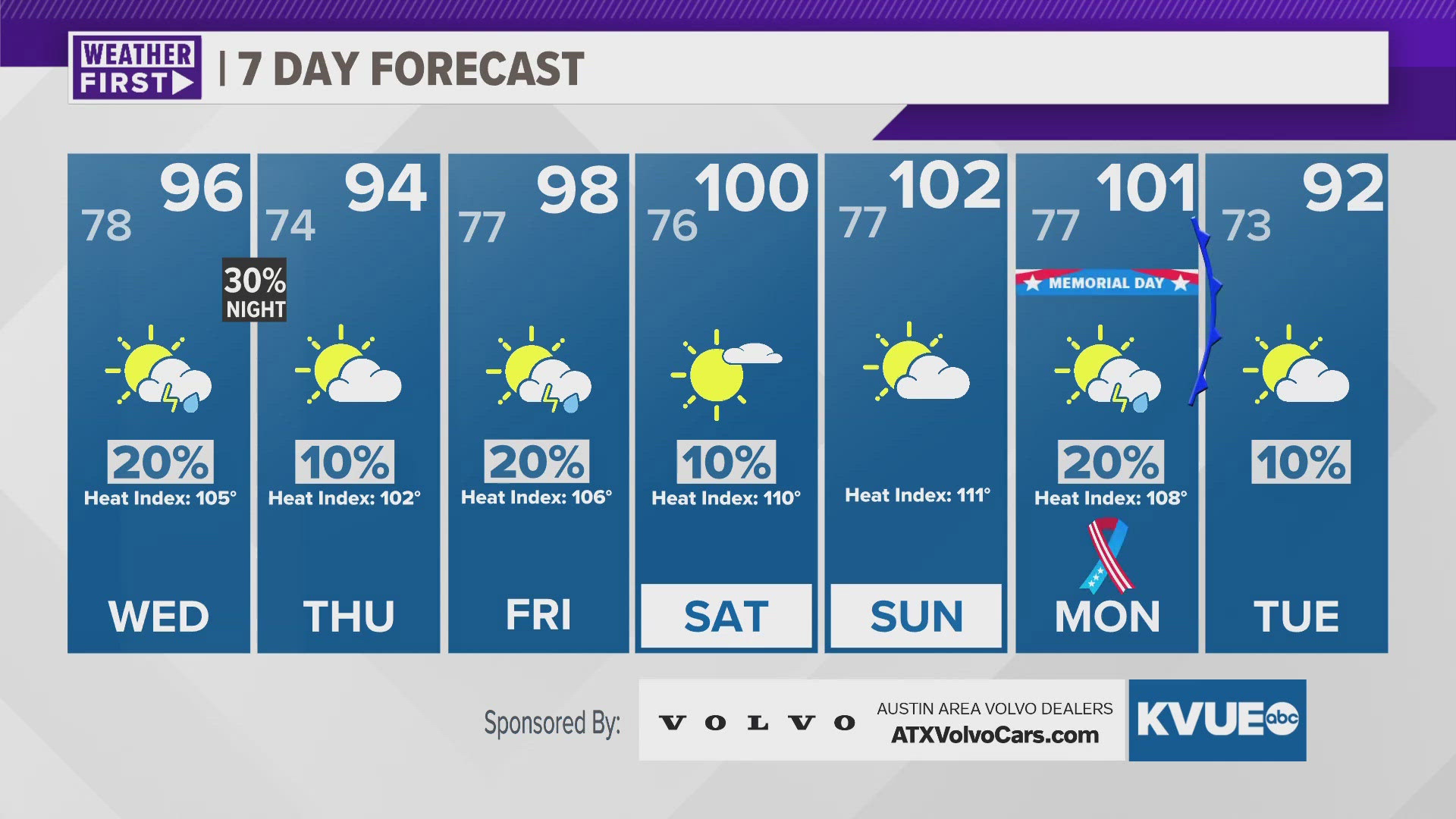
The heat and humidity continue for Wednesday. After morning clouds, the afternoon will bring hazy sunshine with a high near 96 in Austin. Due the humidity, the feels like temperature in Austin could reach 105 degrees. The day will be dry, but there is a 30 percent chance for storms during the evening and early overnight. While most won't see storms, where they form they could be severe with large hail and strong winds.
We now officially have triple digit heat in the forecast for the Memorial Day Weekend. Saturday through Monday will each top out between 100 and 102 degrees. This will be serious heat with the humidity bringing feels like temperatures in excess of 110 degrees in some spots. This heat is likely to trigger Heat Advisories or even Excessive Heat Warnings.
TUESDAY NIGHT:
10% severe storm, mainly across the Hill County. Mostly cloudy and muggy. Southeast wind at 5 to 10 mph with gusts around 20 mph possible.
LOW: 78
WEDNESDAY:
Morning clouds, afternoon sunshine. Hot and humid. Feels like temp of 105. 20% afternoon showers and storms. Southeast wind at 5 to 10 mph.
HIGH: 96
WEDNESDAY NIGHT:
30% showers and storms. Storms could be severe. South-southeast wind at 5 to 10 mph.
LOW: 74
SEVEN-DAY FORECAST:


Check out the live radar for what you can expect the rest of the day and into the workweek.