

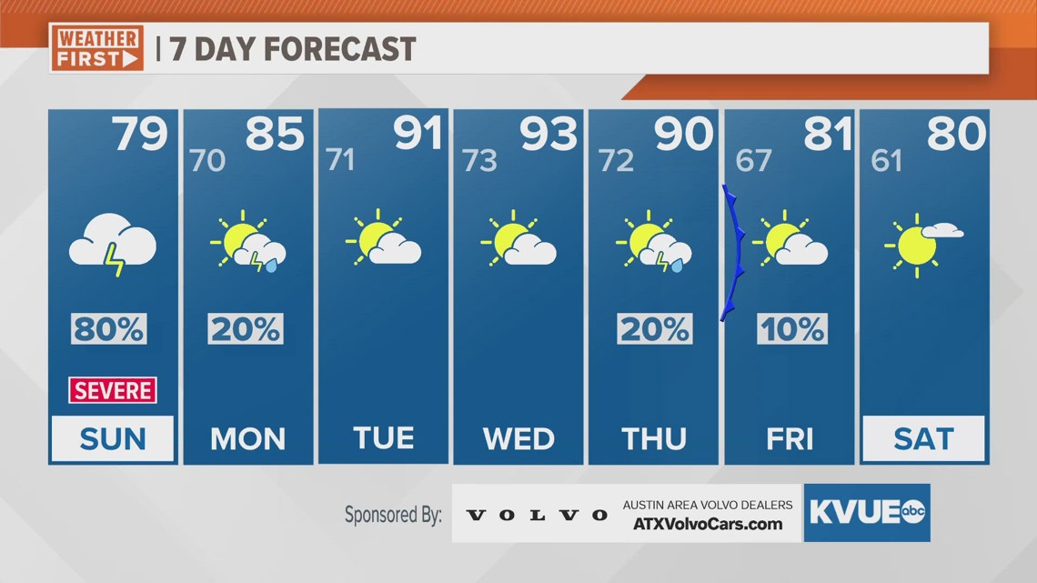
AUSTIN, Texas — Through Sunday evening there will be isolated showers and rumbles of thunder, but we are no longer expecting any additional issues with flooding or severe weather. Overnight low clouds will build in, and widespread fog and drizzle is likely to begin Monday morning. Low clouds give way to partial clearing Monday afternoon with a 20% chance for an isolated shower or non-severe storm.
After Monday, it's all about the heat and humidity for the middle of the week. Tuesday the afternoon high will be in the low 90s, but the feels like temperature will be around 99 degrees. Wednesday will likely be the hottest day of the week with a high near 93 and a feels like temperature of 102 degrees.
A cold front moves through on Thursday with a 20 percent chance for rain and storms, and this will drop our temperatures pretty noticeably for Friday and next week with highs in the low 80s or even upper 70s. Next weekend does not look like a washout, but we could see the return of shower and storm chances by Saturday and Sunday.
SUNDAY NIGHT:
20% chance for showers early. Increasing clouds. Patchy drizzle and fog develop late. Southeast wind at 5 to 10 mph.
LOW: 71
MONDAY:
Morning fog and drizzle, then partial clearing for the afternoon. 20% showers and storms. South-southeast wind at 5 to 15 mph.
HIGH: 85
MONDAY NIGHT:
Mostly cloudy. Drizzle and fog possible late. South-southeast wind at 5 to 10 mph.
LOW: 72
7-DAY FORECAST:

Check out the live radar for what you can expect the rest of the day and into the workweek.