
AUSTIN, Texas — Widespread showers and storms moved through Central Texas Wednesday evening and overnight.
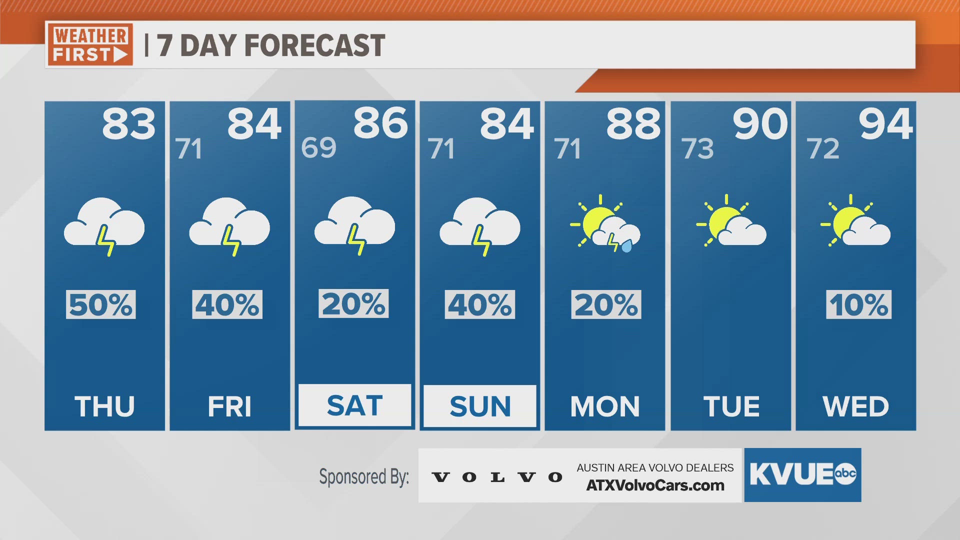
Additional scattered showers and storms will be a possibility Thursday afternoon, especially along and east of I-35. This will contribute to our flood threat as we continue to monitor the potential for heavy downpours. Some storms could also be on the strong side, with large hail and damaging wind. Quieter conditions should arrive Thursday evening as humidity continues to stick around.
Another round of patchy fog could develop for your Friday morning commute. Forecast models have now started picking up on the potential for scattered showers and storms east of I-35 for Friday morning and another round for the Hill Country on Friday evening. These showers and storms will be hit or miss, so we currently have chances at 40% for this timeframe.
Over the weekend, isolated to scattered storm chances will be possible as afternoon highs peak in the mid-80s. As of now, our highest weekend rain chances will be Sunday afternoon.
Drier and much warmer weather arrives next week, as highs climb into the mid-90s by Wednesday.