

AUSTIN, Texas — *A Severe Thunderstorm Watch is in effect for Mason, Llano, Burnet, Williamson, Milam, Gillespie, Blanco, Hays, and Travis counties until 2 a.m.
*A Flood Watch is in effect for Mason, Llano, Burnet, Williamson, Milam, and Lee counties until Sunday afternoon
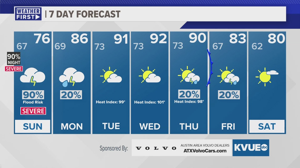
Much higher storm chances arrive overnight with a line of strong to severe storms arriving in Austin around 2 a.m. or so. These storms could produce strong winds and hail, and there is also a low risk for a tornado. In addition to the severe risk, there will also be the threat for locally heavy rain and flooding.
This first round of storms will be moving away by early Sunday morning, but additional rounds of rain and storms are likely through the day on Sunday. The severe weather threat, and especially the potential for flooding will continue. Rain chances decrease by Sunday evening. A widespread 1.5" to 3" of rainfall is likely with isolated amounts of 4" to 5" or more.
Rain chances really dwindle early next week, and the heat will ramp up. High temperatures will be in the low to mid 90s by the middle of next week. Unfortunately, it will also still be very humid so feels like temperatures during the peak heat of the afternoon will be close to 100 degrees.
SATURDAY NIGHT:
90% rain and storms. Storms could be severe. Southeast wind at 5 to 15 mph.
LOW: 68
SUNDAY:
90% rain and storms. Flood risk and severe threat. South-southeast wind at 5 to 15 mph.
HIGH: 76
SUNDAY NIGHT:
20% chance for showers early. Increasing clouds. Patchy drizzle and fog develop late. East wind at 5 to 10 mph.
LOW: 69
7-DAY FORECAST:

Check out the live radar for what you can expect the rest of the day and into the workweek.