
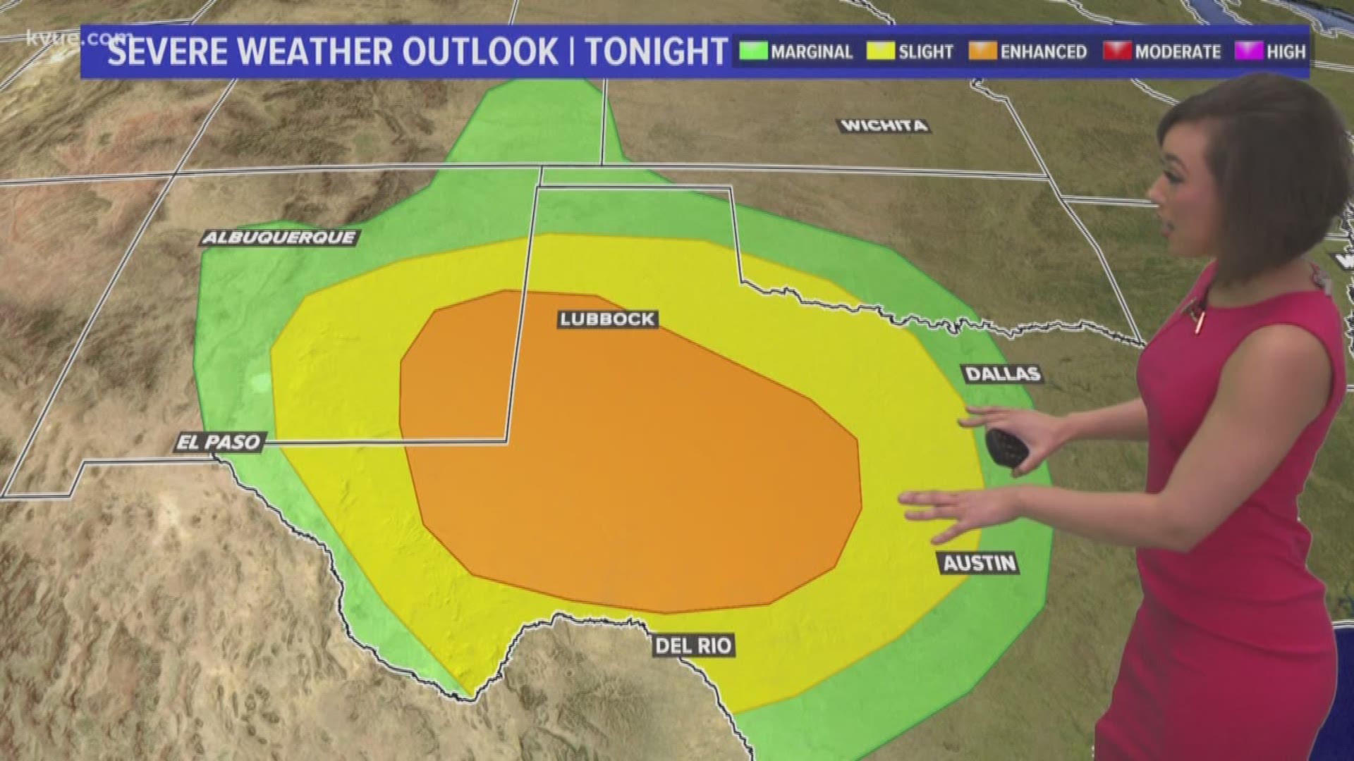
AUSTIN, Texas — It's that time of the year where mother nature brings the threat of severe storms to the Lone Star State.
As our next Pacific front moves into Central Texas overnight Tuesday night into Wednesday morning, numerous showers and thunderstorms are expected and some of them could leave a dent. Though we aren't expecting widespread severe weather, the most intense storms could bring large hail and damaging winds with them. An isolated tornado also can't be ruled out at this point.


Showers will increase late Tuesday night and continue through Wednesday morning as the front moves through the Hill Country. This means a messy commute will be possible for Wednesday morning.

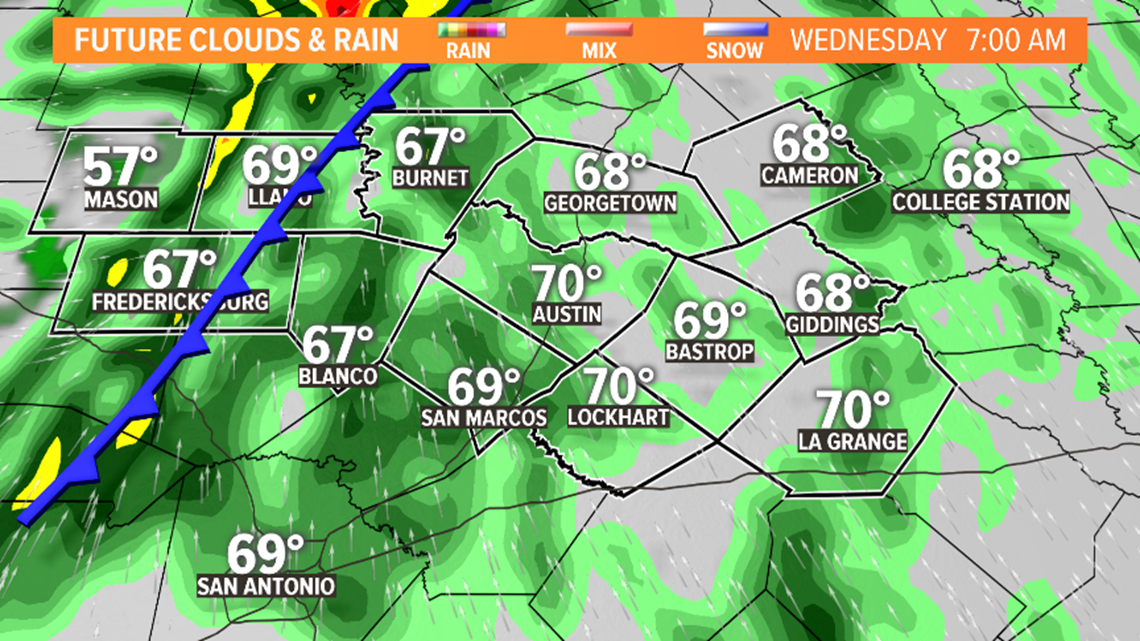
As of Tuesday, it looks like the heaviest storms roll into the Austin metro just before lunchtime. Once storms pass the sunshine will filter in very quickly behind it – setting the stage for a beautiful Wednesday afternoon.

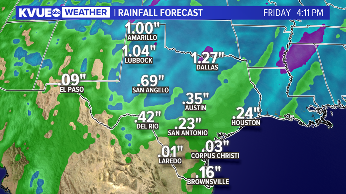
Rainfall amounts for the next seven days could exceed one inch, the bulk of which may fall late Tuesday night into early Wednesday morning.
As we near spring severe season, be sure to remember the safety of those you love and care for. Familiarize yourself with the hazards commonly associated with strong storms and develop a plan for safety.
Seek shelter immediately in a sturdy structure, move indoors away from windows, and avoid areas prone to flooding such as low water crossings, creeks and streams. We refer to this slogan often, "Turn around, don't drown."
Stay tuned to KVUE for the latest on this developing weather situation.