
AUSTIN, Texas — Tropical Storm Harold made landfall at around 10 a.m. Tuesday on Padre Island off the South Texas coast.
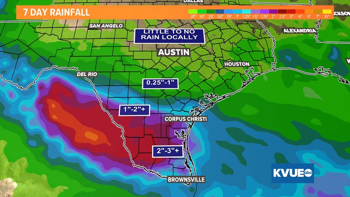
Tropical Storm Warnings are still in effect for the coastal area, but the beneficial rainfall associated with this system is on track to miss the KVUE area entirely.
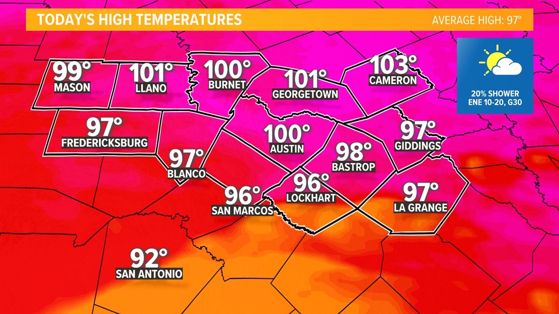
We do have a 20% chance for rain with the outermost bands Tuesday afternoon and evening, but we still expect the vast majority of Central Texas to stay warm and dry.

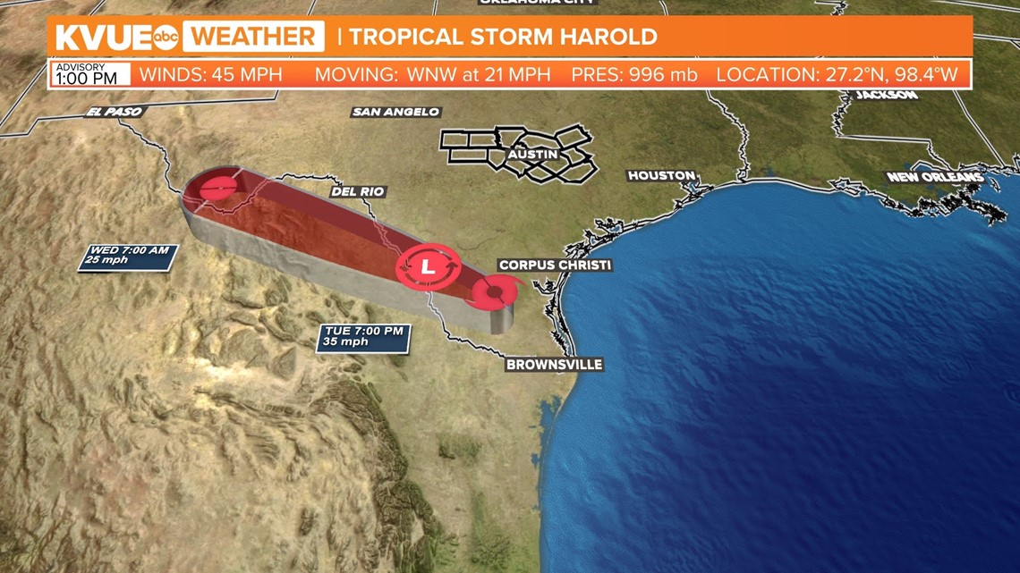
The latest hi-res model data shows widespread rain and windy conditions over South Texas through most of the day on Tuesday. The northernmost outer bands will try to work towards the southern tier of the KVUE area, but again, don't plan on much rain making it this far north.


A widespread 2 to 4 inches of rain is likely for much of South Texas. There could be some localized flooding issues, but these areas are also in need of rain due to current drought conditions.
Again, plan on nearly all of the significant rain to miss the KVUE area.

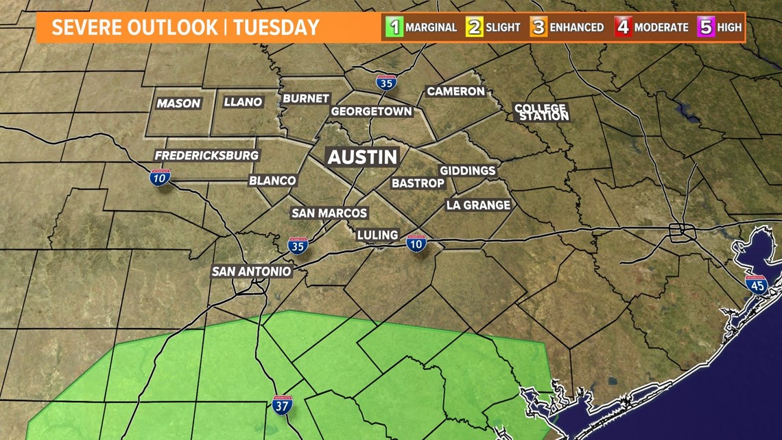
The only wrinkle in the forecast is the very low chance for a spin-up tropical tornado for the southern tier of our area. The main risk for this will stay to our south, but it's something we can't completely rule out.

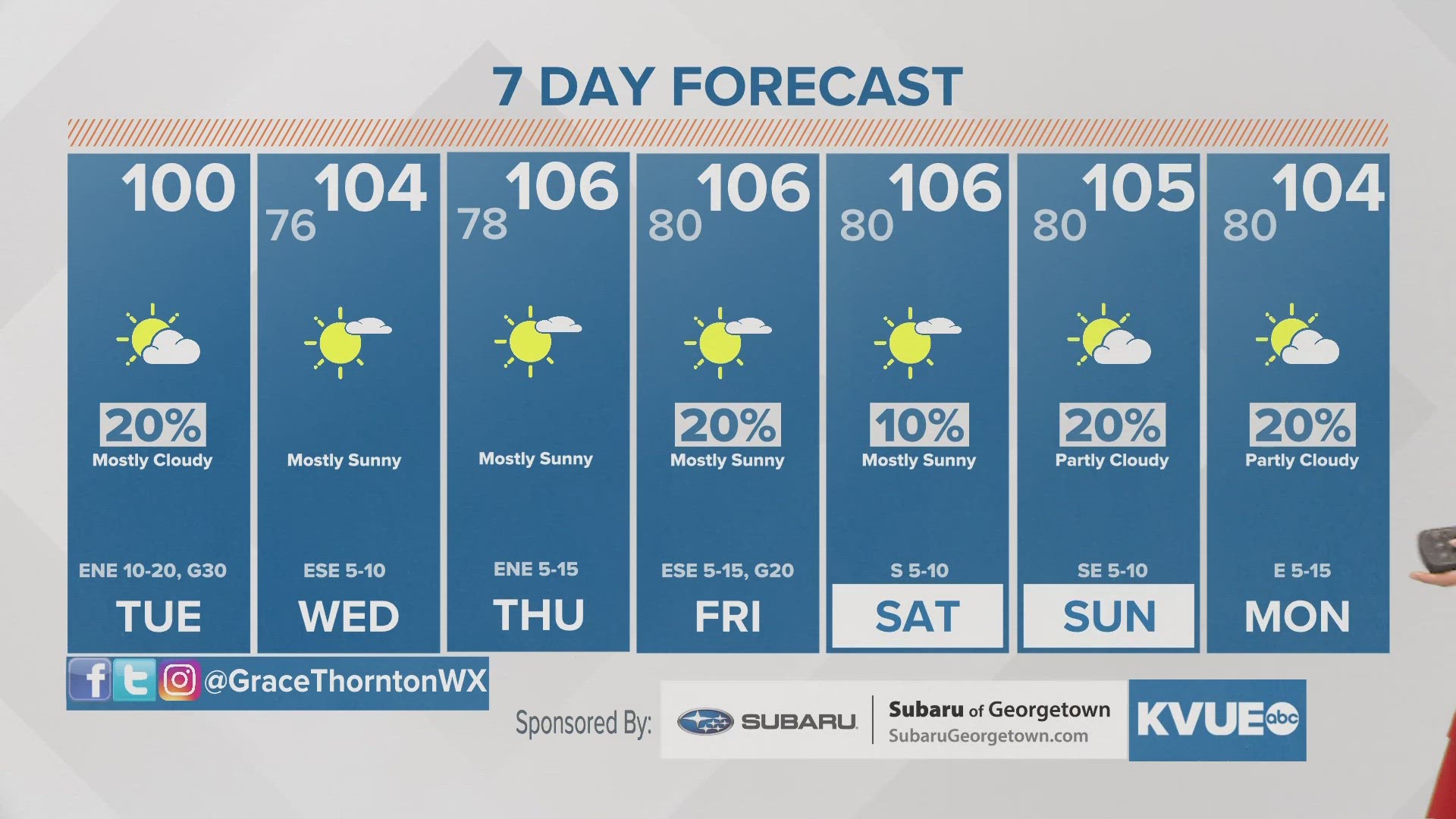
In Central Texas, we get a very meager cool down as this system grazes by to our south. We still expect Austin to reach a high of 100 to 102 degrees, extending our all-time record-long streak of 45 consecutive days of triple-digit heat.
However, added cloud cover and small rain chances should help keep the southern tier of our area in the mid- to upper 90s for at least one day.

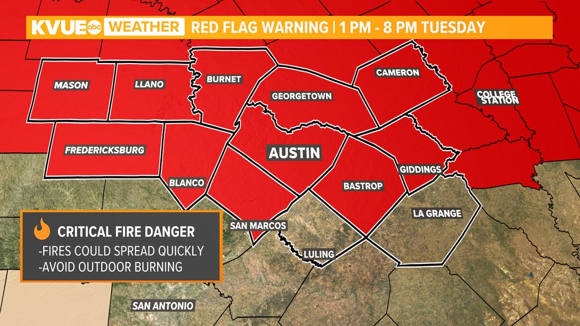
Despite the lack of rain, it will certainly be breezy on Tuesday with wind gusts up to 30 miles per hour possible. This means more critical fire danger and a Red Flag Warning is in effect for Tuesday afternoon and evening.
Please continue to be mindful of outdoor burning and anything that could indirectly result in a spark.

High pressure moves closer to Central Texas for the middle and end of this week, so serious heat will quickly resume. The high temperature will be in the 106 to 108 range for Thursday through the weekend.
The KVUE Weather Team will continue to closely monitor this developing forecast.
In the meantime, the extended forecast can be found below:

