AUSTIN, Texas — Meteorological summer is right around the corner for 2024. This time last year, the region was gearing up for El Niño, which was predicted to bring a wetter, cooler pattern to our area.
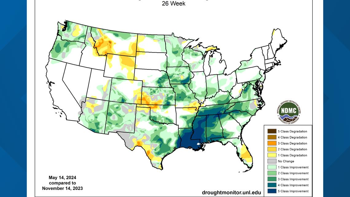
This didn't pan out in time as summer 2023 was the warmest ever for Austin and the globe. However, regarding wetter versus drier conditions, we have seen a considerable easement in our extreme drought during our El Niño fall and winter.
Throughout the next few months, climate scientists at the National Oceanic and Atmospheric Administration (NOAA) are predicting the switch back to La Niña for the El Niño-Southern Oscillation (ENSO). Let's look at what this means for Central Texas, as we head into summer.

What is La Niña?
When we look at ENSO, there are three different phases; El Niño, Neutral and La Niña.
El Niño is characterized by above-average sea surface temperatures, while Neutral conditions have near-normal sea surface temperatures. Lastly, La Niña has below-average sea surface temperatures.
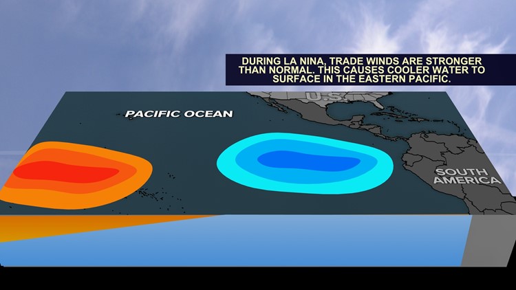
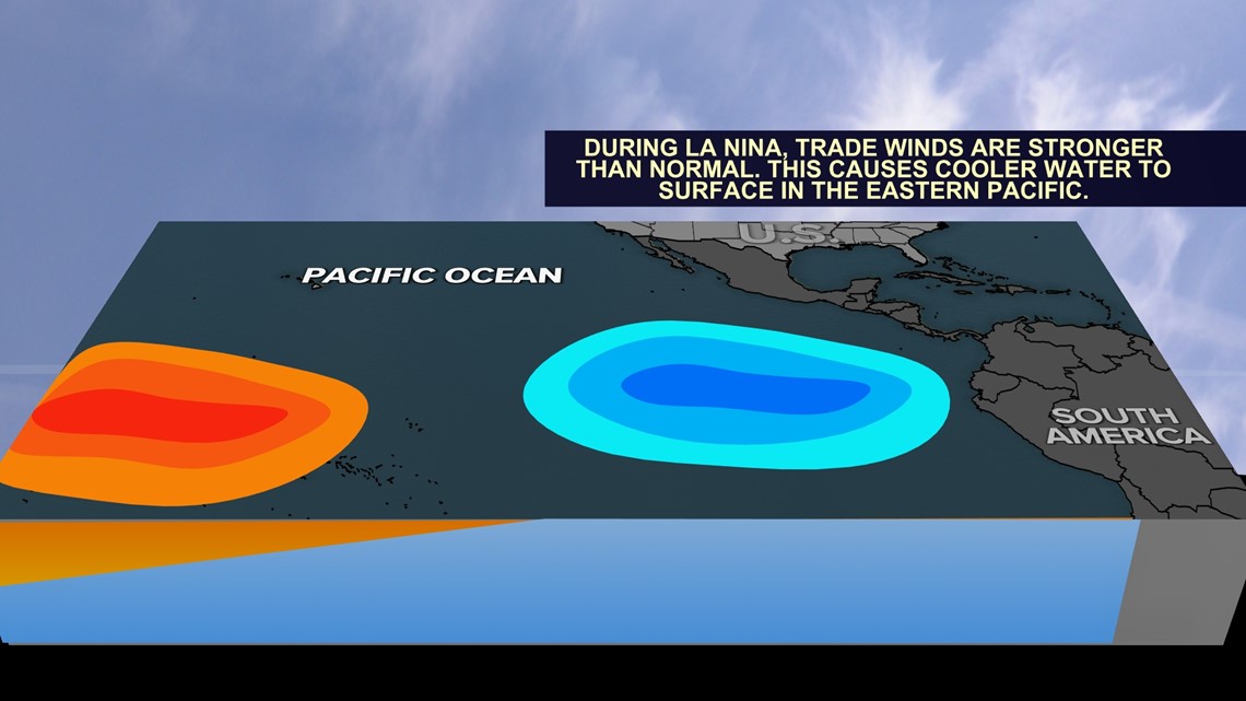
The "cool phase" of La Niña happens when easterly trade winds over the equatorial Pacific increase and push warmer waters west towards Australia, Indonesia and the Philippines. In turn, cooler waters from below come to the surface in a process called "upwelling" along the west coast of South America.
This not only affects weather patterns in the U.S., but around the world as well.

How will La Niña affect summertime conditions?
In short, we are not expecting major impacts from La Niña's formation over the next three months. This is because a strong signal from La Niña, or sufficient below-average sea surface temperatures, is not expected until the July-August-September period.
The percent chance of being in La Niña rises above 50% during late summer. Currently, we are transitioning to Neutral conditions and we will have to wait until the fall and winter to see exactly how things pan out.
Because we will be in a transitional Neutral ENSO phase for summer, here's how other summers looked when we were transitioning from a strong El Niño to La Niña through the summer. To sample a few years, we looked back at 1998, 2010 and 2016. When taking all months into account, it looks like warmer or drier conditions pull ahead over cooler or wetter.

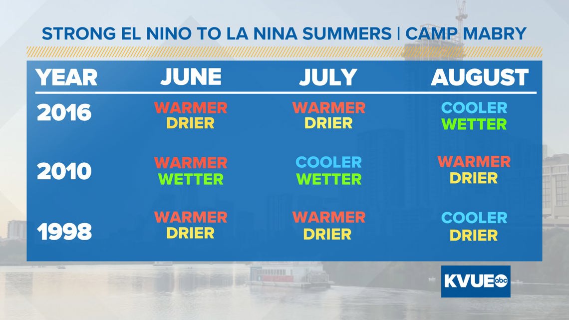
This is just a small sample size, but it matches up with the hot and dry summer forecast that NOAA has been predicting since February. If we see a hot and dry summer and then continue to see above-average temperatures and below-average rainfall throughout the fall and winter, severe drought conditions may come back to haunt us.
RELATED: The science behind Texas-sized hail
Previous La Niña years
In general, the graphic below is the overall pattern for North American winters when La Niña is present.

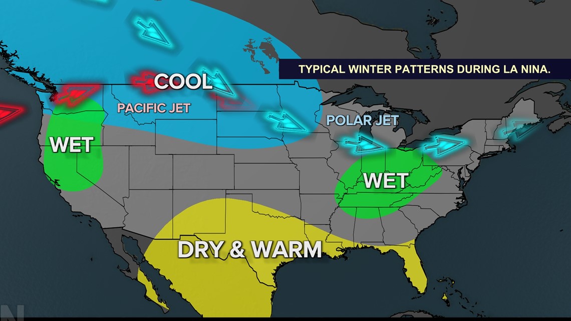
Usually, it leads to above-average temperatures and below-average precipitation. Below is what happened during the last three La Niña winters.

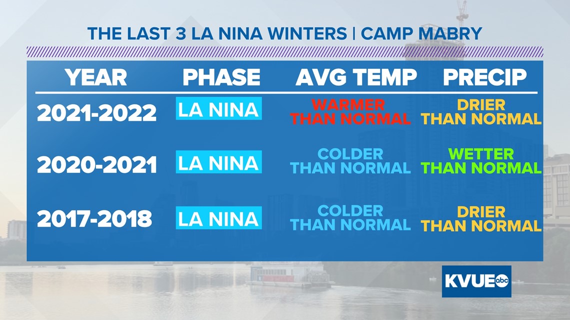
You can see that the generalized "dry and warm" trend doesn't always happen, so while predictions for this summer and winter seem somewhat confident, like many seasonal forecasts, we'll have to wait and see what comes to fruition.