
AUSTIN, Texas — ***THIS BLOG IS NO LONGER BEING UPDATED. FOR THE LATEST FORECAST, CLICK HERE.***
Strong to severe thunderstorms moved across Central Texas Wednesday morning. A Severe Thunderstorm Watch was issued for much of the area through 9 a.m., but it has been canceled.
The two main threats with Wednesday's storms were large hail and gusty winds. The highest risk for severe storms will be for areas north and east of Austin as storms initially move in. Some weakening is possible as storms move south.
After 9 a.m., storms will move south of the area, and clearing is expected through Wednesday afternoon with breezy north wind and highs in the low to mid-80s.
Timeline:
Storms will be possible between now and 9 a.m., with activity shifting south over the next several hours.
By 6 or 7 a.m. storms will likely be widespread for areas along and east of the Interstate 35 corridor.


After about 7 a.m. the most widespread storm activity will likely be moving through the southeastern corner of the KVUE viewing area.
These storms may still be capable of large hail and gusty winds, but some weakening is expected as storms move south, especially after 7 a.m.

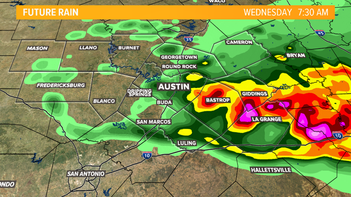
By 9 a.m. the storm threat will end for Central Texas as any lingering storms move to the south.
Behind the storms expect clearing through the afternoon and a breezy north wind. Afternoon highs on Wednesday will reach the low to mid-80s.


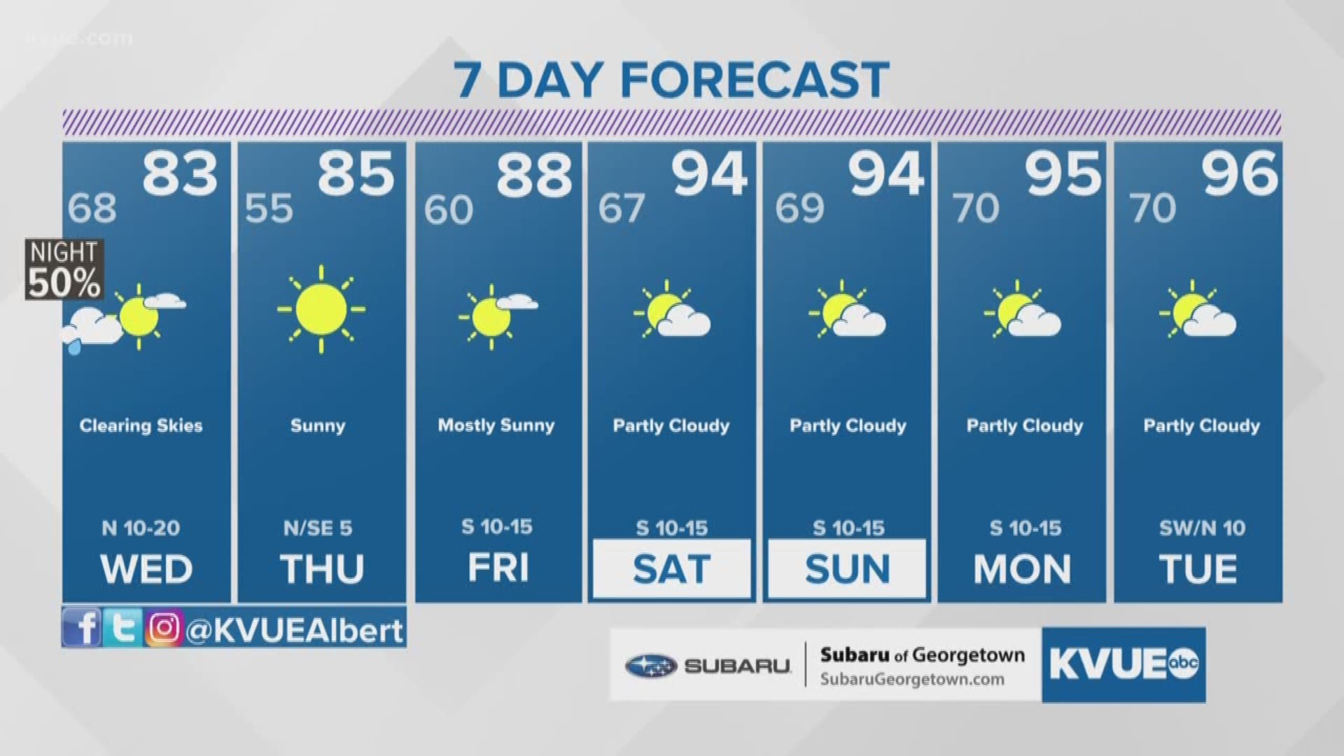
The rest of the week will be warm and dry with highs in the 80s. Afternoon highs will reach the 90s over the weekend.
The extended forecast can be found below: