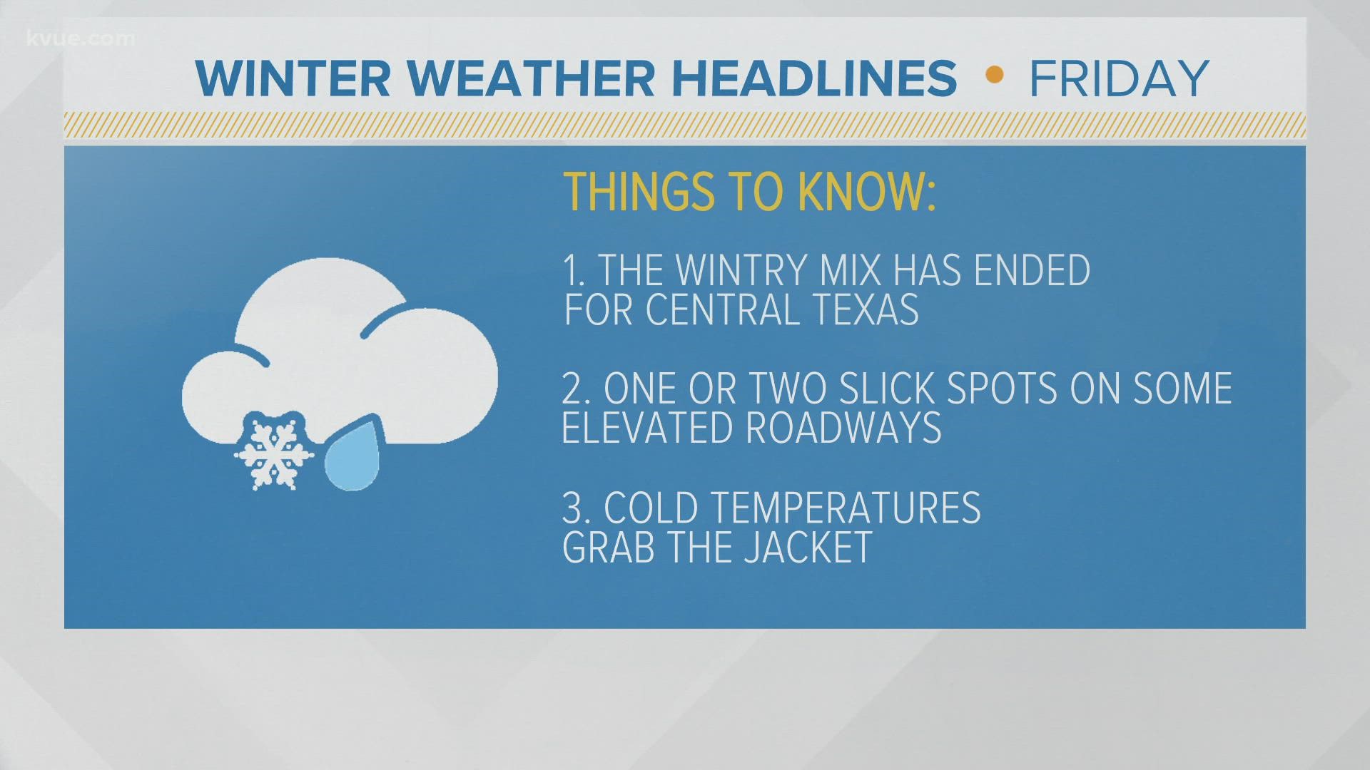
AUSTIN, Texas — The light wintry mix of sleet, freezing rain and snow has come to an end in Central Texas and we are left with cold temperatures. The Winter Weather Advisory has been canceled, but there is still the potential for some light icing on bridges and overpasses through late Friday morning.
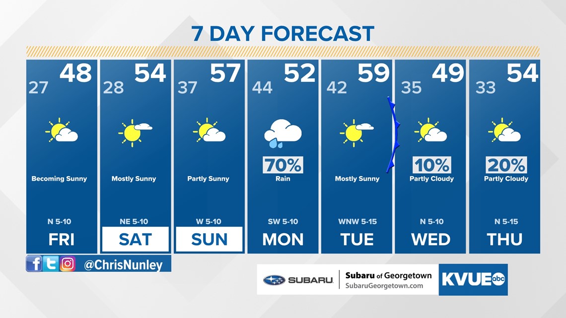
Friday afternoon brings sunshine but will still be very chilly, with highs only in the 40s. We are expecting another hard freeze by Saturday morning.
With a hard freeze on the way, remember the fours Ps: people, pipes, pets and plants. It's not a bad idea to drip the faucets or leave the cabinet doors open so warm air can circulate around the pipes.
Temperatures should warm up a bit over the weekend during the afternoons. Another system could bring some rain Sunday night into Monday. Highs next week could flirt with the 60s on Tuesday before another drop in temperatures around mid-week.
Hard freeze Friday and Saturday morning
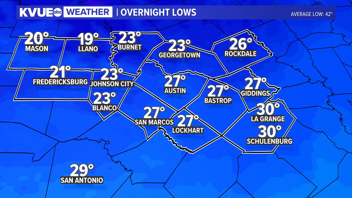
After the precipitation moves out, temperatures plummet to the 20s and upper teens by Friday morning. This will be a hard freeze, even in Austin, where the temperature will drop down to around 27 degrees.

Saturday morning will bring another hard freeze, but temperatures should warm up a bit over the weekend. Another system could bring some rain Sunday night into Monday.
Highs next week could reach the low 60s on Tuesday before another drop in temperatures around mid-week.
The KVUE Weather Team will continue to closely monitor this developing forecast.
In the meantime, the extended forecast can be found below: