
AUSTIN, Texas — Editor's note: Prop A, a $7.1 billion Project Connect plan, passed in the November election. To read more on what that means for Austinites, click here.
This story originally stated the proposed underground tunnel would span about six city blocks. It has been updated to reflect the correct estimated amount, more than 20 city blocks. Additionally, the route of the Gold Line has also been updated.
This November, Austin voters will have the option to approve or reject Proposition A, a ballot measure that would increase property taxes and fund a $7.1 billion mass transit system called "Project Connect."
To help voters make an informed decision at the polls, KVUE is taking an in-depth look at the proposal, breaking down what it would pay for, how much it would cost taxpayers and what supporters and detractors have to say about what Project Connect means for Austin's future. Read all of our Project Connect coverage.
The initial investment for Project Connect includes:
- Blue Line: A light rail line running from Austin-Bergstrom International Airport (AUS), connecting through the downtown station and running north to Lamar Boulevard at Highway 183
- Orange Line: A light rail line running from North Lamar Boulevard at Highway 183 south to Stassney Lane, connecting through Republic Square
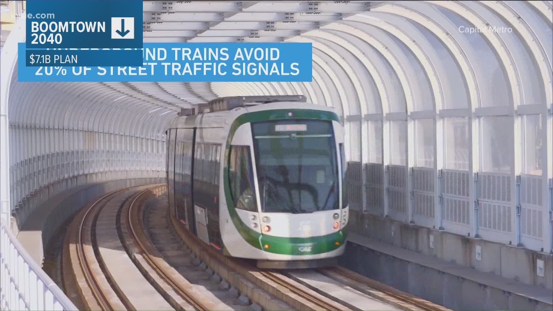
- Downtown Transit Tunnel: The underground tunnel would run more than 20 city blocks (1.6 miles) from Cesar Chavez Street to 11th Street, from Guadalupe Street to Trinity Street, and from Fourth Street to the cul de sac near Lady Bird Lake at Trinity Street.
- Green Line: Like the current Red Line, the Green Line would serve as a commuter rail running from downtown to the Colony Park neighborhood in East Austin
- Gold Line: A new rapid bus route going from the Austin Community College Highland area, through the Downtown Station to the Republic Square Station, then south to a new South Congress Transit Center at Ben White Boulevard
- Three more new MetroRapid routes, which are buses with frequent service and a limited number of stops
- Neighborhood Circulators: 15 new zones or vehicles would be added to help neighborhoods gain better access to the main transit lines
- Community Displacement: A $300 million investment that would help communities affected by transit line creation and construction
- Other features including park and rides, customer technology systems and maintenance facility improvements
But all of those routes can be a little tricky to visualize. So, KVUE created an interactive map that illustrates the routes included in the plan's initial investment, as well as potential future extensions for some of those routes.
You can view the map below. If you click the legend icon in the top lefthand corner, you'll see that the map is broken down into the proposed light rail and MetroRapid routes (thick colorful lines), the proposed downtown tunnel (thick black line), potential route extensions (thin colorful lines), stops, current parking (gray) and proposed parking (blue).
You can check or uncheck each section to see the map with or without those components.
PEOPLE ARE ALSO READING: