
AUSTIN, Texas — After a round of heavy storms brought wind and lots of rain to much of Central Texas Thursday afternoon, our weather is now trending quieter through the overnight. With that being said, there is still a chance for a few more isolated storms late this evening for the Hill Country and northern I-35 corridor. The atmosphere is fairly worked over from earlier storms, but one or two of these storms could still be strong prior to dissipating by through the early overnight hours.
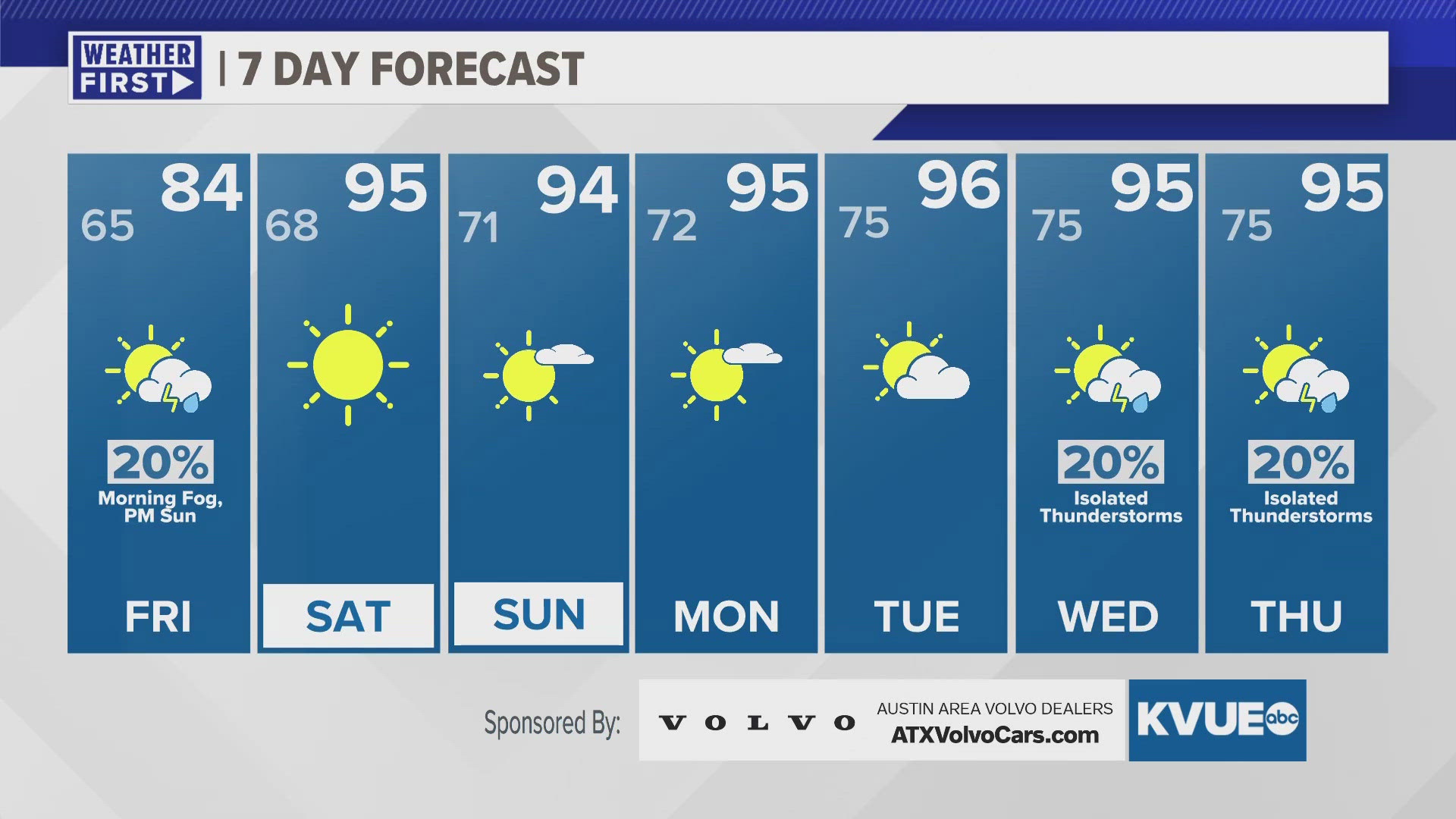
There will be patchy to widespread fog and low clouds for Friday morning, but the afternoon will break to sunshine. Most will stay dry on Friday with the main storm risk shifting to our east. Temperatures will still be in the 80s Friday, but the heat returns this weekend.
We have low to mid 90s in the forecast for both Saturday and Sunday, and mid if not upper 90s continue through most of next week.
THURSDAY NIGHT:
20% rain and storms. Southeast wind at 5 to 10 mph becoming calm.
LOW: 65
FRIDAY:
Morning fog, then late day sun. 20% showers and storms, mainly southeast of Austin. North wind at 5 to 10 mph.
HIGH: 84
FRIDAY NIGHT:
Mostly clear. East wind at 5 mph.
LOW: 68
SEVEN-DAY FORECAST:


Check out the live radar for what you can expect the rest of the day and into the workweek.