
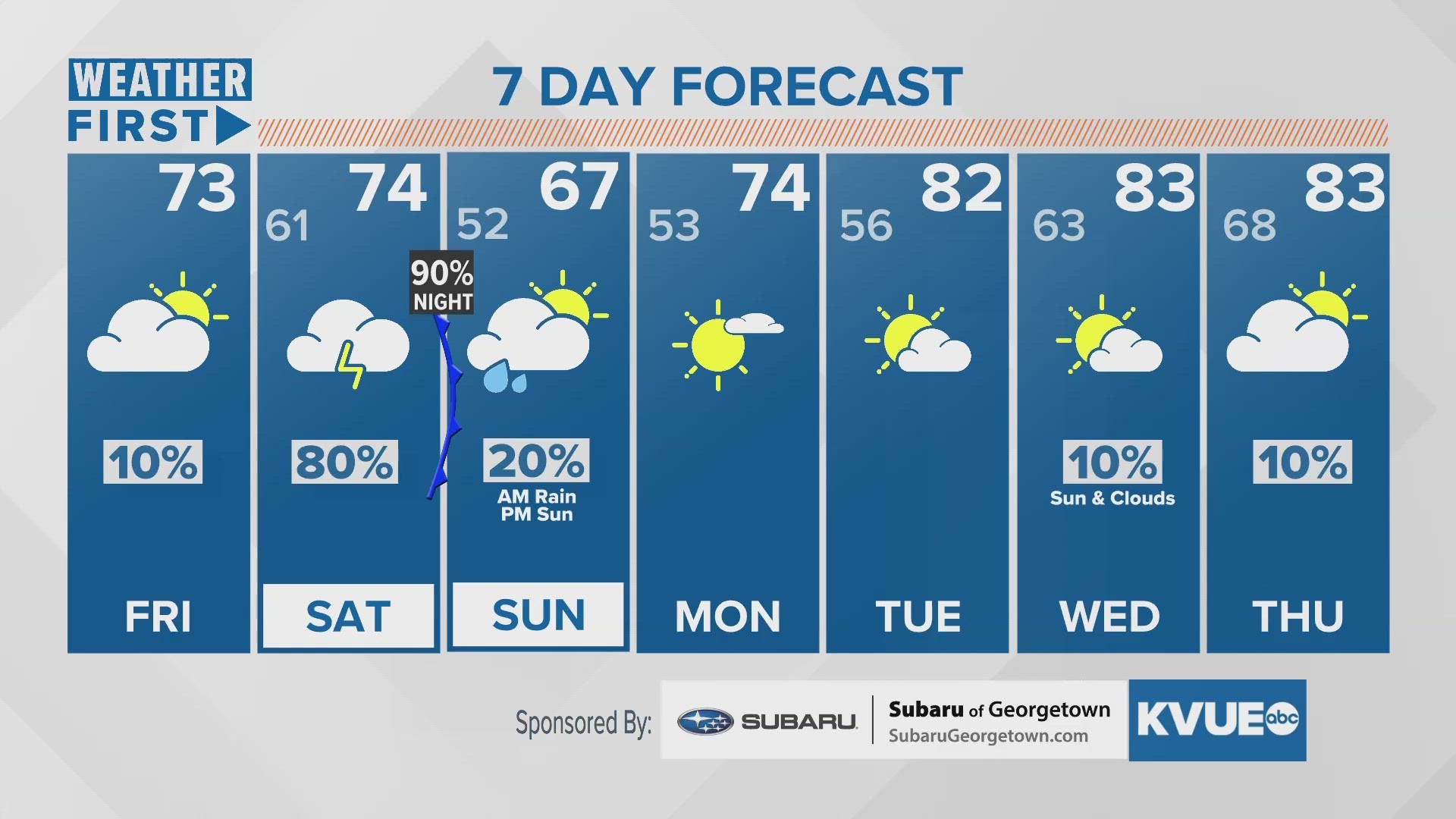
AUSTIN, Texas — We've arrived to the end of the workweek, and we finally have some slight relief on the way from the warm and muggy conditions over the past few days. A cold front is currently sitting over Central Texas and will bring a drop in temperatures and a wet weekend.
We're only tracking highs in the lower 70s with cloud cover limiting radiational heating, especially with the frontal boundary still sitting right over Central Texas, but we expect this front to slide northward overnight. However, with the limited range in temperatures brought on by the cloud cover, expect to only drop to the lower 60s, although upper 50s can't quite be ruled out.
Saturday shouldn't be a washout by any stretch of the imagination, but the afternoon could involve a few scattered showers here and there across Central Texas before more widespread rain could bring a minor flood threat and possibly even a hail and wind threat as the front moves south. Thus, a "marginal" - one out of four - excessive rainfall outlook is forecast for our northeastern counties and a "marginal" - one out of five - severe risk is forecast for our southern counties.
As for rainfall totals, high resolution model data is in and we're trending more in the direction of one to two inches as opposed to the two inches or higher that earlier runs were projecting. That does not mean isolated areas won't get more, that's certainly possible, but it shows a general trend in the wrong direction given our drought situation.
We expect to remain dry from Sunday afternoon through most of next week.