AUSTIN, Texas — Editor's note: This weather blog is no longer being updated. Check for updates on the high fire danger in Central Texas here.
A breezy south wind increased the moisture levels across Central Texas on Tuesday ahead of our next chance for storms overnight. This includes a low-end threat for a few storms that could be strong to severe with gusty winds, hail or a brief tornado.
Ahead of the storm chance, a Wind Advisory went into effect at 1 p.m. Tuesday afternoon through 4 a.m. Wednesday morning. Wind gusts up to 40 mph were possible. There is also a Red Flag Warning along and west of the Interstate 35 corridor due to critical fire danger.
The Austin Fire Department reported multiple fires Tuesday evening:
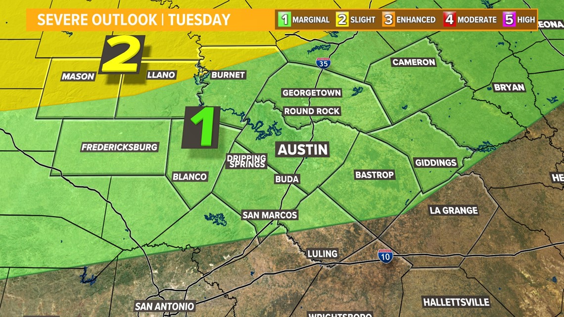
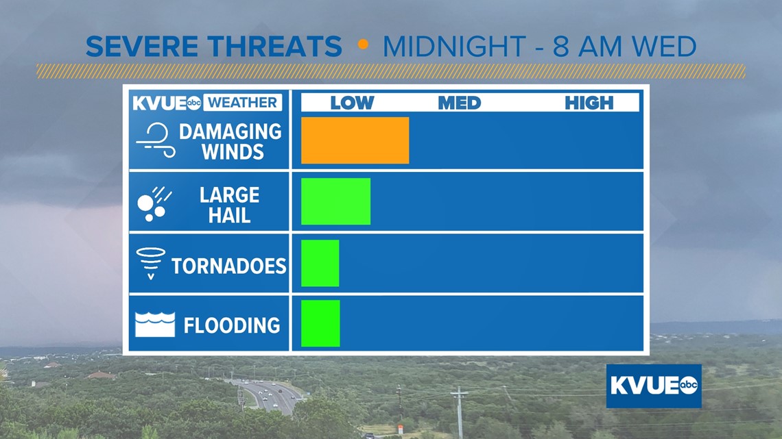
The Storm Prediction Center included most of Central Texas in the "marginal" – level 1 of 5 – risk for severe storms overnight into early Wednesday morning. The "slight" – level 2 of 5 – risk clipped northern Mason, Llano and Burnet counties.
Overall, this was a low-end severe weather threat, but we still wanted everyone to stay weather aware and make sure you have a way to get warnings. Here's a detailed timeline of how we expected things to play out.

Timeline
Hill Country: After a cloudy and warm Tuesday with gusty south winds, all eyes will be on the next dryline, which is expected to spark up our next round of storms.
The Hill Country can expect the line of strong storms approaching after midnight. A few of these storms could be severe, so since this is an overnight threat, we recommend having multiple ways of receiving weather alerts. We highly recommend one of those being the KVUE app.

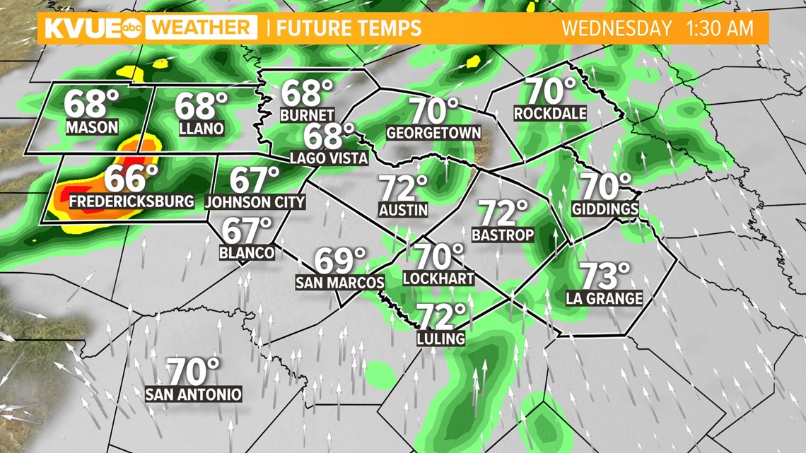
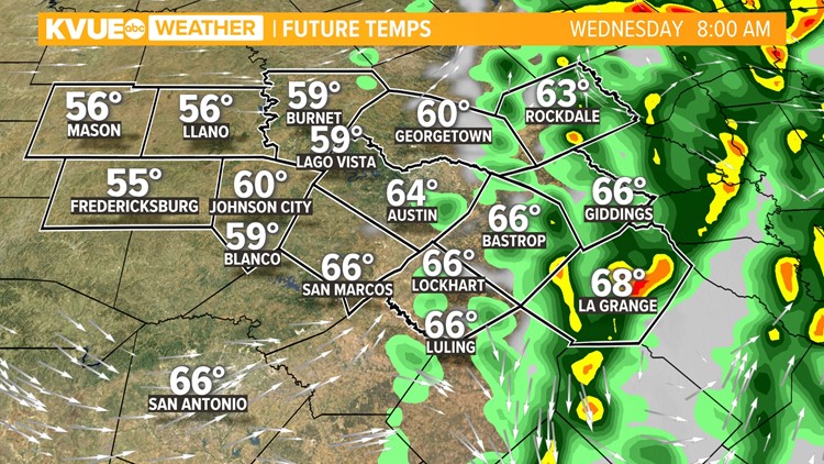
I-35 corridor: Storms will quickly push eastward through the overnight hours, and will likely start to become a more organized line of showers and storms on approach the I-35 corridor. Breezy storms could moving through Austin as early 2 or 3 a.m. Wednesday.

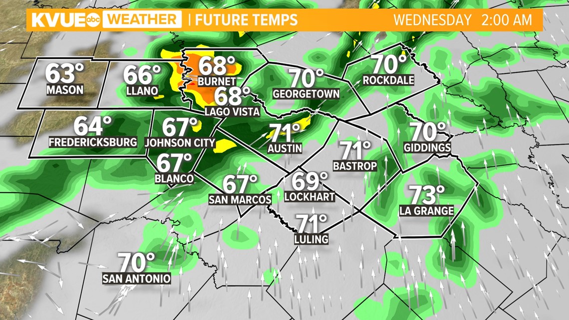
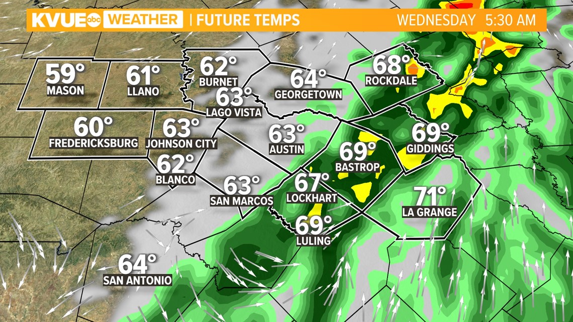
Eastern counties: Storms will push into our eastern counties between 5 a.m. and 7 a.m. Wednesday. It might not be a bad idea to factor in some extra time for the morning commute.
The stormy weather will move out of Fayette and Lee counties by 8 or 9 a.m., and we quickly clear back to sunny breezy weather with a strong west wind.

Damaging wind gusts of up to 60 mph will be our primary concern if we see any severe storms. There could also be some hail, especially as storms initially develop across the Hill Country. The threat of tornadoes is very low, but a brief spin-up cannot be ruled out.

The KVUE Storm Team will continue to closely monitor this developing forecast.
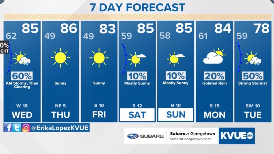
In the meantime, the extended forecast can be found below: