As we close out a July that was cooler and wetter than average, it looks like we have a similar pattern for at least the beginning of August. A late-season front will bring higher rain chances and cooler temperatures for the first half of the upcoming week.
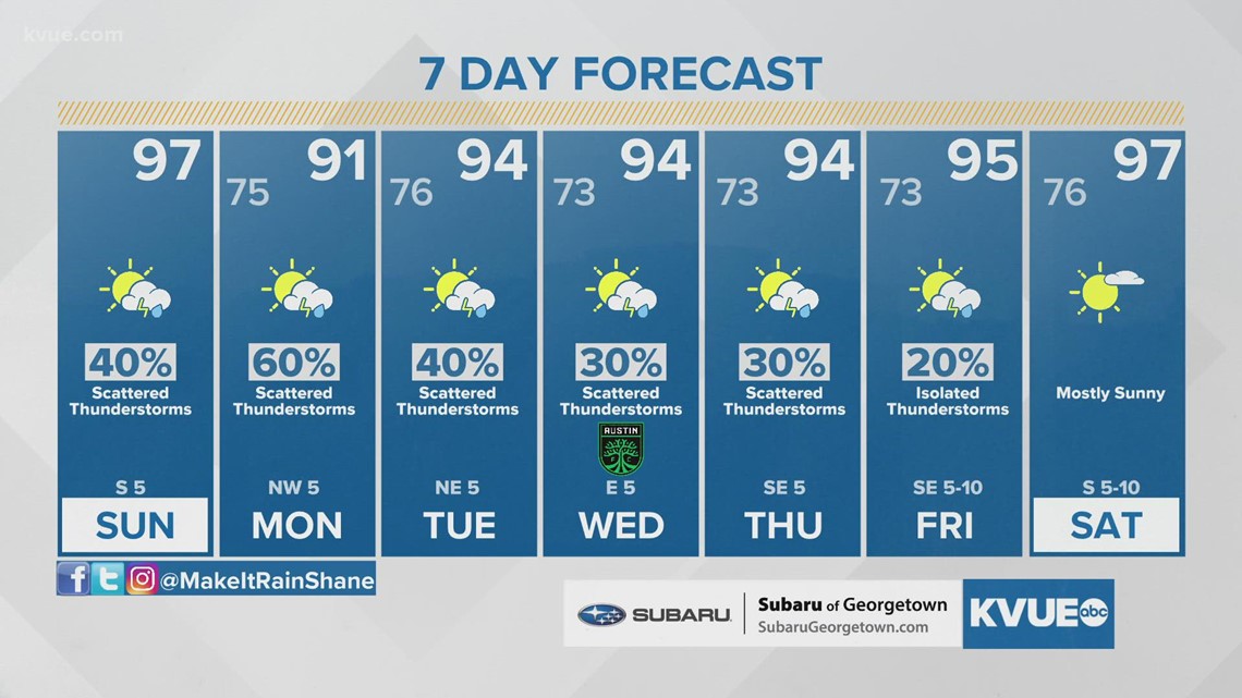
Sunday will still be hot with highs in the mid- to upper 90s and triple-digit feels-like temperatures, but the rain chances will be higher starting late morning into the afternoon with about a 40% chance of showers and storms.

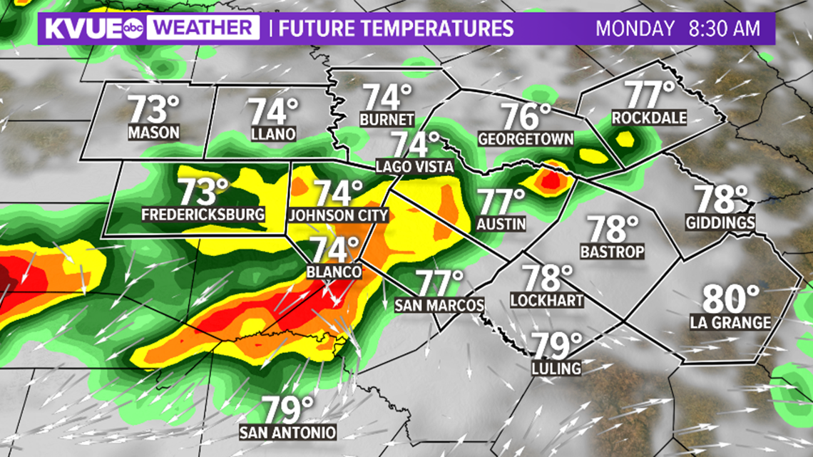
As the front drifts southward, rain and storms will remain a possibility through Sunday night. It's not out of the question that a storm or two could be strong with gusty winds and heavy rain. Gusts in excess of 50 mph will be possible. Locally heavy rainfall up to 20 inches will be possible. Some isolated areas could receive higher amounts.
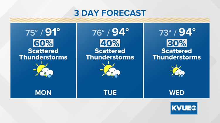
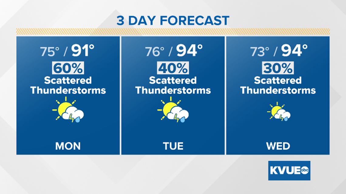
Monday is looking like the wettest day with the front stalled nearby. We're expecting about a 60% chance of showers and storms. The rain and clouds will keep temperatures in the low to mid-90s for the afternoon.

Rain chances continue through mid-week as the front lingers nearby. Therefore, we can expect additional scattered showers and storms through Tuesday and Wednesday with highs still in the low to mid-90s.
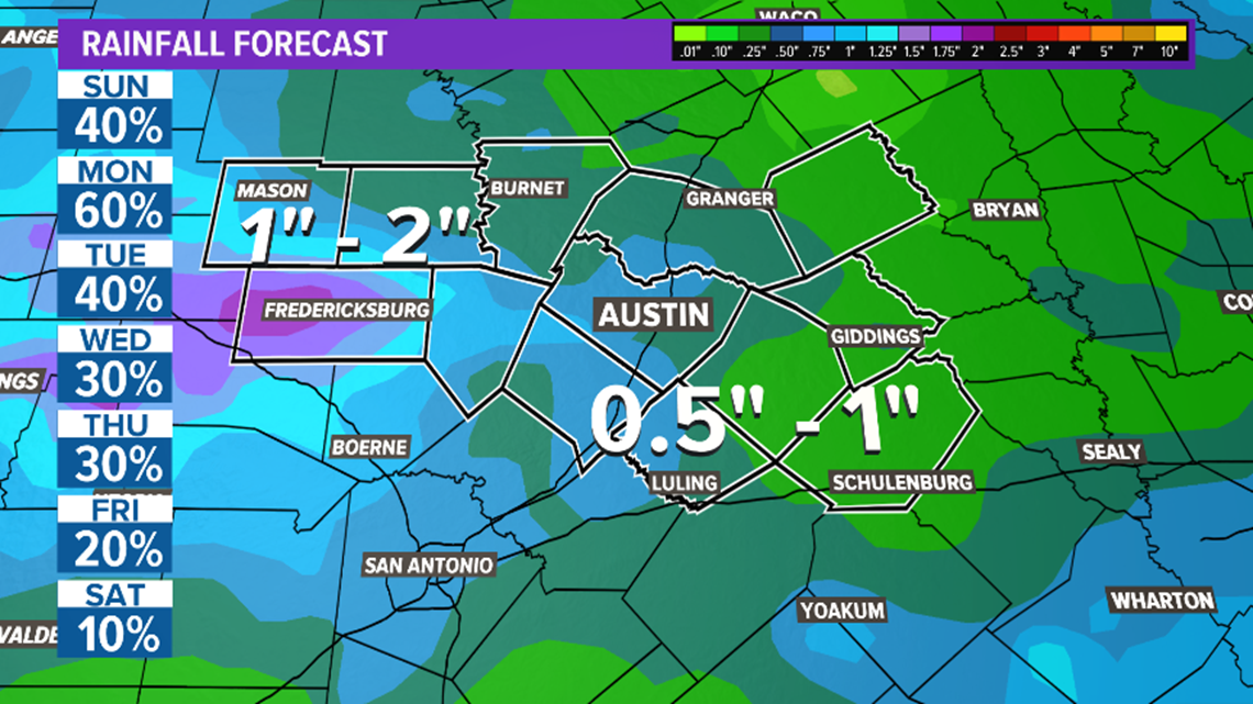
Rain chances will dwindle late week into next weekend as high temperatures return closer to average. Some parts of Central Texas could get 1 to 2 inches of rain in the next seven days.

The KVUE Storm Team will continue to monitor this developing forecast.
In the meantime, the extended forecast can be found below: