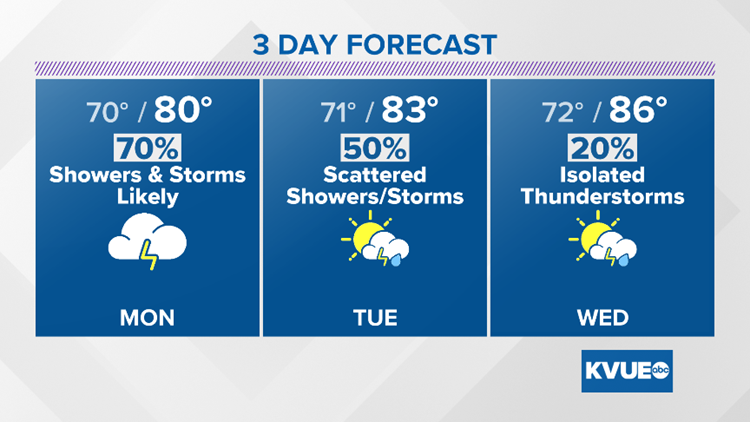
AUSTIN, Texas — The widespread rain from earlier today has now become much more isolated, but widely scattered showers and downpours remain a possibility through tonight. Gulf moisture continues to stream into Central Texas, so more rain and storms are expected both Monday and Tuesday.
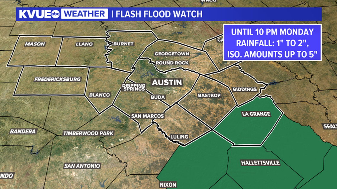
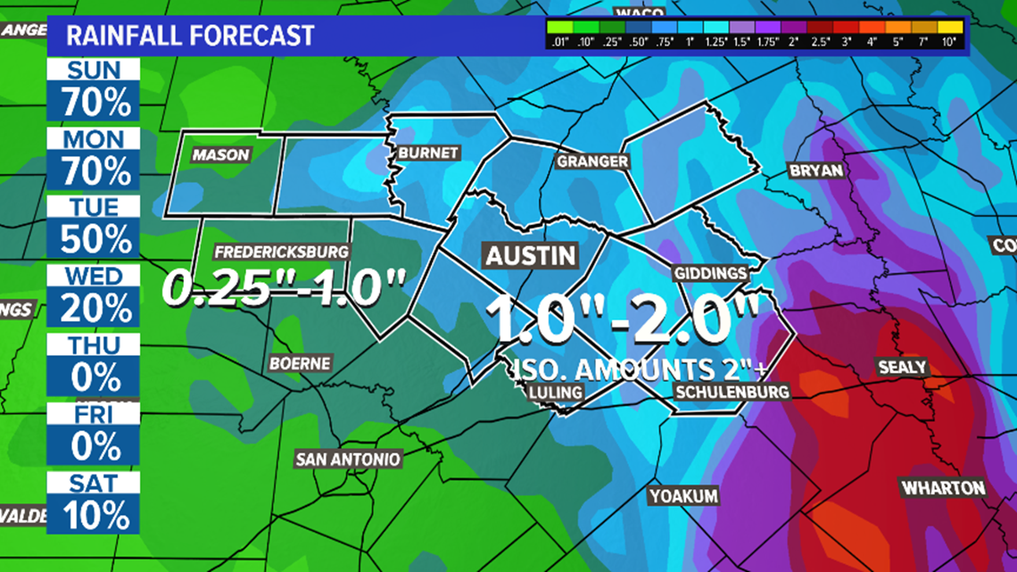
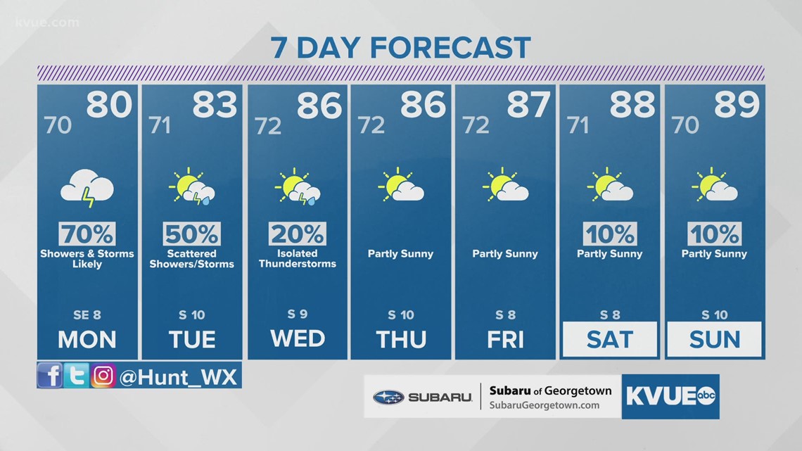
For Monday we're expecting another round of scattered to numerous showers and storms. Some of these could contain locally heavy rainfall, especially over Fayette County where a Flash Flood Watch is in effect through Monday evening.

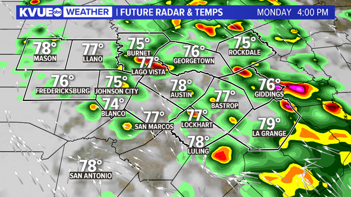
Outside of Fayette County there is still the potential for some localized minor flooding as scattered showers and storms remain in the forecast through Tuesday with totals upwards of 1 inch possible along and east of the I-35 corridor.

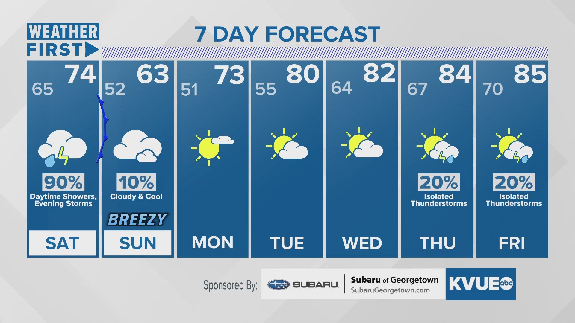
Finally, it looks like a break in the rain is on the way for the middle and end of the upcoming week. Thursday and Friday will likely both stay completely dry as highs warm through the 80s.
An early look at the Memorial Day weekend suggests things should be warm and primarily dry, but some models have shown a chance for some rain especially around Saturday. For now, we'll go with a warm and mainly dry forecast, and we'll fine tune things as we get closer.

The KVUE Storm Team will keep a close eye on this developing forecast.
In the meantime, the extended forecast can be found below:

Download the KVUE app to check radar, to get updates and to upload pictures and video: kvue.com/app. Also be sure to follow KVUE on Facebook, Twitter, YouTube and Instagram.