
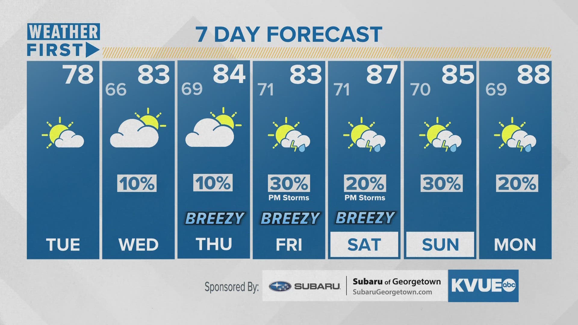
AUSTIN, Texas — It was a gorgeous start to the week and we'll see another nice day Tuesday in Central Texas, but the warmth and humidity will gradually make a return over the coming days.
A mostly clear start will give way to a partly sunny afternoon as temperatures begin in the 50s but eventually climb into the upper 70s. Expect a cool and comfortable morning, but humidity will be on the rise throughout the day and should linger throughout the week.
Enough moisture moves into the area to warrant the possibility of patchy fog and drizzle for Wednesday morning as temperatures start in the 60s. Our afternoons will continue to trend warmer and breezier for the back half of the workweek. Highs climb to the lower to mid-80s while gusts between 25 and 30 mph will be possible Thursday through Saturday.
A few rounds of rain and storms will be possible Friday through this upcoming weekend. As of now, it looks like the primary risk for severe weather will stay north of our area, but we'll have more specifics on this more unsettled weather pattern in the coming days.
Currently, we have scattered rain and storm chances for Friday afternoon and evening along with another round possible Saturday.
Temperatures will continue to climb Saturday through the beginning of next week as highs reach closer to 90 degrees.