
AUSTIN, Texas — The KVUE Weather Team will be monitoring the potential for strong storms developing mostly west of Interstate 35 Thursday evening into the early nighttime hours.
We're tracking a "slight" - 2 out of 5 - risk for severe weather for the Hill Country, with hail and damaging winds being the main threat. Hail is especially a concern, as the same area is in the "hatched area", which means that significant hail getting up to two inches or more in diameter is possible with some storms. However, the coverage looks to only be around 40% overall when you consider the Hill Country as opposed to the rest of the KVUE area.
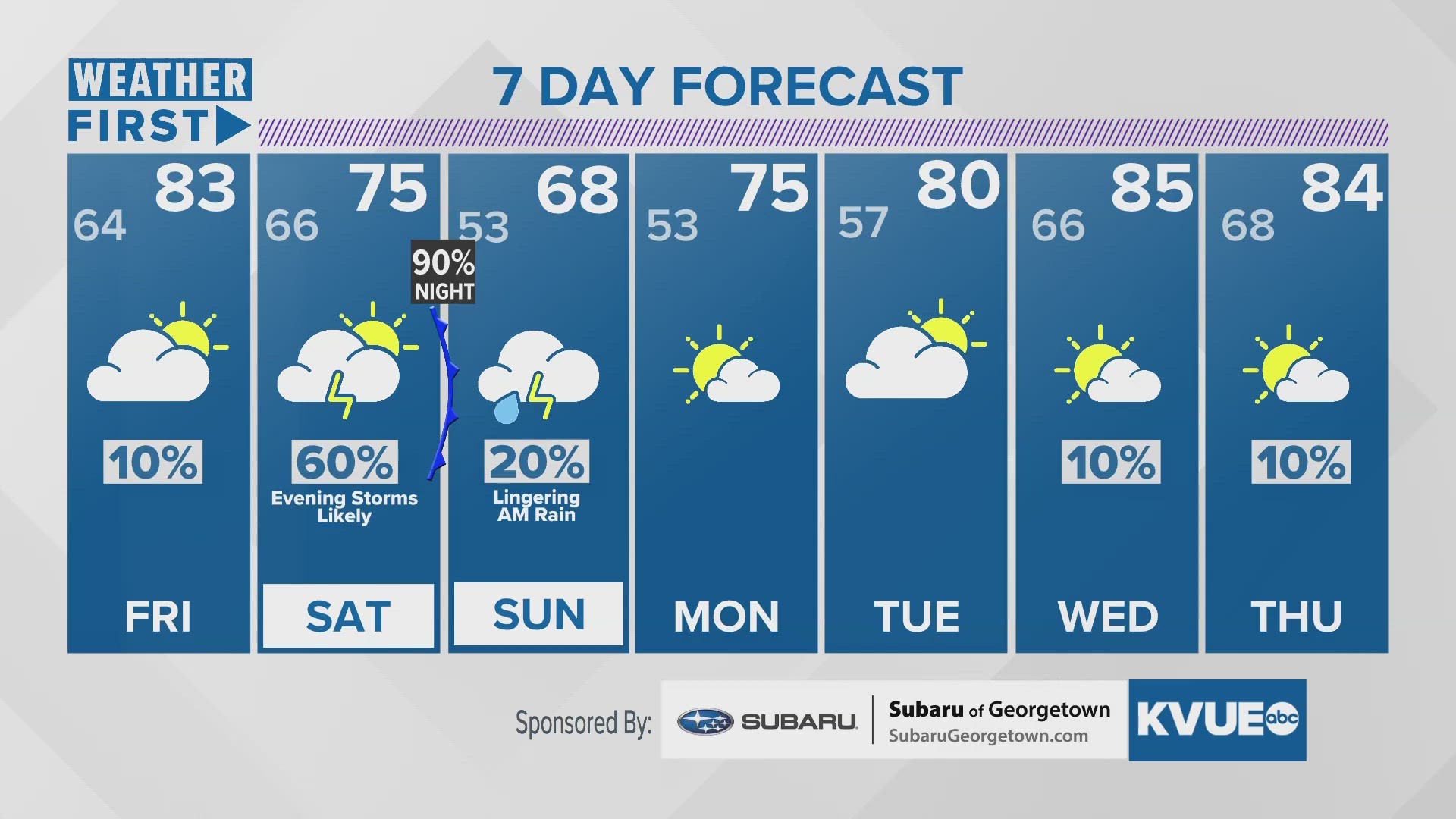
Friday could bring a dry lull, but we are tracking slightly cooler temperatures with highs in the lower 80s under mainly cloudy skies, but it's Saturday during the later afternoon and early evening hours we're watching as a strong cold front comes in and brings a better widespread rain chance, and that rain could get up to around two or three inches in some of our northern zones.
We do stay dry most of Sunday and most of next week, but we'll have a few trailing showers behind the front and highs Sunday don't look like they get to 70.