

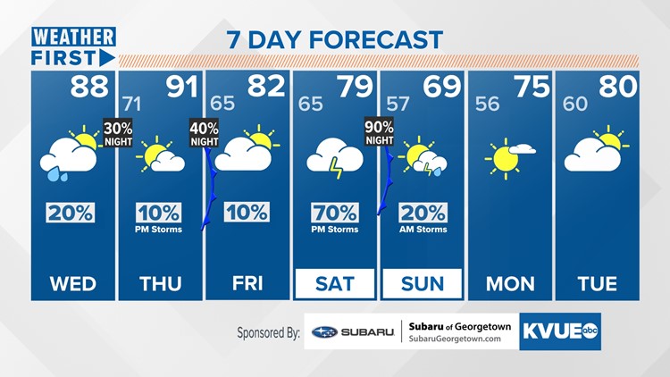
AUSTIN, Texas — We're tracking a rather warm and humid remainder of the work week with a few scattered shower and storm chances sprinked in throught the week.
That'll include a chance for maybe 90s for Thrusday, but there's a couple of cold fronts sliding in between now and Sunday. This is likely due to the same front moving in once Thursday evening into Friday, before lifting back north and coming through again Saturday night into Sunday. This second passage provides our best storm chances, mainly late Saturday night into early Sunday. Some of those storms could be strong, as are the ones Thursday afternoon, where a marginal - one out of five - risk for severe weather exists for the Hill Country. Additionally, rainfall could be upwards of three inches or more in spots that desperately need it when all is said and done Saturday night.
Additionally, as that front moves in, we expect to be below average for Saturday through Monday as those storms inhibit radiational heating and the northerly flow limits afternoon warming Sunday and Monday.