
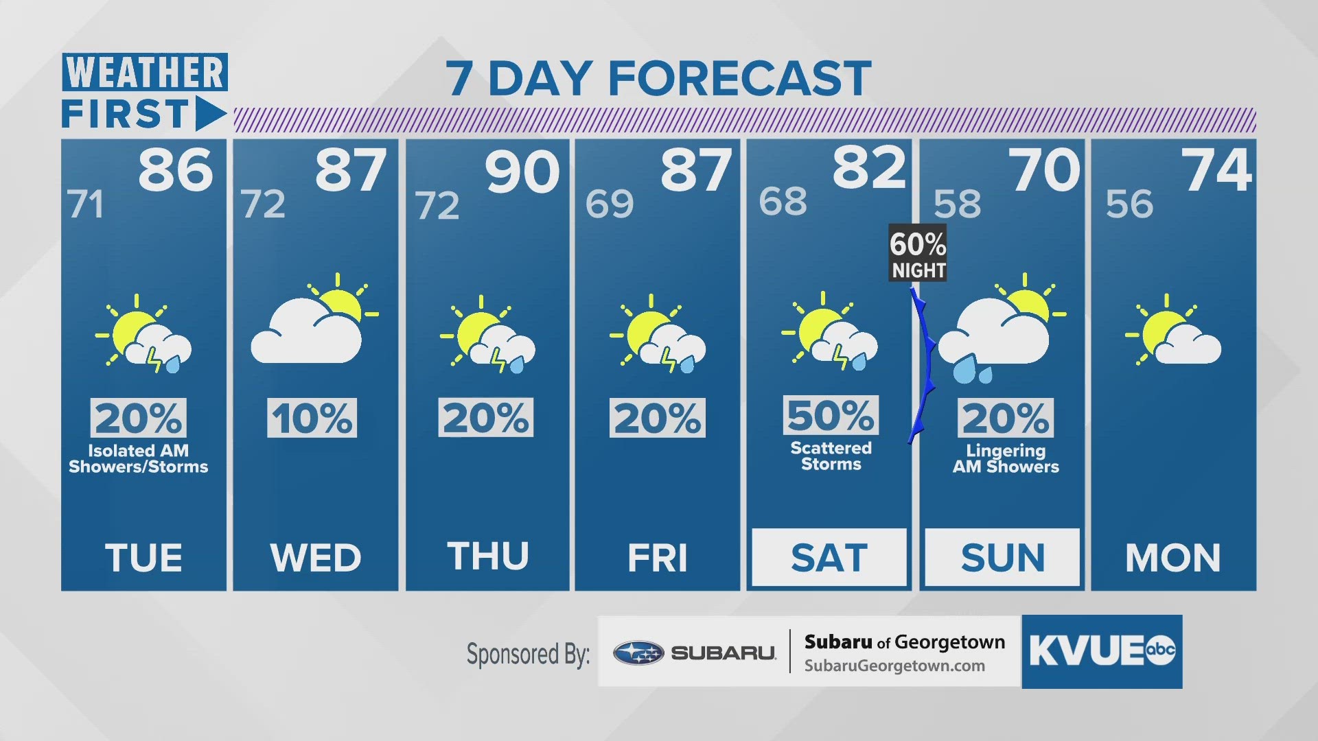
AUSTIN, Texas — Late tonight and early Tuesday, the risk for showers and storms will favor the I-35 corridor and Coastal Plains. The front will slowly move east in the early afternoon on Tuesday, squeezing out a few raindrops on its way.
Wednesday will be dry, and then Thursday, Friday, and the weekend ahead, the KVUE Storm Team will be tracking minor chances for wet weather again.
Also on Wednesday, we will see a sufficient warming trend, with highs in the upper 80s, and a few suspected 90-degree days. With dewpoints staying high before the weekend front, expect conditions to feel pretty soupy.
A cold front tracking through Saturday night and Sunday morning could give us a shot at stronger storms, and better rainfall totals, but we will have a better idea of that event later this week. Temperatures will fall back to the 70s after that moves through.