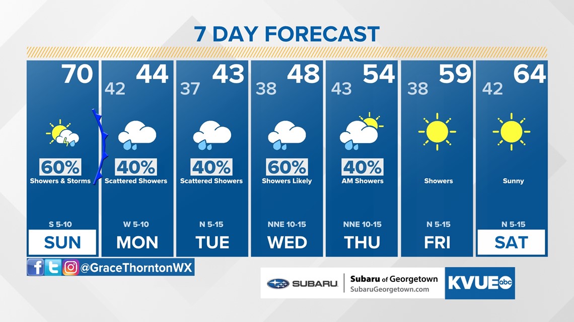
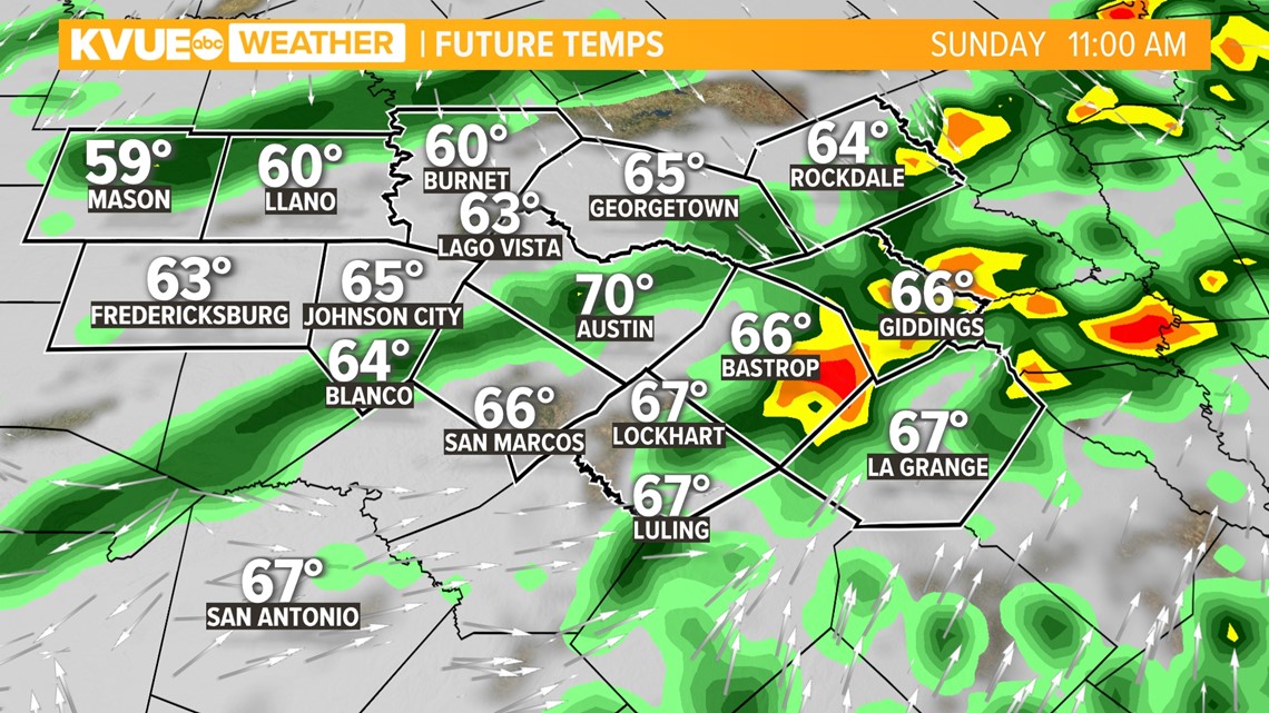
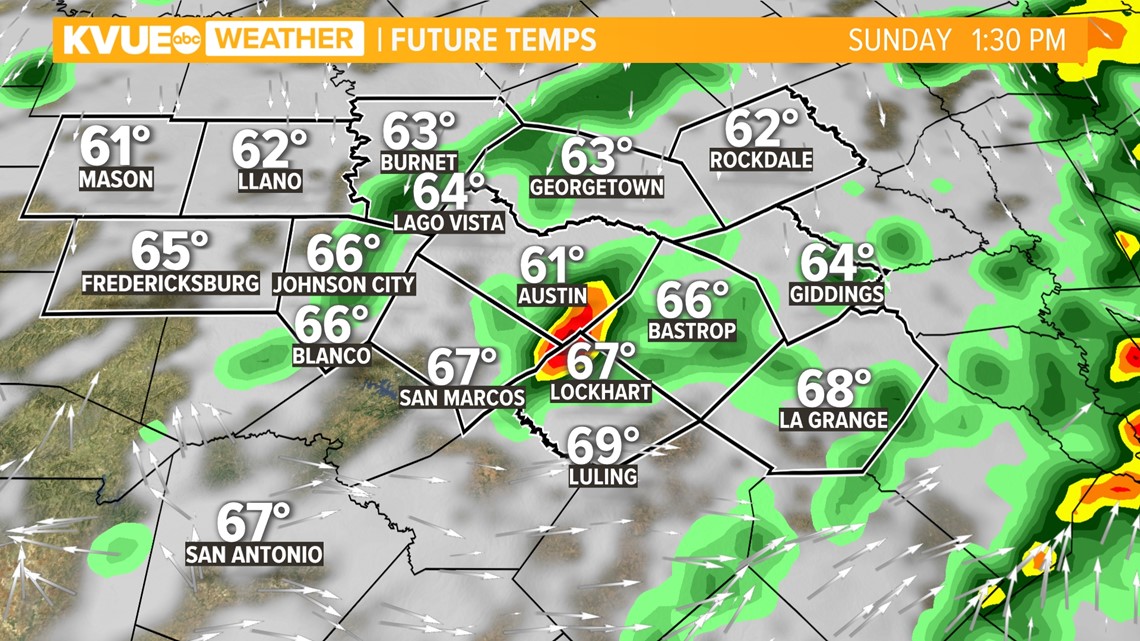
AUSTIN, Texas — Changes will be abrupt to start off another week in Central Texas. While Sunday afternoon will be warm, a cold front pushing across the Austin area will cause scattered showers, rain, and a few strong end thunderstorms for the north and east counties. Looking ahead, an active weather pattern will give way to rain chances almost each day this week. The highest rain chances look to be mid-morning and into the early afternoon.
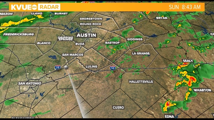
A Fog Advisory will expire at 10 a.m. Sunday morning, but rain chance persist and increase through the mid morning and afternoon.

The majority of our region is not expecting severe weather, but some of the storms could produce lightning, heavy rainfall and gusty winds. The Storm Prediction Center outlines a "marginal" - level one of five - risk for severe weather across southeast Texas, which as of Saturday morning now includes Fayette, Bastrop, Lee and eastern Williamson counties.

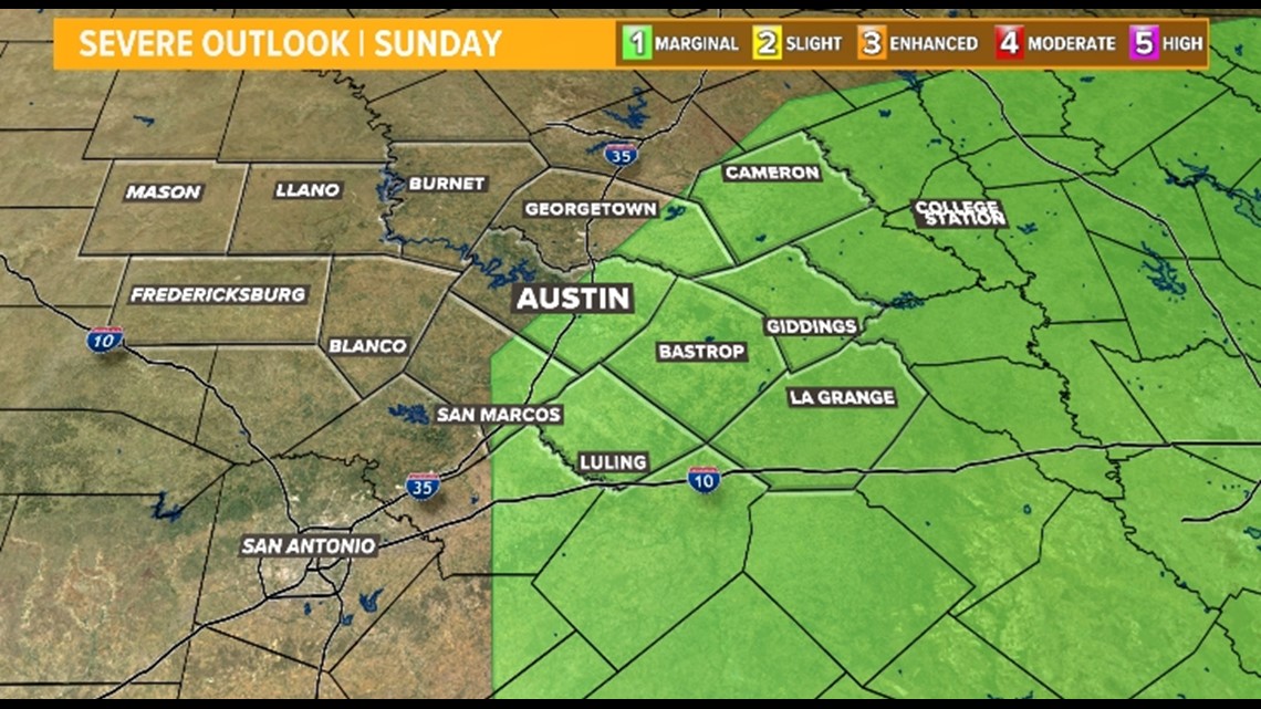
Areas east of I-35 could have a strong storm or two on Sunday. Potential impacts from storms could include lightning, hail, damaging wind gusts and the possibility for an isolated tornado. The more potent storms are expected through the late morning and afternoon, again, mainly north and east of Interstate 35.

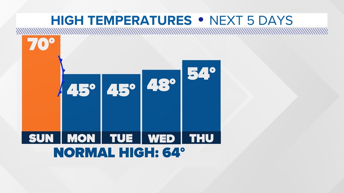
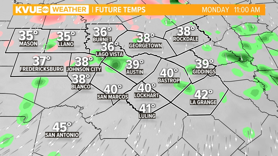
When the sun sets on Sunday, that will be the last of the warm weather for awhile. North winds behind a cold front will plummet temperatures into the lower 40s and mid/upper 30s overnight for Monday morning.
Monday afternoon, temperatures wont budge too much with a high of 44°F expected. Similar cool temperatures will be on tap for Tuesday and Wednesday afternoon. We wont re-enter the 60s until Saturday.
The several systems that will provide a chance of rain every day through Thursday will create chilly and damp conditions throughout the area.

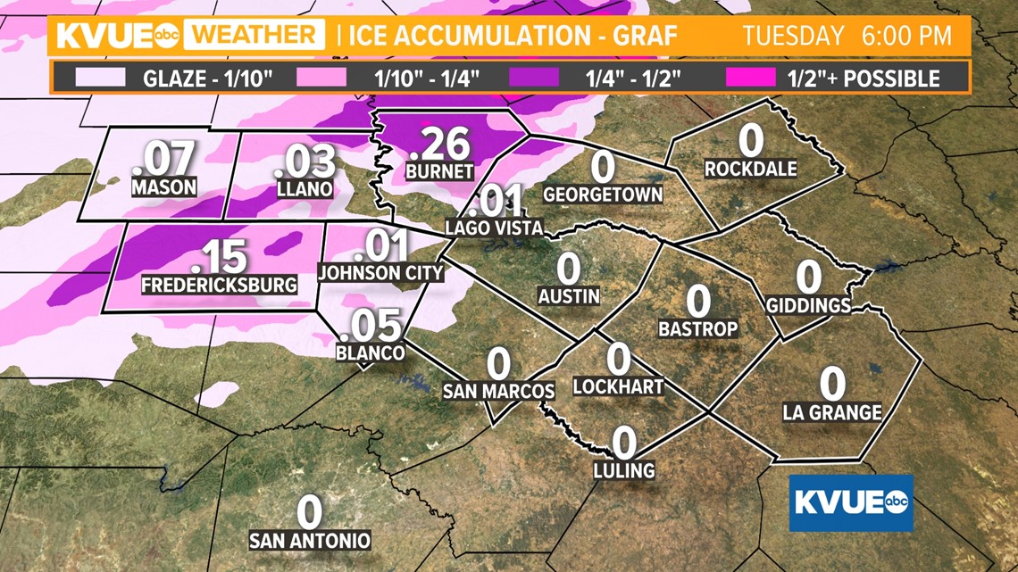
A second, weaker system will move in Monday into Tuesday, and some model data, with sufficient cold air, has been hinting at the possibility for light freezing rain in sections of the Hill Country.

This would likely affect bridges, overpasses and other elevated surfaces, but no other issues besides that. While you wont need to go stock up on milk and bread, this event could make road conditions hazardous for certain neighborhoods, so be sure to keep checking the updated forecast.

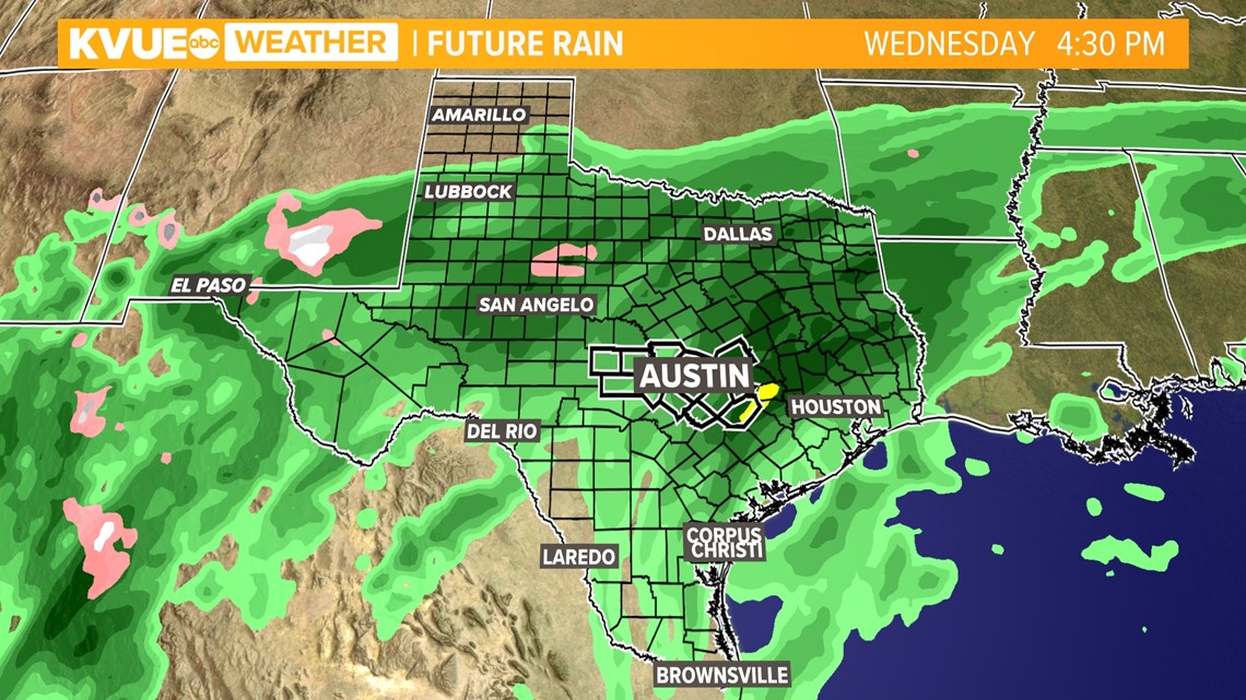
Following that system, a third will bring a more widespread chance for rain Wednesday into Thursday morning. While the gloomy week of weather will benefit drought issues, it will keep many indoors.

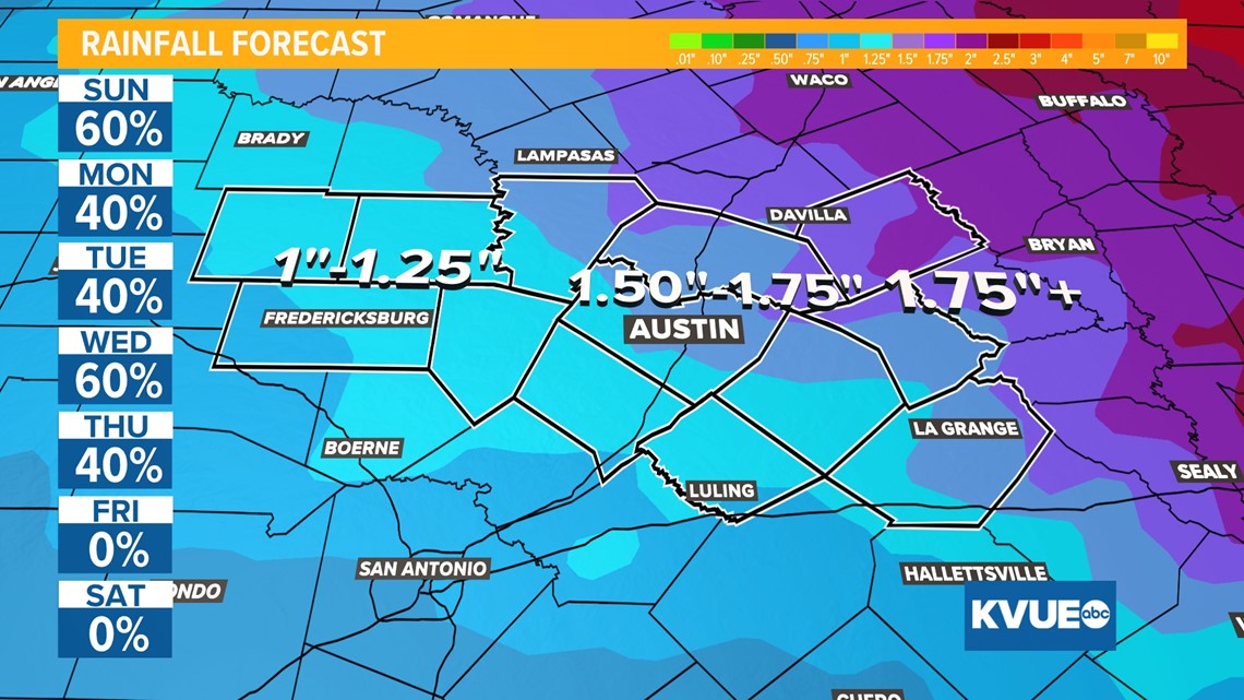
Seven-day rainfall totals continue to trend higher with most of Central Texas now on track to pick up anywhere from 1" to 1.5" inches of rain. Greatest totals are expected to be 2-3" in isolated areas, mainly east of I-35.

The KVUE Storm Team will continue to monitor this developing forecast.
In the meantime, the extended forecast can be found below.