
AUSTIN, Texas — *A Severe Thunderstorm Watch is in effect for Bastrop, Caldwell, and Fayette County until 6 p.m. Friday. Damaging gusts up to 70 mph, very large hail, and frequent lightning will be possible.*
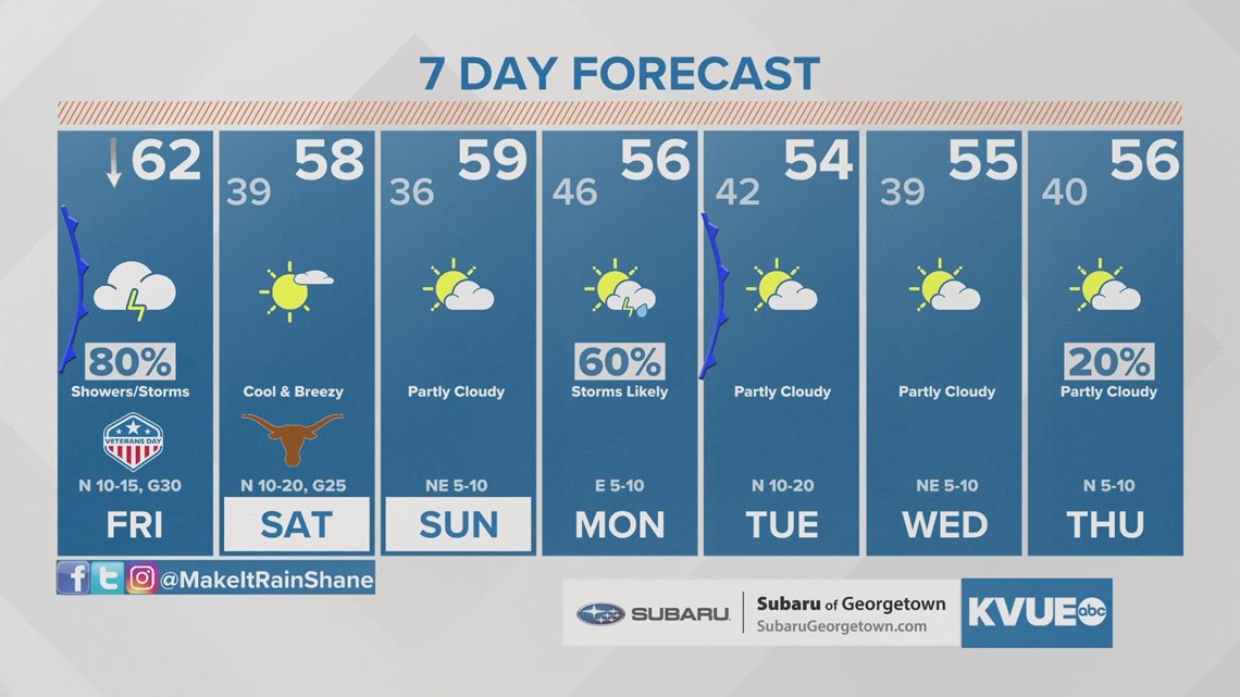
A spring-like week comes to an abrupt end on Friday. A strong cold front will bring the coolest air so far of the season for Central Texas, and parts of the Hill Country could even see a light freeze over the weekend.
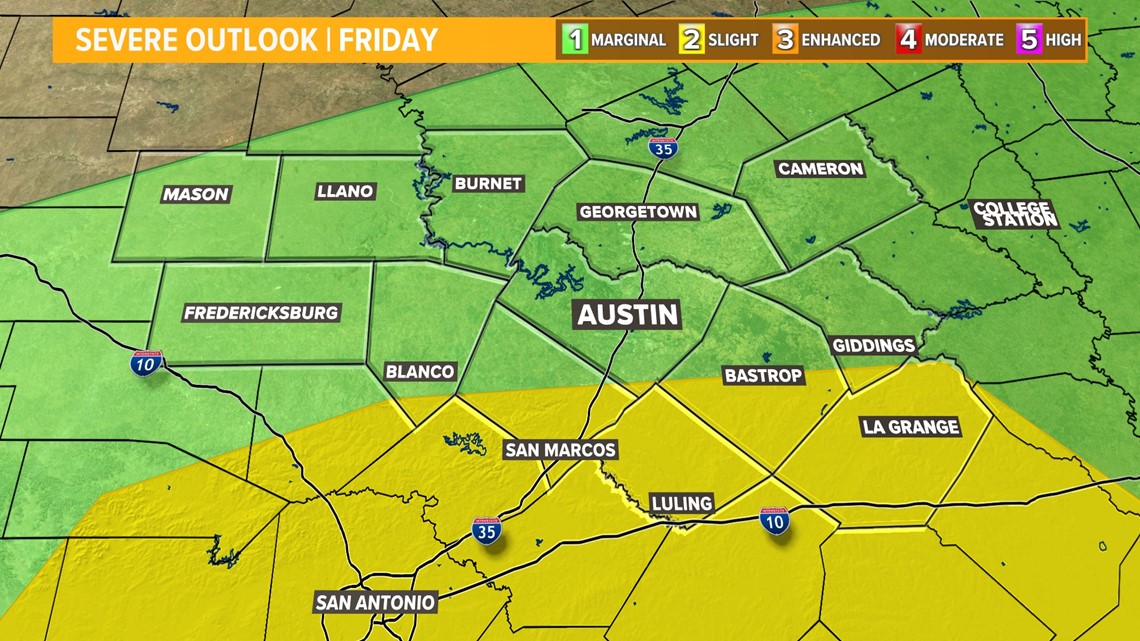
There are two aspects to this forecast: the cooldown and the storm chance. Let's start with the storms. We don't expect Friday to be a big severe weather day, but one or two storms could be severe with hail and gusty winds.
The Storm Prediction Center includes most of the KVUE area in the "marginal" – level 1 of 5 – risk for severe storms. As of Friday morning, the Storm Prediction Center upgraded the risk for portions of Hays, Caldwell, Bastrop and Fayette County to a "slight" – level 2 out of 5 – risk for severe storms. The main concerns will be damaging gusts and the possibility of large hail.

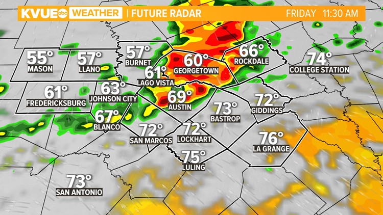
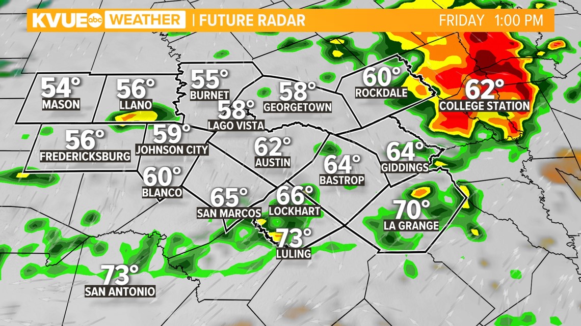
Timeline: Storms nearing Austin by late morning
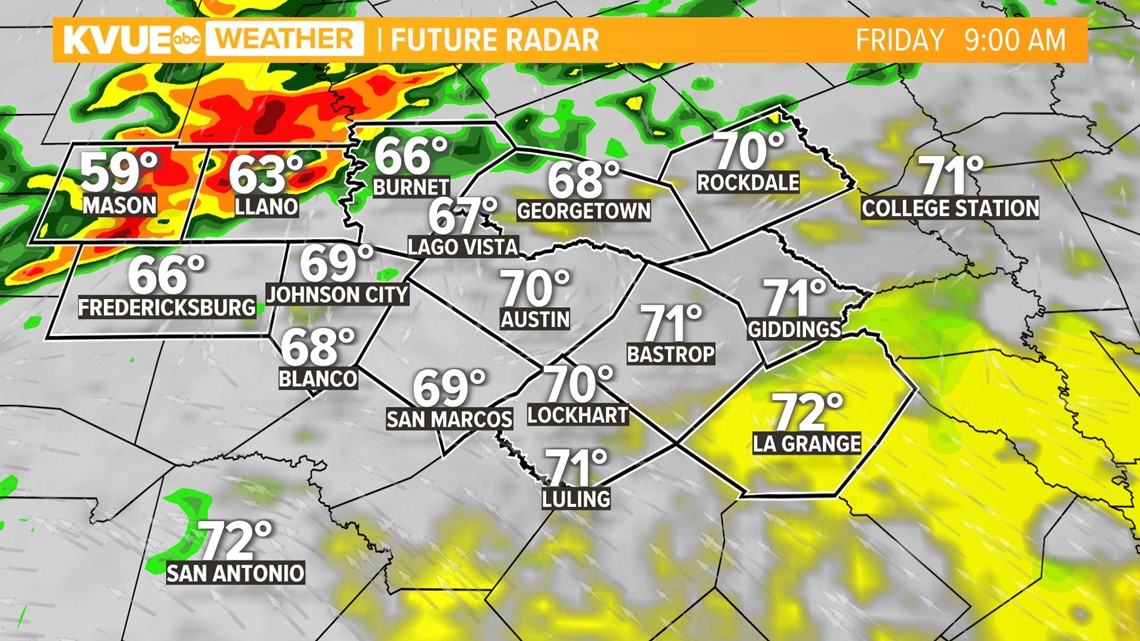
The Friday morning commute will be mainly dry for the Austin area as storms initially move in across the Hill Country by 7 a.m. or so. Ahead of the front, temperatures will still be warm in the upper 60s to low 70s.

By late morning into the lunchtime hour, the cold front will be reaching the Austin area and Interstate 35 corridor. Widespread storms move in along and behind the front. Temperatures will begin to drop behind the front by early to mid-afternoon.

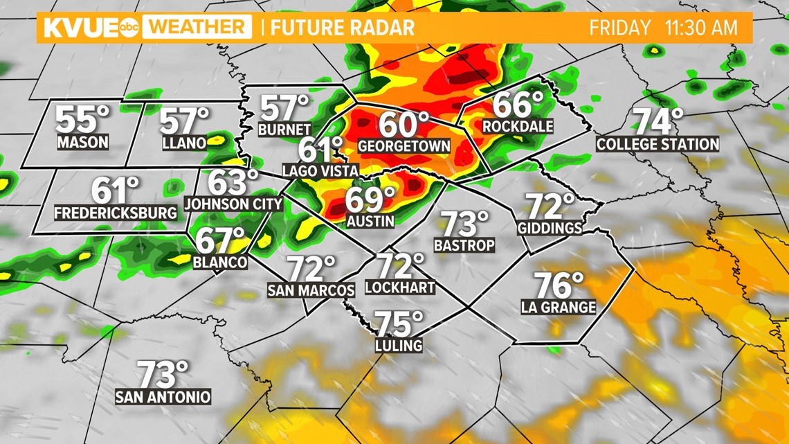
Rain chances continue into the late afternoon, especially for areas along and east of I-35. Colder air quickly rushes in on the back side of the cold front with temperatures falling into the low to mid-50s with a brisk north wind.
By Friday evening, the rain is moving out and temperatures will fall in the 40s. Bundle up if you have plans to be outdoors!

First freeze of the season expected over the weekend
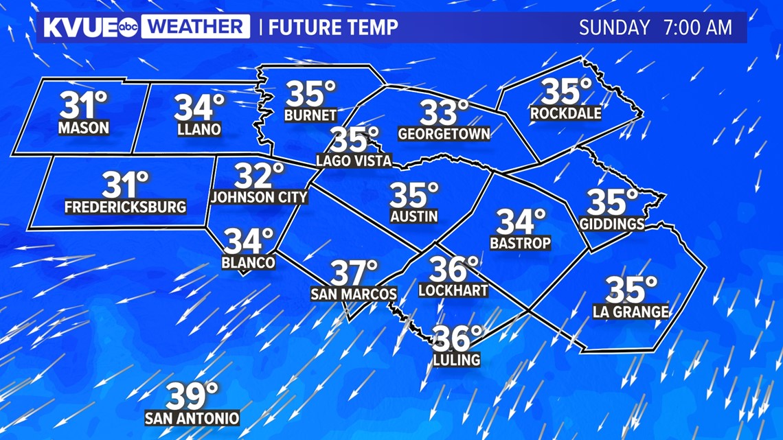
By Saturday morning, the rain is long gone, but some of the coolest valleys and creek beds in the Hill Country could drop down to a light freeze. A Freeze Warning will be in effect for Mason County from 3 a.m. until 8 a.m. on Saturday. Steps should be taken to protect pets, sensitive plants and vegetation in areas expected to experience freezing temperatures.
Highs stay in the 50s on Saturday, and then Sunday morning will bring a more widespread freeze to the Hill Country and possible locations along the I-35 corridor.
Austin likely stays just above freezing in the mid-30s in the city, but the colder outlying suburbs could briefly drop to or below freezing.

Stick with the KVUE Storm Team for the latest on this developing forecast.
In the meantime, your seven-day forecast is below.

PEOPLE ARE ALSO READING:
