


AUSTIN, Texas — Another scorcher expected across Central Texas Wednesday afternoon with added humidity levels. Dew point temperatures are still expected to be in the upper 60s and 70s leading to heat index values likely in the upper 90s and low 100s.
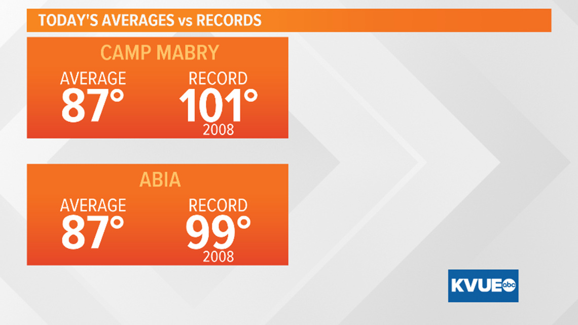
The forecast high of 95 for Austin would will come in roughly 4 degrees shy of the record high in 2008 at 101.

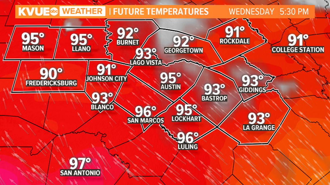
The hottest temperatures in our area will continue to be out towards the Hill Country with upper 90s forecast for our residents in Mason, Llano, Burnet, and Gillespie counties.

The area of high pressure will weaken a bit starting on Wednesday. This will allow for temperatures to decrease and moisture off the Gulf of Mexico to increase over the area by late-week.

As moisture builds across Central Texas late week into the holiday weekend, expect a gradual increase in rain chances up to 40 and 50 percent.

Thunderstorm chances are probable with some localized moderate to heavy downpours.

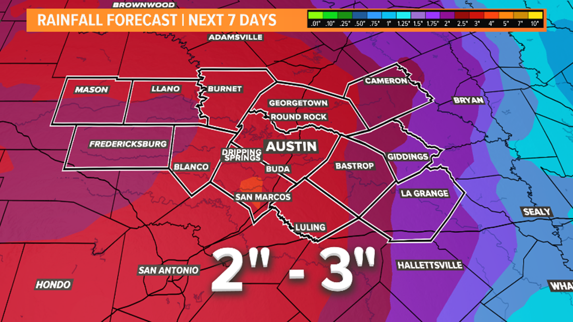
The latest outlook from the Weather Prediction Center indicates that one to three inches of rainfall will be possible over the next seven days.
The KVUE Storm Team will continue to monitor this developing forecast.
In the meantime the extended forecast can be found below:
PEOPLE ARE ALSO READING:
- Texas Gov. Abbott outlines plans and guidance to reopen bars, child care facilities, bingo halls and more
- Checklist: Tattoo, massage and other parlors can reopen in Texas
- Checklist: How Texas bars will operate when they can reopen May 22
- Timeline: Gov. Greg Abbott's economic plan to reopen Texas businesses
- Travis County leaders plan to keep 75% of employees working from home
