AUSTIN, Texas — THIS BLOG IS NO LONGER BEING UPDATED.
Déjà vu?
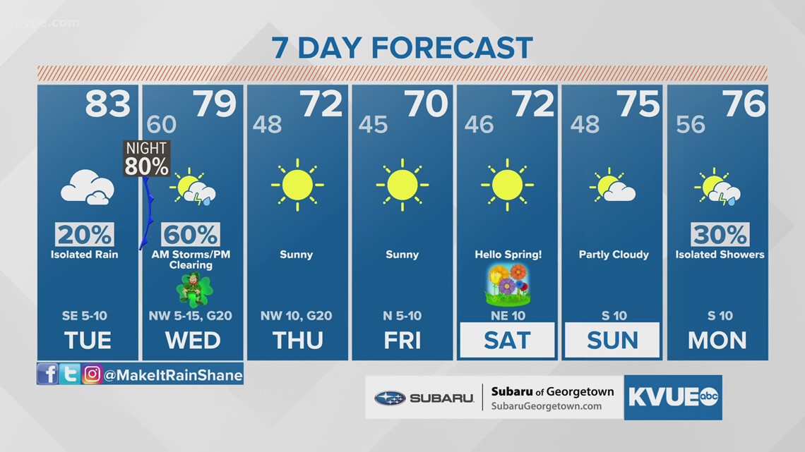
An incoming cold front on Tuesday night will look familiar to Central Texas as it will resemble a system that moved through just last weekend.
Download KVUE's app to get alerts and to check radar 24/7: kvue.com/app

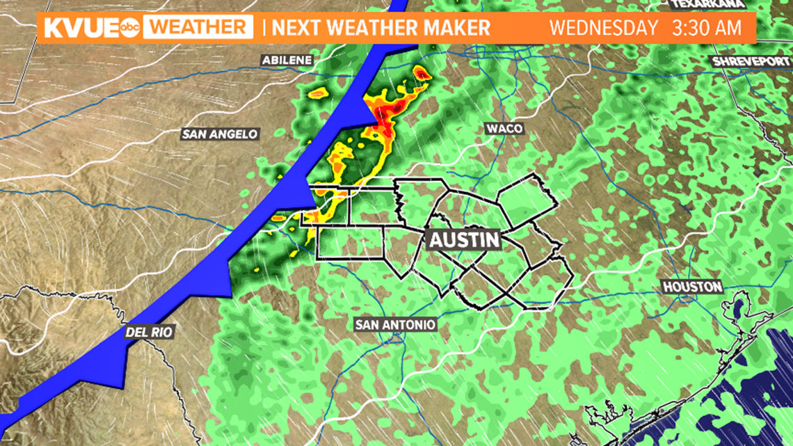
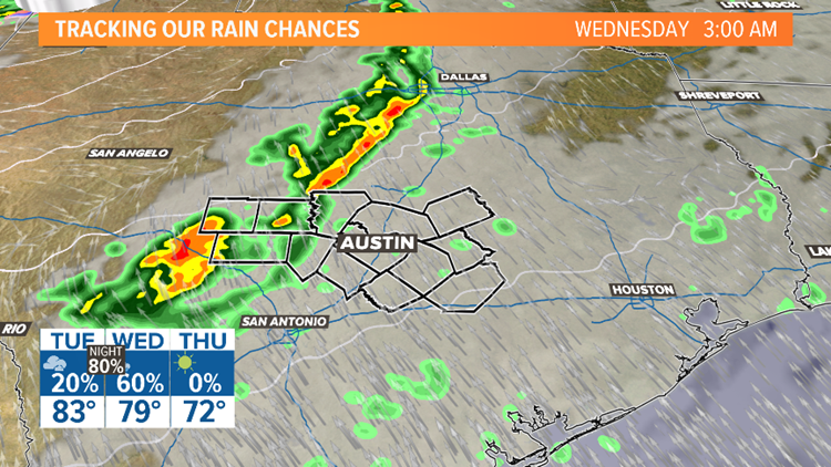
A low-pressure system will push through the panhandle of Texas and drag a cold front across Central Texas on Tuesday night through Wednesday morning. Forecast models have indicated not only a chance for scattered showers, but potentially strong thunderstorms, as well.
The Storm Prediction Center has placed a majority of Central Texas under a slight risk for severe weather late Tuesday night through Wednesday morning.

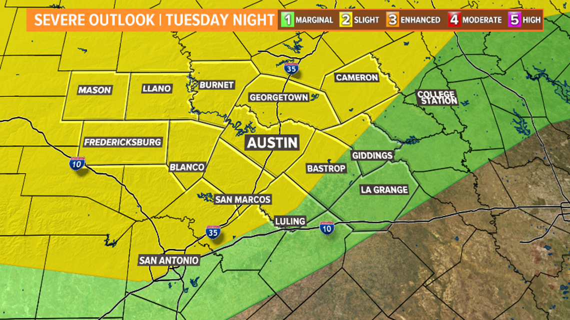
The main concern with these storms will be the potential for strong winds, hail and isolated tornadoes. While forecast models are not entirely in agreement on the exact timing of this system, the consensus is that the front will move through late Tuesday night and early Wednesday morning. Conditions should begin to clear on Wednesday afternoon.

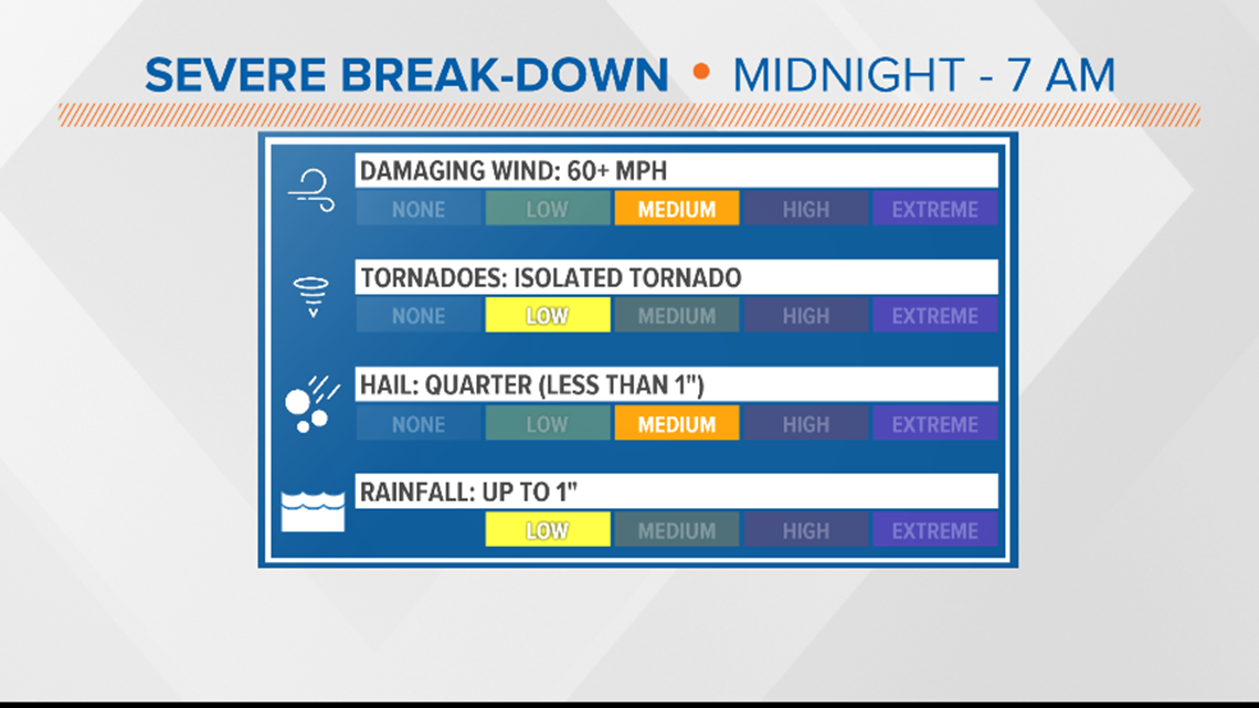
There is the possibility of a shortwave moving ahead of the cold front, which could create isolated showers and storm chances Tuesday afternoon. However, the best chances for rain will be with the passage of the front itself. Estimated rainfall totals range from one-10th of an inch to three-fourths of an inch. Isolated areas could see rainfall totals closer to an inch.
The KVUE Weather Team will closely monitor the forecast and provide you with updates both on air and online. Be sure to follow KVUE on YouTube, Facebook, Twitter and Instagram