AUSTIN — Rainfall continues to be the plot of Friday's weather story across the Austin-metro area.
Storm reports have now dotted the landscape areas north and west of Interstate 35 Friday morning with more showers and thunderstorms possible to the east. The question remains: Is there more on the way and what damage has already been done?
Our cold front has so far triggered not only gusty winds causing damage to some building and housing structures, but also to trees and power lines. It has also led to some flash flooding near the University of Texas Austin and in South Austin near Slaughter Lane and William Cannon Drive. National Weather Service has recorded reports of a house fire in the Lakeway area caused by a lightning strike, as well as tree damage in numerous neighborhoods including Rollingwood, North Lamar, North Austin and Tarrytown.
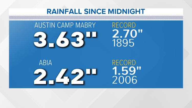
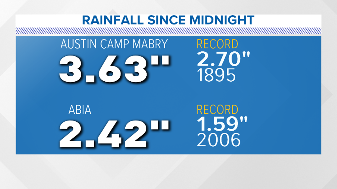
As of 3 p.m. Friday, Camp Mabry has broken its old record in 1895 with 3.63 inches of rainfall recorded Friday. The old record was 2.70 inches. Austin-Bergstrom International Airport has raked in 2.42 inches.
Here are some additional totals across the area.
Austin metro area:
Lakeway: 3.17 inches
Bee Cave: 3.70 inches
Bull Creek at Loop 360: 2.53 inches
South Austin: 3.28 inches
East Austin: 2.28 inches
Central Austin: 3.36 inches
North Austin: 1.36 inches
Cedar Park: 2.00 inches
Leander: 1.80 inches
Florence: 1.72 inches
Pflugerville: 1.73 inches
Manor: 2.00 inches
Elroy: 2.31 inches
Webberville: 1.47 inches
Buda: 2.38 inches
Kyle: 1.66 inches
Dripping Springs: 3.25 inches
San Marcos: 1.65 inches
Georgetown: 1.08 inches
Round Rock: 1.34 inches
Areas east of Austin:
Bastrop: 1.04 inches
Giddings: 0.58 inches
La Grange: 0.53 inches
Carmine: 0.31 inches
Rosanky: 1.20 inches
Smithville: 1.26 inches
Cedar Creek: 0.84 inches
Thorndale: 0.84 inches
Hill Country areas:
Mason: 1.51 inches
Llano: 1.54 inches
Fredericksburg: 3.24 inches
Blanco: 1.98 inches
Johnson City: 2.54 inches
Round Mountain: 2.34 inches
Marble Falls: 2.16 inches
Burnet: 1.97 inches
Peak wind gusts Friday during the heaviest rain events reached 48 mph at Fredericksburg, 47 mph at Dripping Springs and 45 mph at ABIA.
As we move forward into the afternoon and evening hours, a few light to moderate rain showers are still possible; however, no severe weather events are likely.
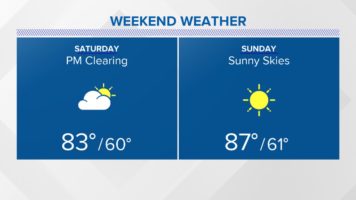
Mostly sunny skies lie ahead for Saturday with daytime highs expected to climb just above 80 degrees. Additionally, a north to northwest wind will help to drown out our excessive humidity from the past couple of days.
Next week, Austin enters a stretch of quiet, dry, dominated by high pressure. Our surface winds eventually change from a northerly to a southerly component and we kick things into high gear to push our surface temperatures to near 90 degrees.