AUSTIN, Texas — Editor's note: This blog is no longer being updated. Check out our latest weather blog.
Tuesday will bring some of the best rainfall that Central Texas has seen in quite some time. But it's also a day where we need to keep an eye out for some strong storms and localized flooding.
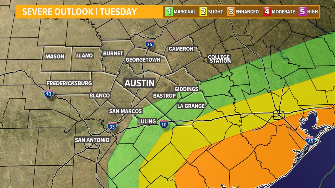
In fact, Tuesday will be quite the weather day across the Lone Star State, with winter weather concerns over parts of the panhandle and north Texas. On the warmer side of the system, a significant severe weather threat develops over the mid and upper Texas coast.
Here in the middle, we're hoping for just the beneficial rainfall. But we'll be keeping a close eye on areas southeast of Austin, where we can't rule out a few storms capable of gusty winds and an isolated tornado.
The Storm Prediction Center includes parts of our area in the "marginal" – level 1 of 5 – risk for severe storms. The bigger threat unfolds from Victoria to Galveston, where there is an "enhanced" – level 3 of 5 – risk for severe storms, including a few strong tornadoes.

Timeline: Rain and storms move in Tuesday morning
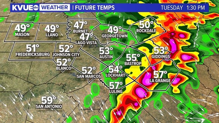
Rain will be moving into much of Central Texas by early Tuesday morning. Initially, this will be mostly light to moderate rain, but plan on at least some wet roadways and damp conditions heading out the door.
The rainfall intensity picks up through the mid to late morning hours as the brunt of the system approaches.
At this point, expect some embedded downpours and thunderstorms to begin developing.

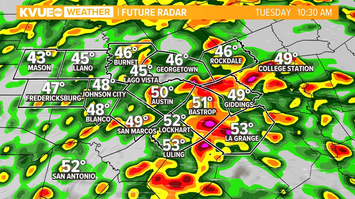
The main window to watch will be from noon to 3 p.m. as the back line of storms moves over the Interstate 35 corridor and points east.
For most of Central Texas, it will still be cool with a lack of instability, but warmer temperatures and a more favorable storm environment may start to develop by the early afternoon southeast of Austin.

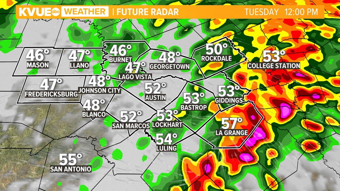
Storms may develop into a more organized line by 1 p.m. or 2 p.m. as they exit the KVUE area through Bastrop, Lee and Fayette counties. This is where severe weather potential will be highest with gusty winds and an isolated tornado possible.

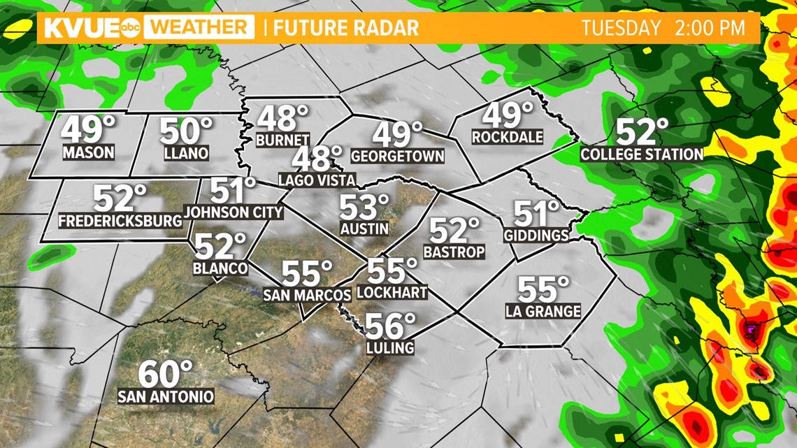
After 3 p.m., cooler and drier air will move in for the rest of the day. It will be a breezy and cool afternoon with wind gusts up to 30 mph possible.
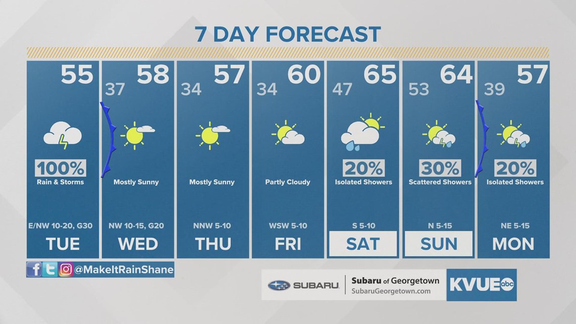
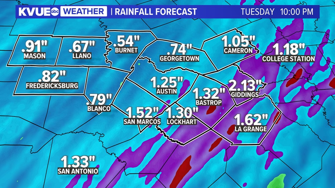
A widespread half-inch to one and a half inches of rain is likely for Central Texas, including in the areas that need it most across the Hill Country. There could be pockets of two or three inches or more of rainfall southeast of Austin, which could lead to potential localized flooding.

The KVUE Storm Team will continue to closely monitor this developing forecast.
In the meantime, the extended forecast can be found below:
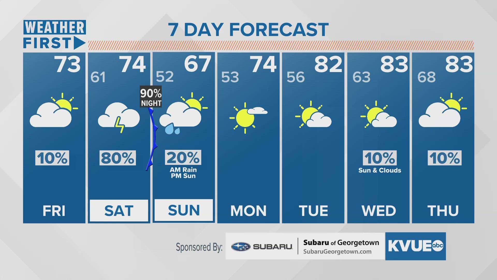
Here is a look at your extended forecast: