
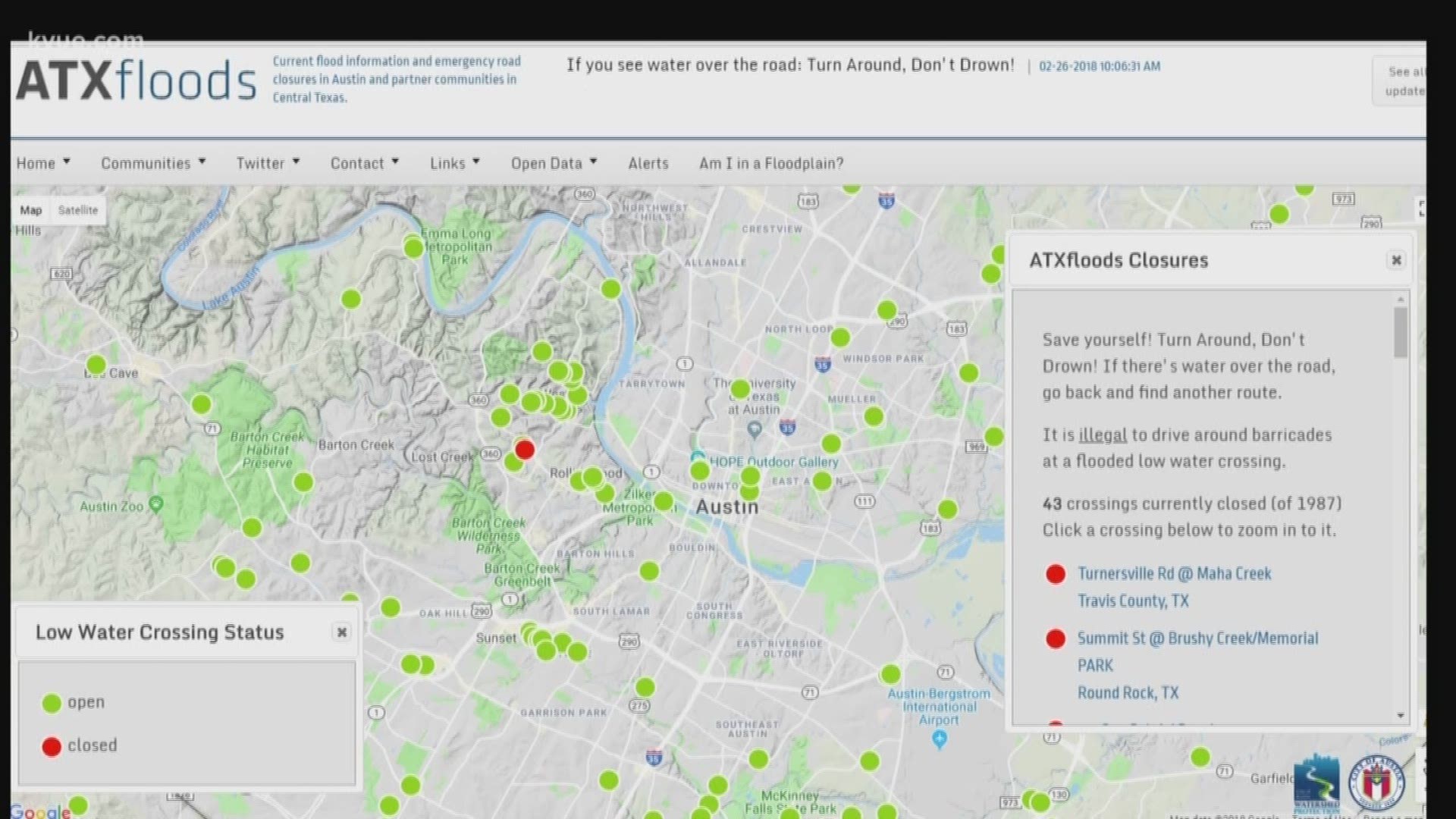
AUSTIN — Changes are coming to the ATX Floods website just in time for the storm season. The site shows users the status of road closures at low water crossings in Central Texas.
The watershed department said the website, which launches in mid- to late-April, will be faster and have a cleaner interface.
It is also going to be easier to use on your phone, according to city officials.
The city plans to add new cameras at low water crossings on Shoal Creek and on Spicewood Springs Road.
"Seventy-five percent of flash flood deaths occur in vehicles,” said Scott Prinsen, supervisor for the city’s Flood Early Warning System. “That, combined with the fact that we're in flash flood alley – this site really is a valuable tool. In fact, life-saving tool."
There will also be a new “caution” category in addition to the green and red markers.
"Let's say a bridge is washed out,” Prinsen said. “And it may take some time for that bridge to get repaired. So, in that case, instead of having it closed -- we'll have a 'caution' because there could be a time, depending on damage, where it might be only for a week or possibly longer."
You will be able to access live video from the new cameras on the website.
The city said it plans to add Burnet and Llano counties to the website – but was not able to give an exact date for those additions.
The URL for the website remains the same.
Austin’s watershed department said the ATX Floods website first launched in 2012. This new site has been in the works for about two years.